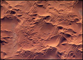
Sand dunes and outcrops add color and dimension across the Namib Sand Sea.
Published Jan 13, 2020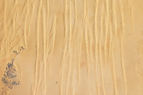
Winds shape the sands that were left behind by an ancient river.
Published Jun 4, 2012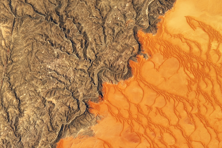
Namibia’s sea of sand is bounded on its northern side by the impermanent Kuiseb River.
Published Jan 2, 2020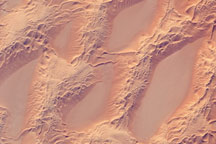
This astronaut photograph shows classic large and small sand masses of the central Sahara Desert, where wind is a more powerful land-shaping agent than water.
Published Jan 19, 2009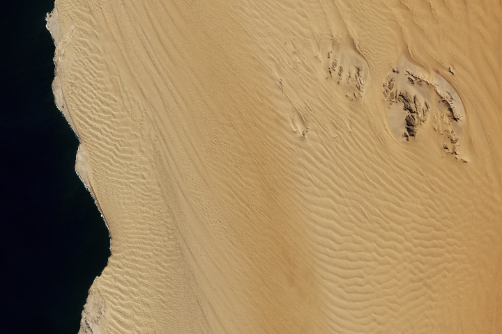
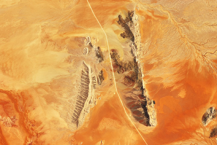
Scattered in a sea of sand, inselbergs in Namibia host ecology uniquely influenced by fog.
Published Sep 4, 2018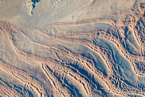
Dunes grow upon dunes at one of the most visually spectacular places on Earth, at least from an astronaut’s perspective.
Published Nov 21, 2016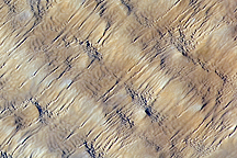
Layers of dunes march across a sand sea in the east-central Tenéré Desert of Niger in this astronaut photo from December 1, 2009.
Published Dec 28, 2009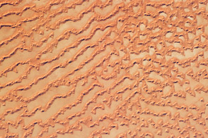
The Ar Rub’ al Khali, or Empty Quarter, covers much of the south-central portion of the Arabian Peninsula and is the largest continuous sand desert on Earth.
Published May 30, 2011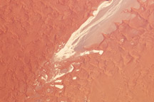
A pale, dry riverbed cuts through the red dunes of the Namib Sand Sea.
Published Jan 25, 2010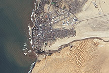
Acquired April 2, 2011, this natural-color image shows the Swakop River draining into the Atlantic Ocean just south of Swakopmund.
Published Apr 12, 2011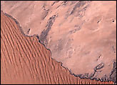
he Issaouane Erg (sand sea) is located in eastern Algeria between the Tinrhert Plateau to the north and the Fadnoun Plateau to the south. Considered to be part of the Sahara Desert, the Issaouane Erg covers an area of approximately 38,000 km2. These complex dunes form the active southwestern border of the sand sea.
Published Feb 7, 2005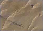
A plume of black smoke blowing westward is silhouetted against linear dunes in the great sand sea of northeast Libya. Smoke from flares at remote well heads is commonly seen by astronauts flying over the Sahara Desert. The plume dispersal pattern visible at the left edge of the image may be due to upper-level winds or gravitational settling of heavier particulates.
Published Dec 27, 2004