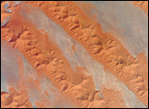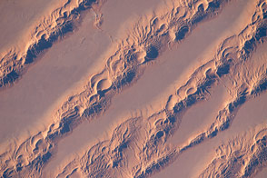
An astronaut aboard the International Space Station (ISS) used a long lens to document what crews have termed one of the most spectacular features of the planet: the dunes of the Namib Sand Sea.
Looking inland (from an ISS position over the South Atlantic) near sunset, the highest linear dunes show smaller linear dunes riding along their crests. Linear dunes are generally aligned parallel to the formative wind—in this case, strong winds from the south. Southerly winds explain the parallel north-aligned linear dunes on the left side of the image.
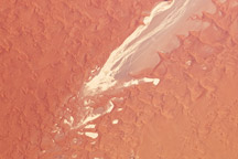
But this simple pattern is disrupted near the Tsondab valley. The valley acts as a funnel for winds from the east. These less frequent but strong winter winds are channeled down the valley and usually carry large amounts of sand, similar to the Santa Ana winds in California. These strong easterly winds significantly deflect all the linear dunes near the valley so that they point downwind (image center).
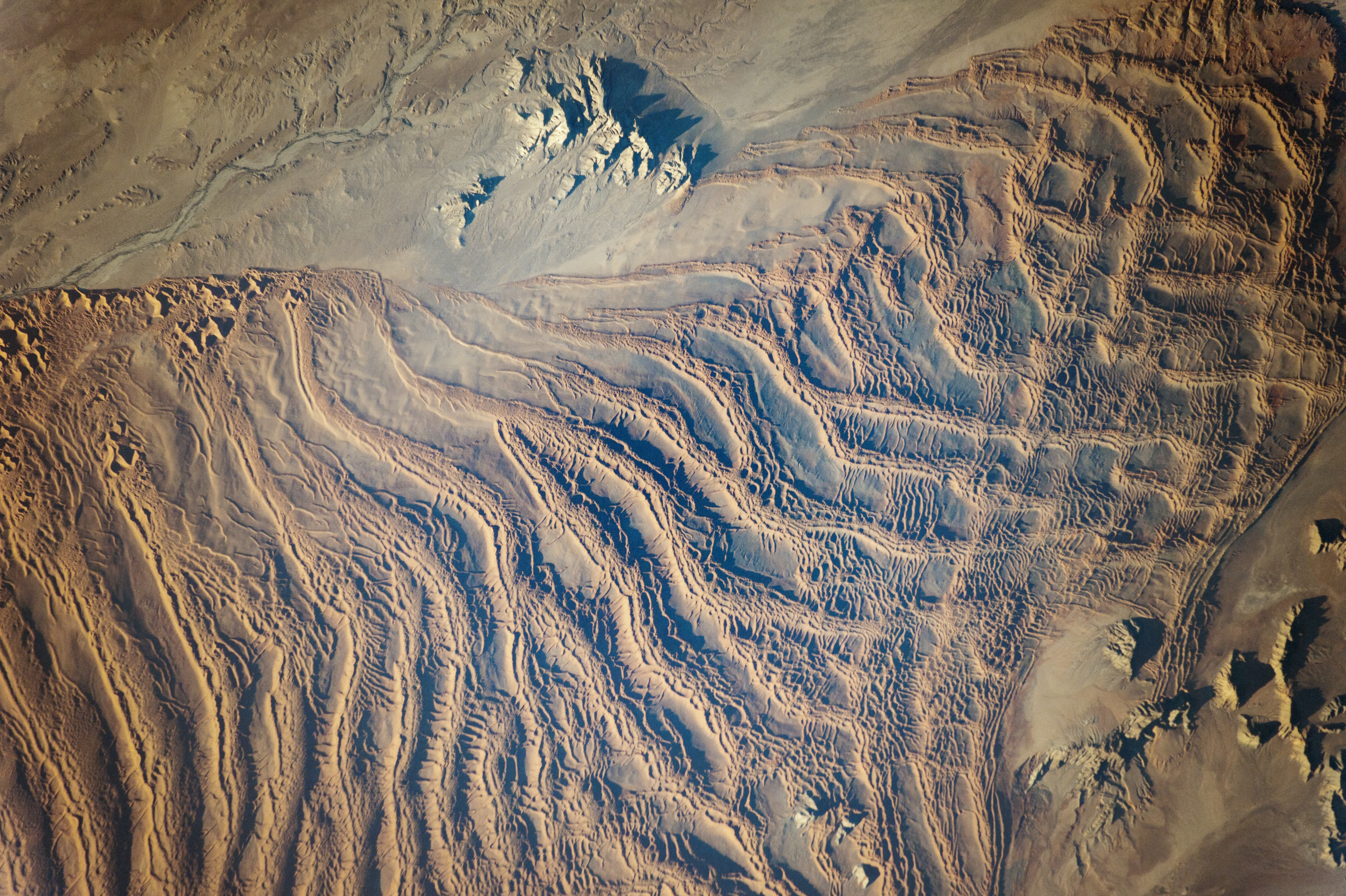
Further inland (right), the north-pointing and west-pointing patterns appear superimposed, making a rectangular pattern. Because the Namib Desert is very old—dating from the time when the cold, desert-forming Benguela ocean current started to flow about 37 million years ago—wind patterns and dune patterns have shifted over time. North-oriented dunes have shifted north and east with drier climates and stronger winds, overriding but not removing earlier dune chains and making the rectangular dune network we see today.
The Tsondab River is a well-known Namib Desert river because it is blocked by linear dunes (just outside the left margin of the image) 100 kilometers (60 miles) from the Atlantic Ocean. Research has shown that during wetter times, it did reach the ocean. The name Tsondab means “that which is running is suddenly stopped” in the local Khoisan language.
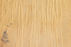
Along the edge of the dune-free Tsondab River valley, we can see star dunes, which are smaller and display multiple arms (top left).
Astronaut photograph ISS047-E-23405 was acquired on March 27, 2016, with a Nikon D4 digital camera using a 500 millimeter lens, and is provided by the ISS Crew Earth Observations Facility and the Earth Science and Remote Sensing Unit, Johnson Space Center. The image was taken by a member of the Expedition 47 crew. The image has been cropped and enhanced to improve contrast, and lens artifacts have been removed. The International Space Station Program supports the laboratory as part of the ISS National Lab to help astronauts take pictures of Earth that will be of the greatest value to scientists and the public, and to make those images freely available on the Internet. Additional images taken by astronauts and cosmonauts can be viewed at the NASA/JSC Gateway to Astronaut Photography of Earth. Caption by M. Justin Wilkinson, Texas State University, Jacobs Contract at NASA-JSC.