The Earth Observatory has published its last Image of the Day on this website. Please join us on our new home at science.nasa.gov/earth/earth-observatory.
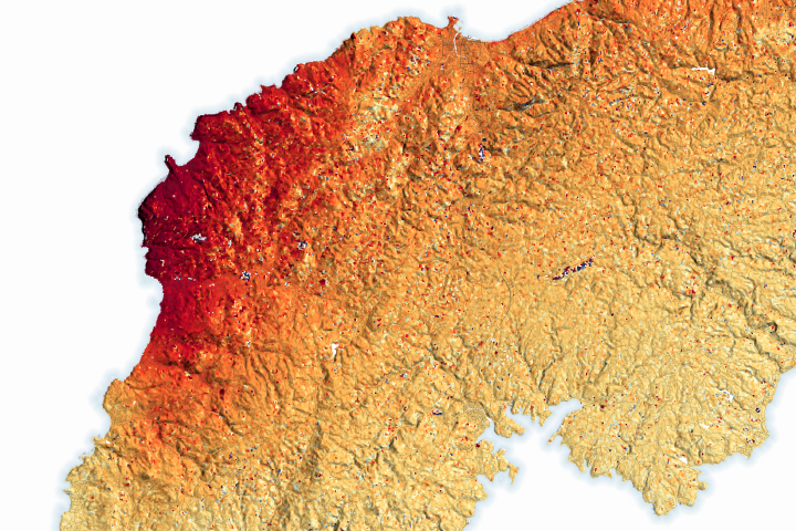
Some parts of the peninsula rose up to 4 meters (13 feet), shifting the position of coastlines and leaving some ports dry.
Published Jan 23, 2024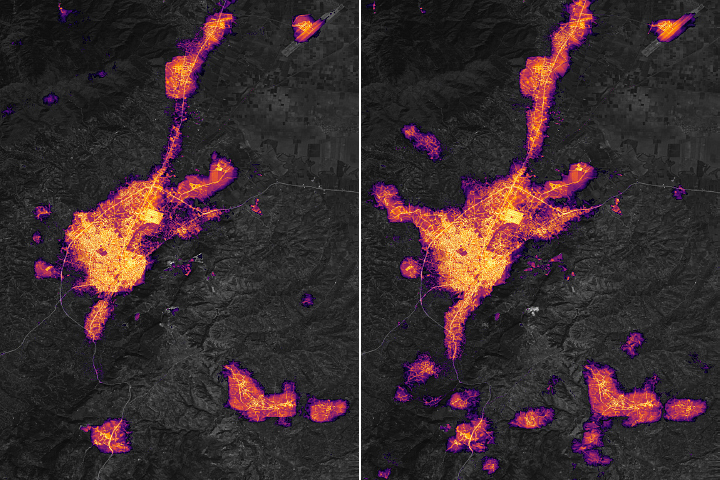
In the days after strong earthquakes struck Türkiye, significant destruction left many areas without electric power.
Published Feb 24, 2023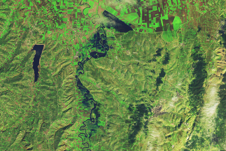
Some towns and farmland were flooded after powerful earthquakes and heavy rains struck areas of Türkiye and Syria.
Published Feb 23, 2023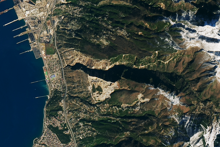
Scientists are using satellite images to locate landslides following the powerful earthquakes that struck in early February.
Published Feb 23, 2023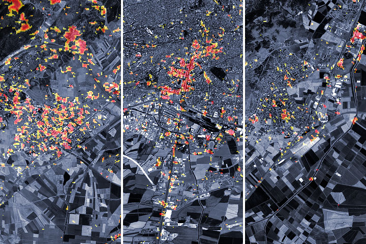
Scientists from NASA and other agencies are using satellites to map damage caused by the devastating earthquake.
Published Feb 9, 2023Image of the Day Land Human Presence Remote Sensing Earthquakes
