The Earth Observatory has published its last Image of the Day on this website. Please join us on our new home at science.nasa.gov/earth/earth-observatory.
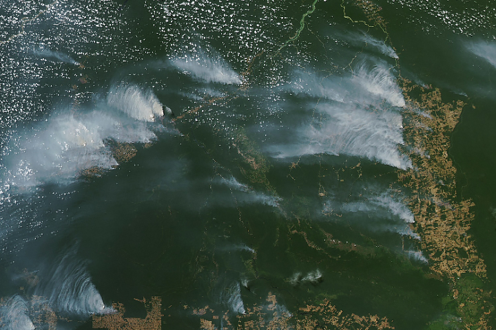
Dense smoke streamed from rainforests in Amazonas and Pará.
Published Aug 9, 2024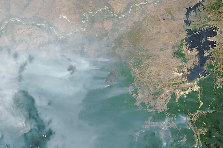
Drought and heat have fueled unusually high numbers of fires in the South American country during the first three months of 2024.
Published Mar 28, 2024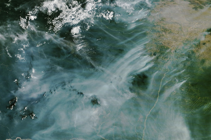
Huge understory fires are spreading throughout the state in northern Brazil as drought and heat turn the rainforest into tinder.
Published Mar 1, 2024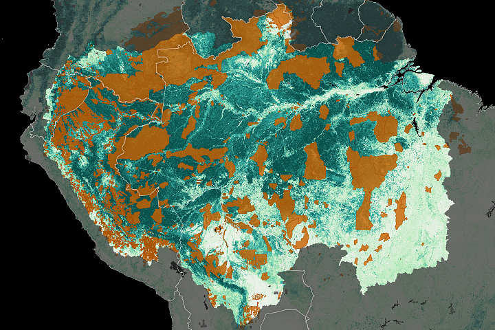
Indigenous people are protecting carbon-rich forests in South America, and satellites are helping.
Published Oct 9, 2023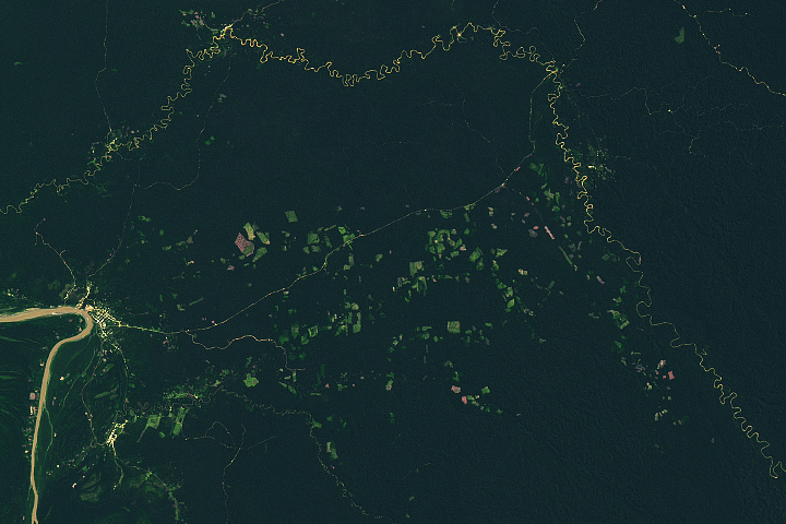
A remote oil and logging road first established in eastern Peru in the 1980s has become a hub for forest clearing.
Published Oct 25, 2022
Using satellite data from the past two decades, scientists are starting to pinpoint which crops and farming styles have lasting impacts on forests.
Published Aug 11, 2021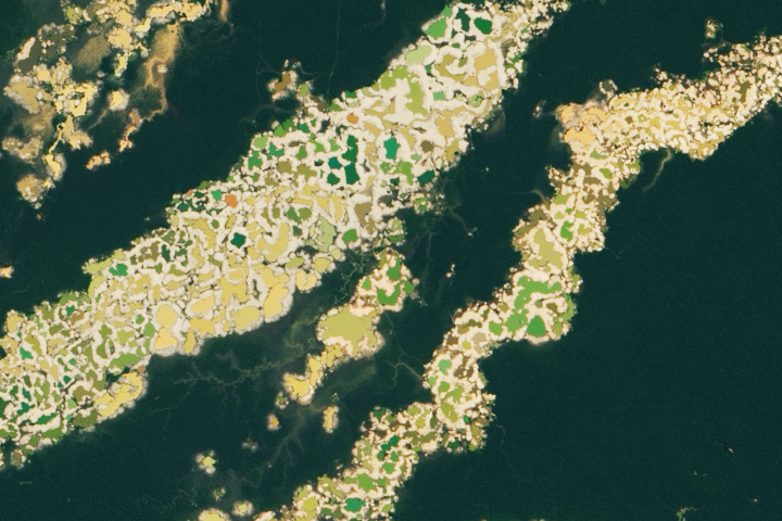
Researchers have created a satellite-based tool to help officials identify new activity.
Published Jun 16, 2021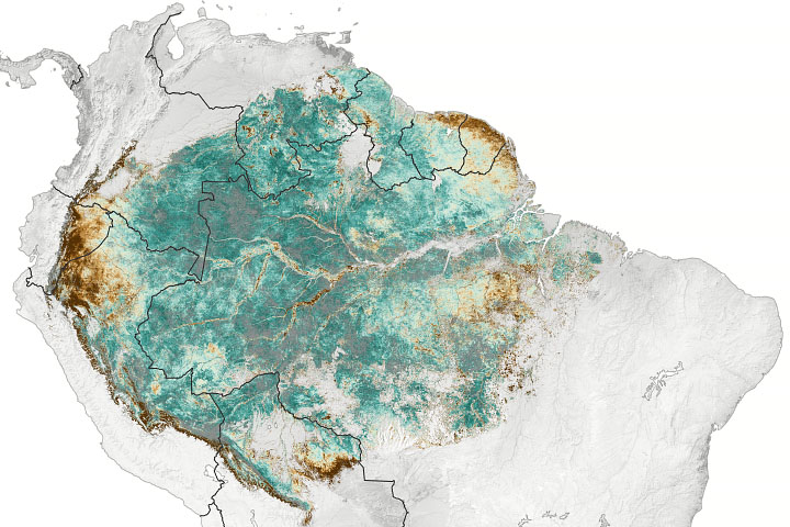
An analysis of geostationary satellite data found a 10 to 15 percent increase in greening around the rainforest during the dry season.
Published Jun 1, 2021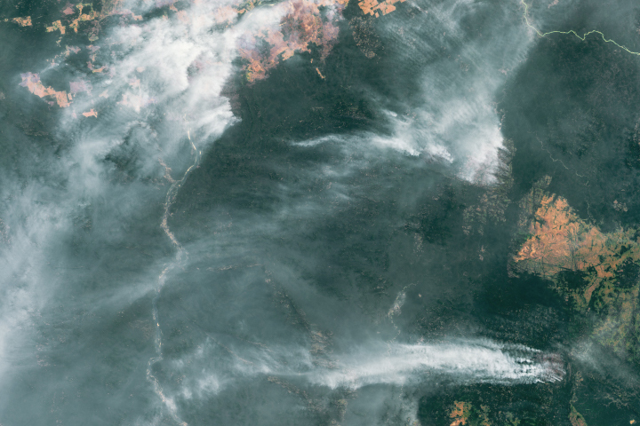
Large numbers of deforestation-related fires burned in the Amazon rainforest, while uncontrolled wildfires blazed in savanna and grassland ecosystems in central Brazil, Bolivia, and Paraguay.
Published Feb 19, 2021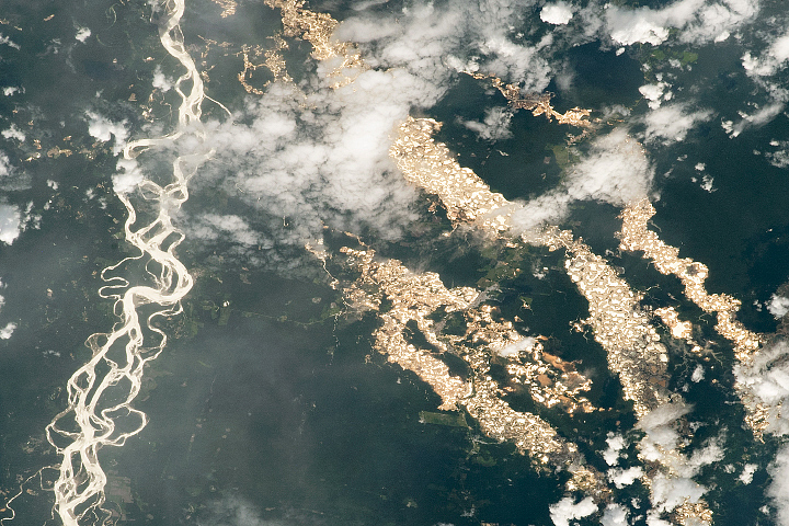
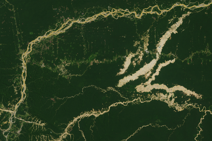
Gold mining pits line the rivers and cut into the rainforest.
Published Feb 7, 2021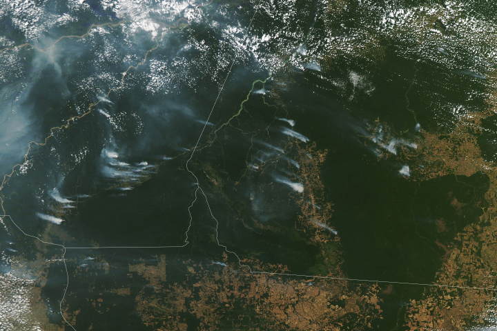
Following a notable increase in fire activity in August 2019 and a gradual rise in deforestation, scientists have been watching for signs of how 2020 might shape up. Several worrisome signs have emerged.
Published Aug 19, 2020Image of the Day Heat Land Fires Human Presence Remote Sensing

The reality of science, statistics, and satellites is that a deep understanding of the causes, effects, and severity of a fire season takes time.
Published Mar 3, 2020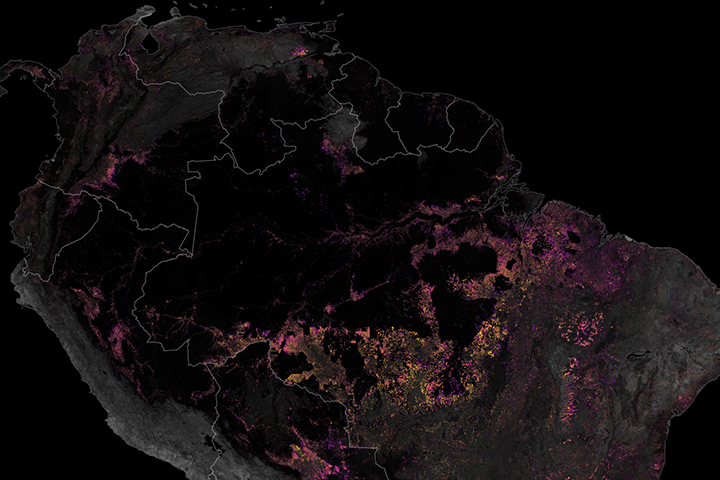
Satellites have played a key role in monitoring and reducing the rate of deforestation in the rainforest.
Published Dec 19, 2019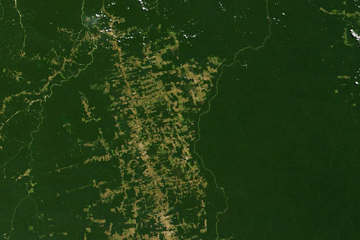
Decades of satellite data make it possible to map how deforestation has evolved over time.
Published Nov 21, 2019
A new tool helped detect water-stressed vegetation near some 2019 Amazon rainforest fires.
Published Nov 8, 2019
The atmosphere above the rainforest has become drier, increasing the demand for water and leaving ecosystems vulnerable to fires and drought.
Published Nov 6, 2019
In spite of its clear significance to the planet, the expansive region is a complex and challenging place for remote sensing scientists to study.
Published Sep 26, 2019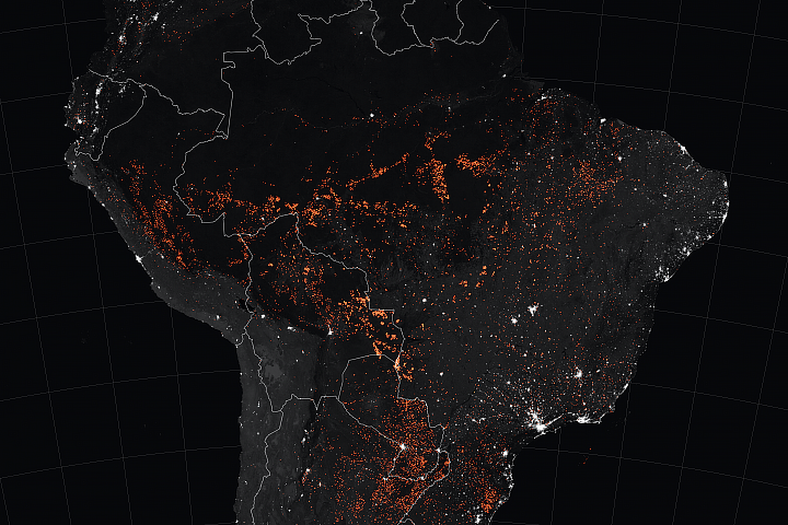
Satellites have detected an increase in fire activity early in the 2019 dry season in the southern Amazon.
Published Aug 23, 2019Image of the Day Atmosphere Heat Land Fires Human Presence Remote Sensing
The Madre de Dios region has a rich concentration of endemic species, but their habitats are being threatened by human activity.
Published Apr 19, 2019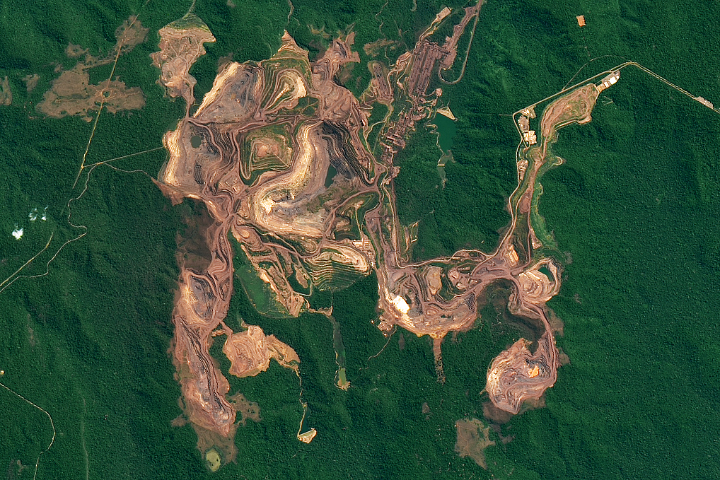
The red-brown earth exposed by open pit mines contrast with the greens of the surrounding Amazon forest.
Published Feb 23, 2019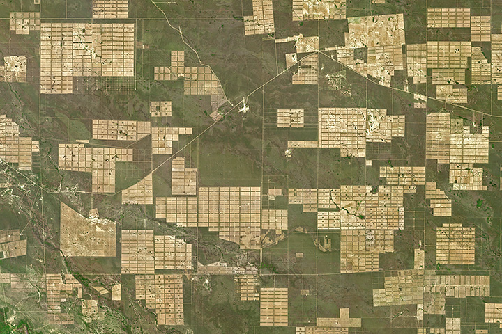
Roughly 20 percent of Gran Chaco’s forest has been converted into farmland or grazing land since 1985.
Published May 1, 2018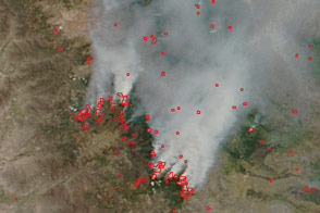
Peru’s intense fire season in 2016 saw burning extend into 11 of the country’s protected areas.
Published Feb 10, 2017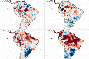
The 2015-16 El Niño has primed the rainforest and watershed for burning.
Published Jul 5, 2016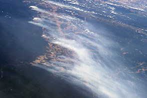
Astronauts caught a glimpse of rainforest being cleared for agriculture in Brazil.
Published Sep 22, 2014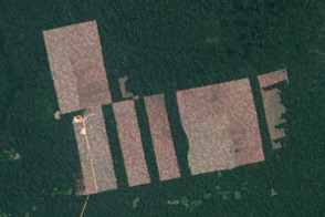
Free, open-access imagery helps scientists monitor remote areas and protect tropical forests.
Published Nov 19, 2013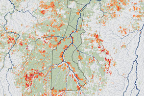
New maps of understory forest fires in the southern Amazon suggest there’s little connection between deforestation and understory fires. Some indigenous reserves where deforestation is minimal still have frequent understory fires.
Published Jun 8, 2013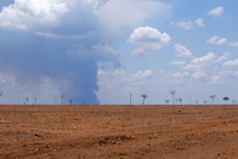
Tropical forests are home to half the Earth's species, and their trees are an immense standing reservoir of carbon. Deforestation will have increasingly serious consequences for biodiversity, humans, and climate.
Published Mar 30, 2007
Although forest clearing for pasture is the primary driver of Amazon deforestation in the state of Mato Grosso, Brazil, a new study led by scientists at the University of Maryland showed that large-scale mechanized agriculture, mostly for soybeans, is rapidly becoming a major force behind forest loss in the region.
Published Sep 21, 2006
Just months after coming online, the ASTER instrument captured a view of forest clearing in Rondonia.
Published Feb 1, 2001