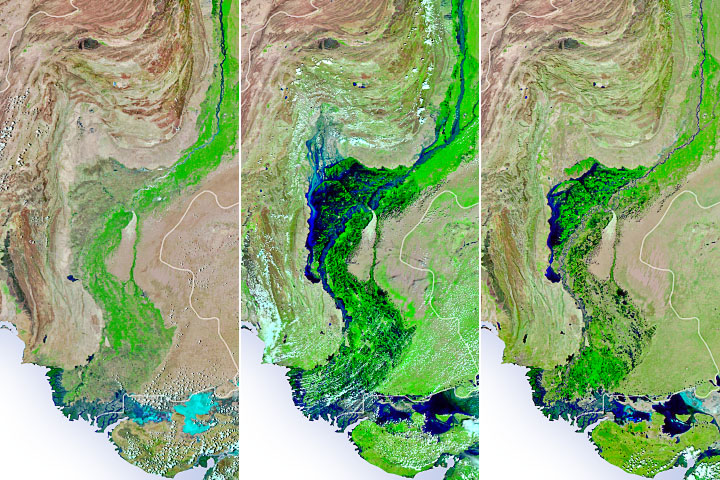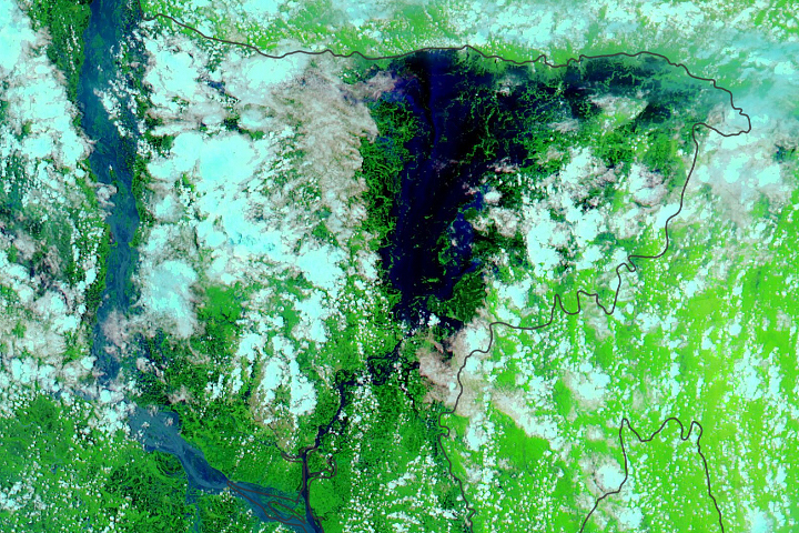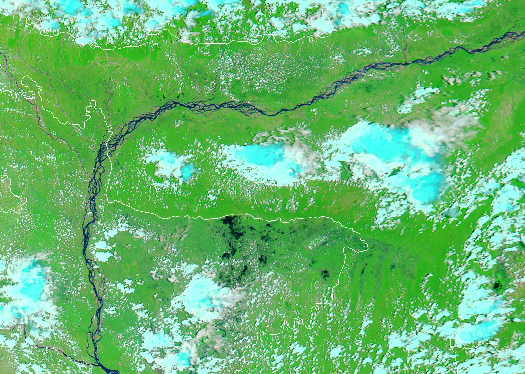
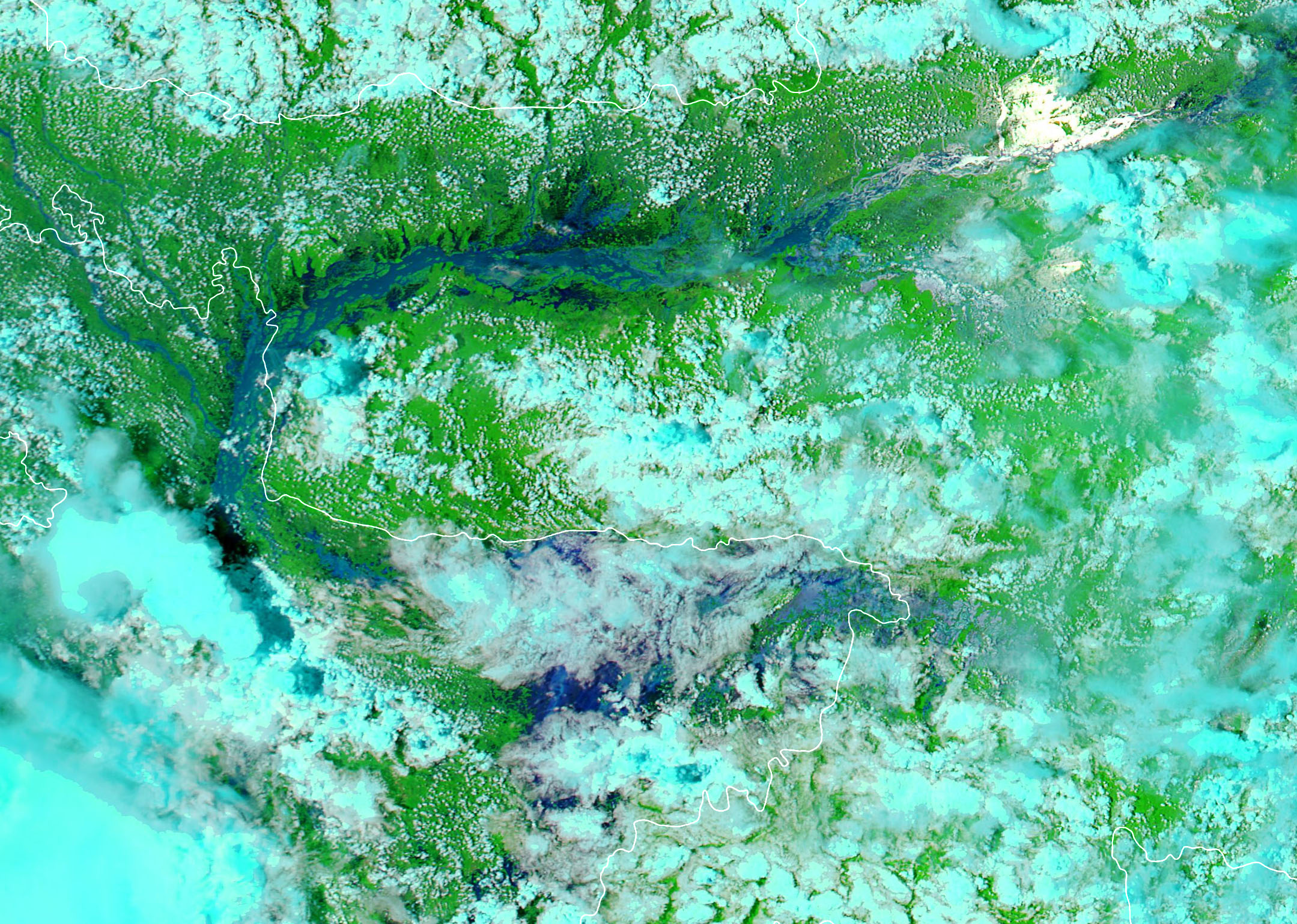
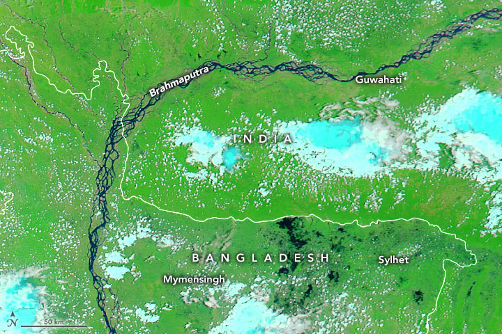
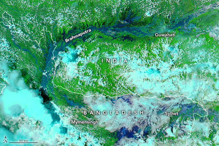
Torrential monsoon rains, lightning, and landslides are common in Bangladesh and the northeastern Indian states of Assam and Meghalaya during the summer. But the intensity of the severe weather that pummeled the low-lying region in mid-June 2022 stands out.
After weeks of downpours, flooding has swamped millions of homes and displaced hundreds of thousands of people in India and Bangladesh, according to reports from humanitarian agencies. Officials from the hard-hit Sylhet region of Bangladesh have called the floods the worst to hit the area in more than a century.
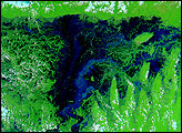
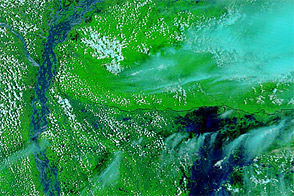
The images above show northeast Bangladesh and India on May 8 (left) and June 22 (right). These false-color images, acquired with the Moderate Resolution Imaging Spectroradiometer (MODIS) on NASA’s Aqua satellite, combine infrared and visible light (bands 7-2-1) to make it easier to see the boundary between water and land. Water appears navy blue and black; clouds are white or cyan; and vegetation is bright green.
On June 22, the Bangladesh Flood Forecasting and Warning Centre reported water levels along the Surma River in Sylhet were at or above “danger level” at several locations. About half of the croplands in Sylhet have flooded, according to the Dhaka Times.
NASA Earth Observatory images by Joshua Stevens, using MODIS data from NASA EOSDIS LANCE and GIBS/Worldview. Story by Adam Voiland.