The Earth Observatory has published its last Image of the Day on this website. Please join us on our new home at science.nasa.gov/earth/earth-observatory.

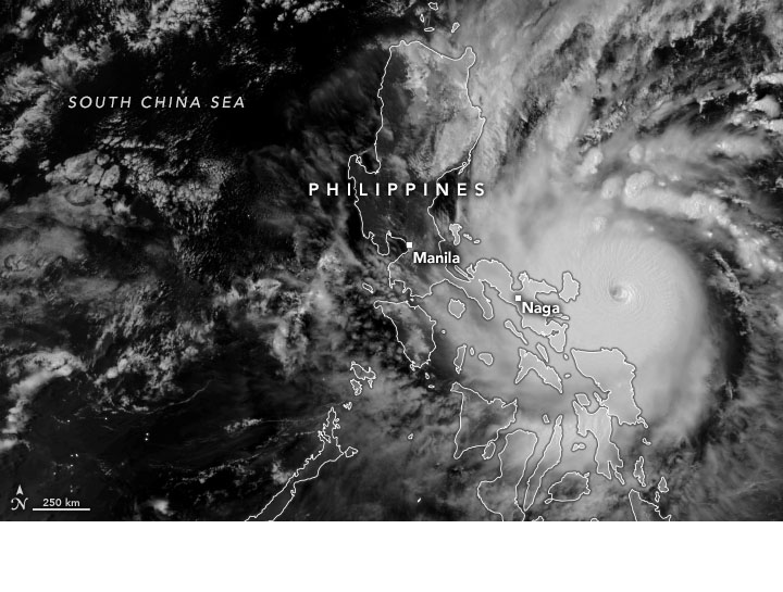
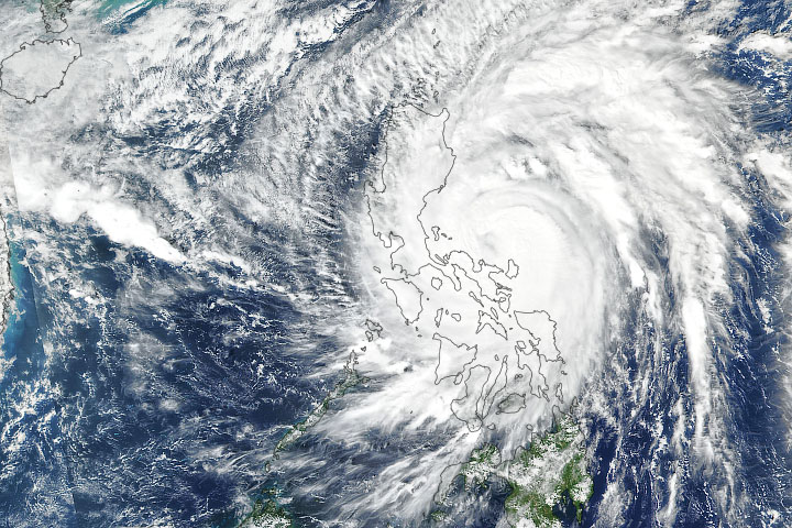
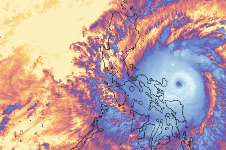
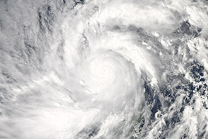
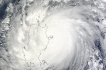
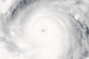
On November 1, 2020, the strongest storm of the year pummeled the Philippines. The Joint Typhoon Warning Center reported that Super Typhoon Goni made landfall with maximum sustained winds of 310 kilometers (195 miles) per hour near its center.
Relief organizations suggest that on Catanduanes Island, where the storm initially made landfall, up to 90 percent of buildings were destroyed. Though the national capital, Manila, was largely spared, the storm destroyed tens of thousands of homes on the island, displaced more than 300,000 people, and killed at least 20 people. As of November 2, the Philippine Red Cross reported Catanduanes Island had no access to electricity, water, and cellular network.
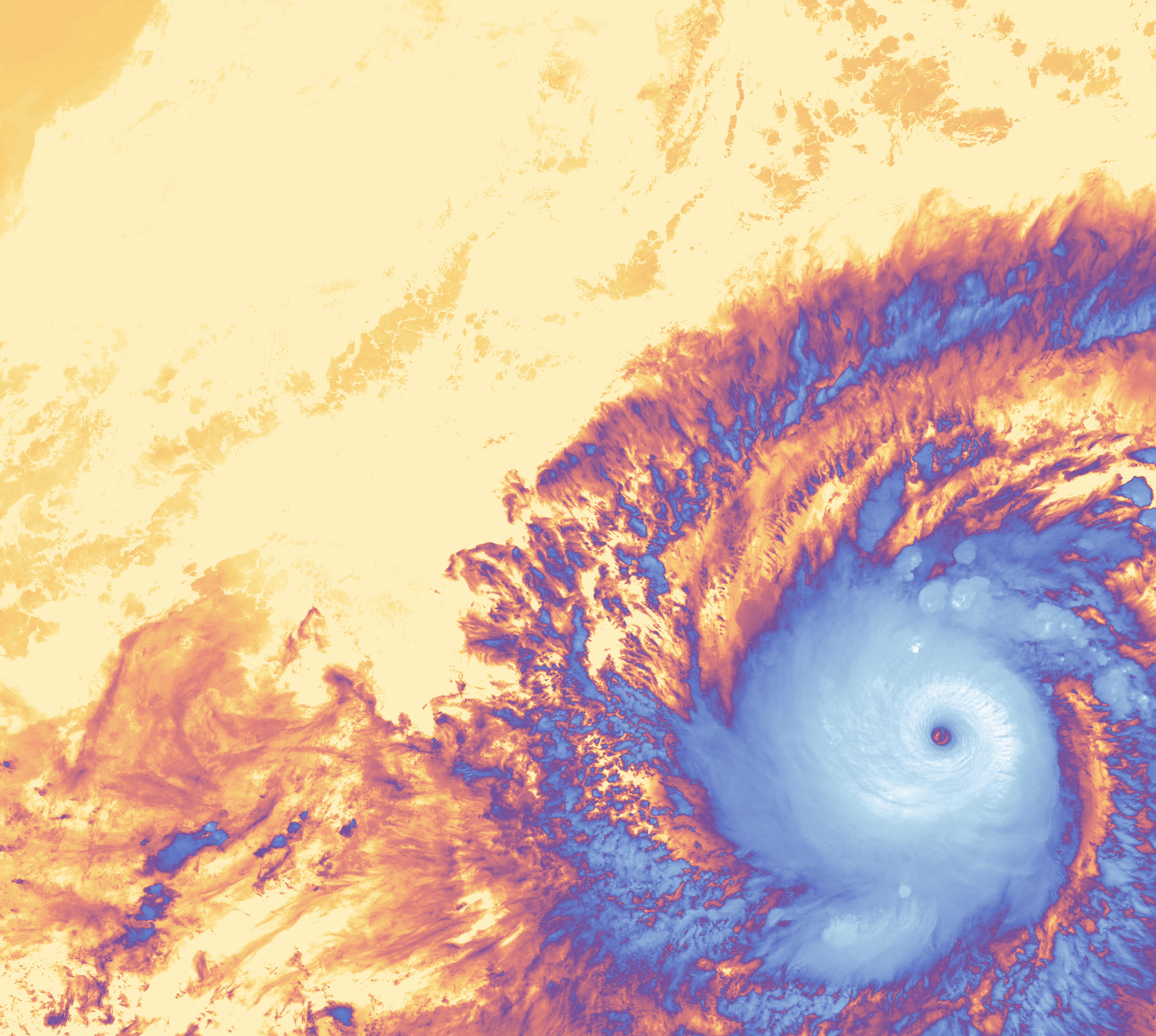
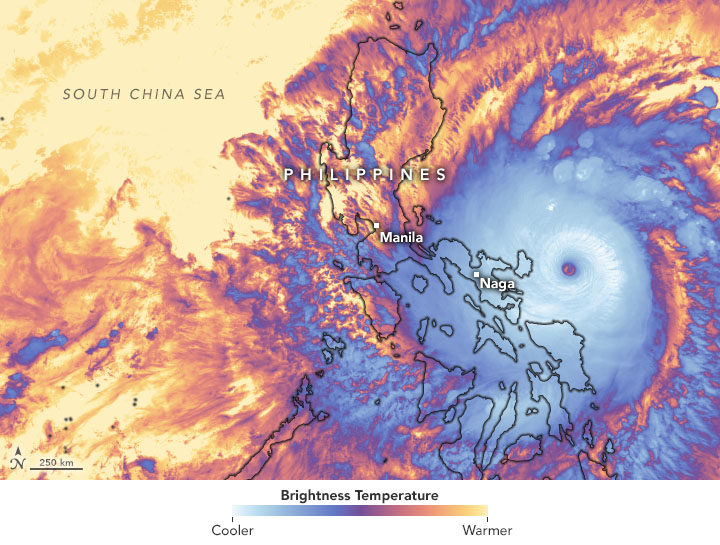
On October 31, 2020, the Visible Infrared Imaging Radiometer Suite (VIIRS) instrument on NASA-NOAA’s Suomi NPP satellite captured these natural-color and infrared images of Goni (locally known as Rolly) before making landfall. The image on the right shows brightness temperature data, which is useful for distinguishing cloud structures (blue) from the surface below (yellow).
Goni started to rapidly intensify on October 28, increasing from a tropical depression with 50-kilometer (30-mile) per hour winds to a 280-kilometer (175-mile) per hour super typhoon in 54 hours. Conditions for intensification were nearly ideal: Goni encountered a moist atmosphere, very warm ocean temperatures, and little wind shear.
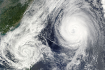
On average, the country experiences 20 storms and typhoons per year. However, the last typhoons to approach the region at this strength were Super Typhoon Meranti in 2016 and Super Typhoon Haiyan in 2013.
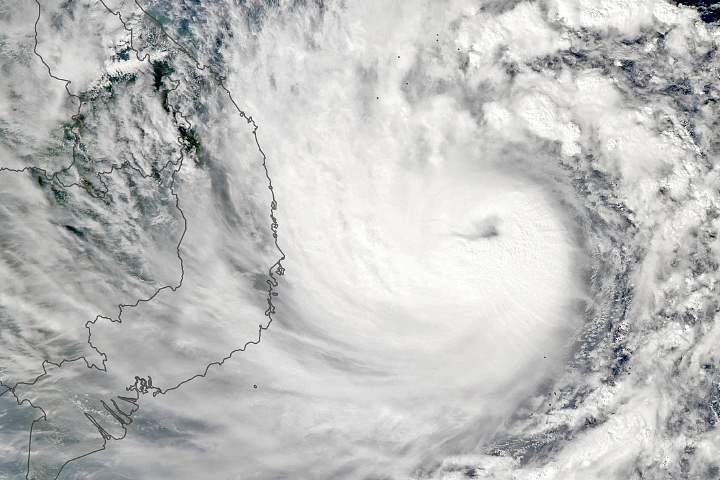
Goni has since weakened to a tropical storm and is expected to make landfall in central Vietnam this week. Goni will be the sixth tropical storm to hit Vietnam since the beginning of October. Vietnam is still reeling from recent typhoon Molave, which was one of the most powerful storms to hit the country in decades.
NASA Earth Observatory images by Joshua Stevens, using VIIRS data from NASA EOSDIS/LANCE and GIBS/Worldview and the Suomi National Polar-orbiting Partnership. Story by Kasha Patel.