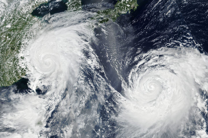
Twin typhoons continued to churn across the Western Pacific Ocean, threatening East Asian countries with destructive winds and rain.
Published Aug 9, 2019Image of the Day Atmosphere Land Water Severe Storms Human Presence
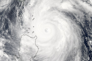
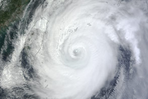
Super Typhoon Songda swirled off the coast of Luzon, at the northern end of the Philippine Islands chain, in the afternoon of May 27, 2011.
Published May 29, 2011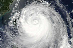
Typhoon Soulik is forecast to bring extremely heavy rain to Taiwan and China in the next couple of days.
Published Jul 13, 2013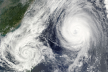
A little over 1,000 kilometers separated the center of Tropical Storm Parma from the center of Typhoon Melor on October 6, when the this composite image was taken.
Published Oct 7, 2009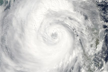
Category 4 Typhoon Megi sprawls over much of the South China Sea in this true-color image from October 20, 2010.
Published Oct 20, 2010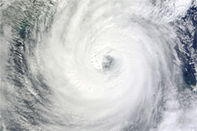
Acquired October 21, 2010, this natural-color image shows Typhoon Megi over the South China Sea.
Published Oct 21, 2010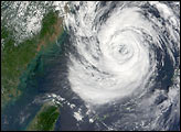
The storm was headed for Okinawa and the main island of Japan in late September 2012.
Published Sep 29, 2012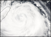


The category 3 storm swept over the Philippines on August 12, 2013.
Published Aug 13, 2013