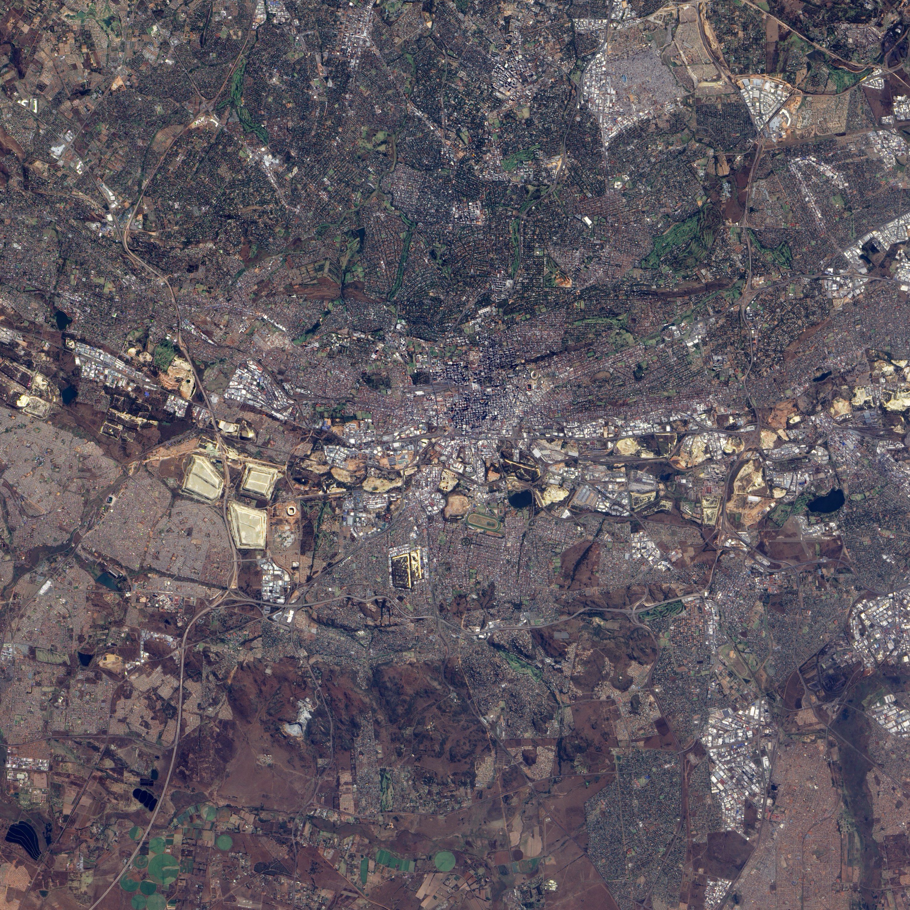
The site of the June 11 opening game for the 2010 World Cup, Soccer City sits in Johannesburg’s Soweto Township. Previously named the FNB Stadium, the facility underwent an upgrade for the 2010 World Cup games. The Advanced Land Imager (ALI) on NASA’s Earth Observing-1 (EO-1) satellite captured this natural-color image of the stadium on May 14, 2009, while upgrades were apparently still in progress. Shaped roughly like a rectangle with rounded corners, the stadium sports high walls that cast long shadows toward the southwest.
Capable of seating 94,700 spectators, Soccer City is nevertheless dwarfed by nearby slag piles left over from decades-long mining operations. The slag heaps hold massive dumps of crushed rock discarded after gold extraction. Gold-bearing rock layers were originally discovered in this region in the late nineteenth century, and gold mining long powered South Africa’s economy.
On the opposite side of the slag piles from Soccer City is Diepkloof, one of several settlements comprising Soweto. The roughly circular-shaped settlement shows a street grid typical of residential areas, with small, closely packed houses. East and northeast of Soccer Stadium are clusters of much larger buildings characteristic of an industrial park.
Although vegetation appears in this image, it is relatively scarce, and much of the ground appears in shades of beige and brown, either sparsely vegetated land, or earth upturned to prepare for construction. One exception is the green golf course immediately east of Soccer City.
NASA Earth Observatory image created by Jesse Allen, using EO-1 ALI data provided courtesy of the NASA EO-1 team and the United States Geological Survey. Caption by Michon Scott.