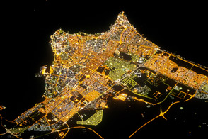
The patterns and colors of lighting reveal the urban geography of the capital city.
Published Sep 17, 2012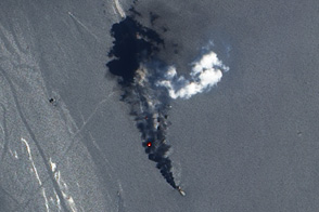
Daytime and nighttime satellite imagery shows the burning of methane that goes together with the oil extraction process.
Published Sep 14, 2012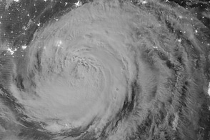
Isaac, a slow-moving storm, hit the Gulf Coast as a category 1 hurricane on August 28, 2012.
Published Aug 30, 2012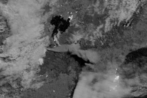
A new satellite captured the eruption of a volcano at night on New Zealand's North Island.
Published Aug 8, 2012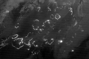
The Suomi NPP satellite carries an instrument so sensitive to low light levels that it can detect wildfires in the middle of the night.
Published Aug 7, 2012
Unique satellite instruments capture the view of the Olympic host city at night.
Published Jul 26, 2012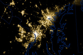
A powerful line of thunderstorms knocked out power to millions of households in the U.S. Midwest and Mid Atlantic on June 29, 2012.
Published Jul 4, 2012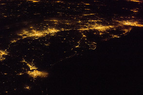
One of the largest conurbations in the world is located along East Coast of the United States, and stretches from Boston to Washington.
Published May 23, 2011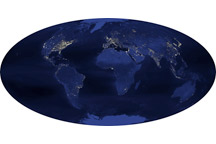
Observations collected at night shed light on the changing face of our planet.
Published Nov 29, 2008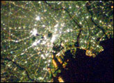
This nighttime photograph of Tokyo, Japan, was taken by International Space Station astronaut Dan Tani on February 5, 2008. The heart of the city is brightest, with ribbons of lights radiating outward from the center along streets and railways.
Published Apr 22, 2008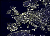
Satellite map of the man-made lights on Earth, which scientists use to study development and urbanization.
Published Oct 23, 2000