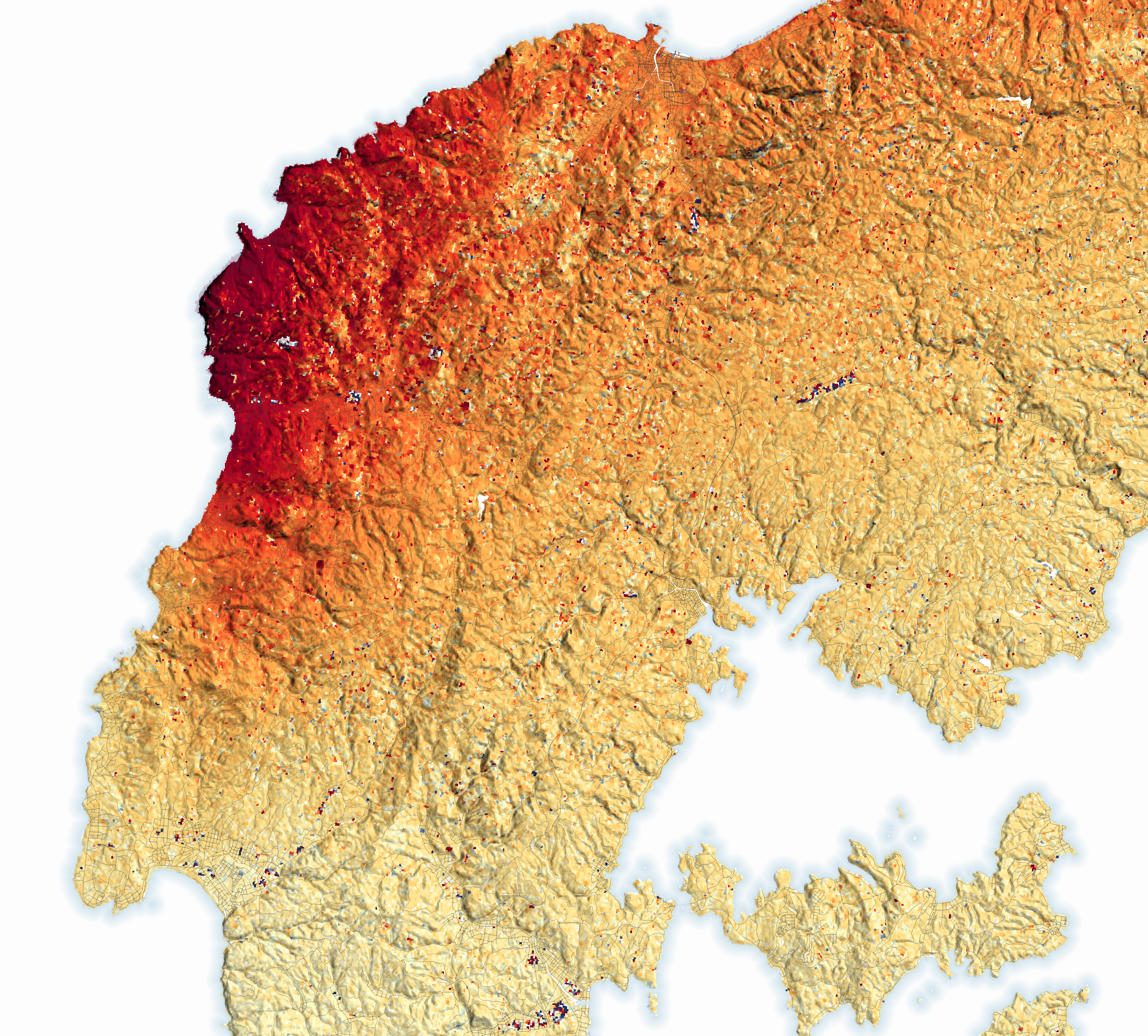
The first day of 2024 brought catastrophe to parts of Japan. At 4:10 p.m. Japan Standard Time (07:10 Universal Time), the land on the Noto Peninsula in northwestern Honshu began to lurch, shaking violently for about 50 seconds. The 7.5 magnitude mainshock was followed by dozens of strong aftershocks in the following minutes, hours, and days.
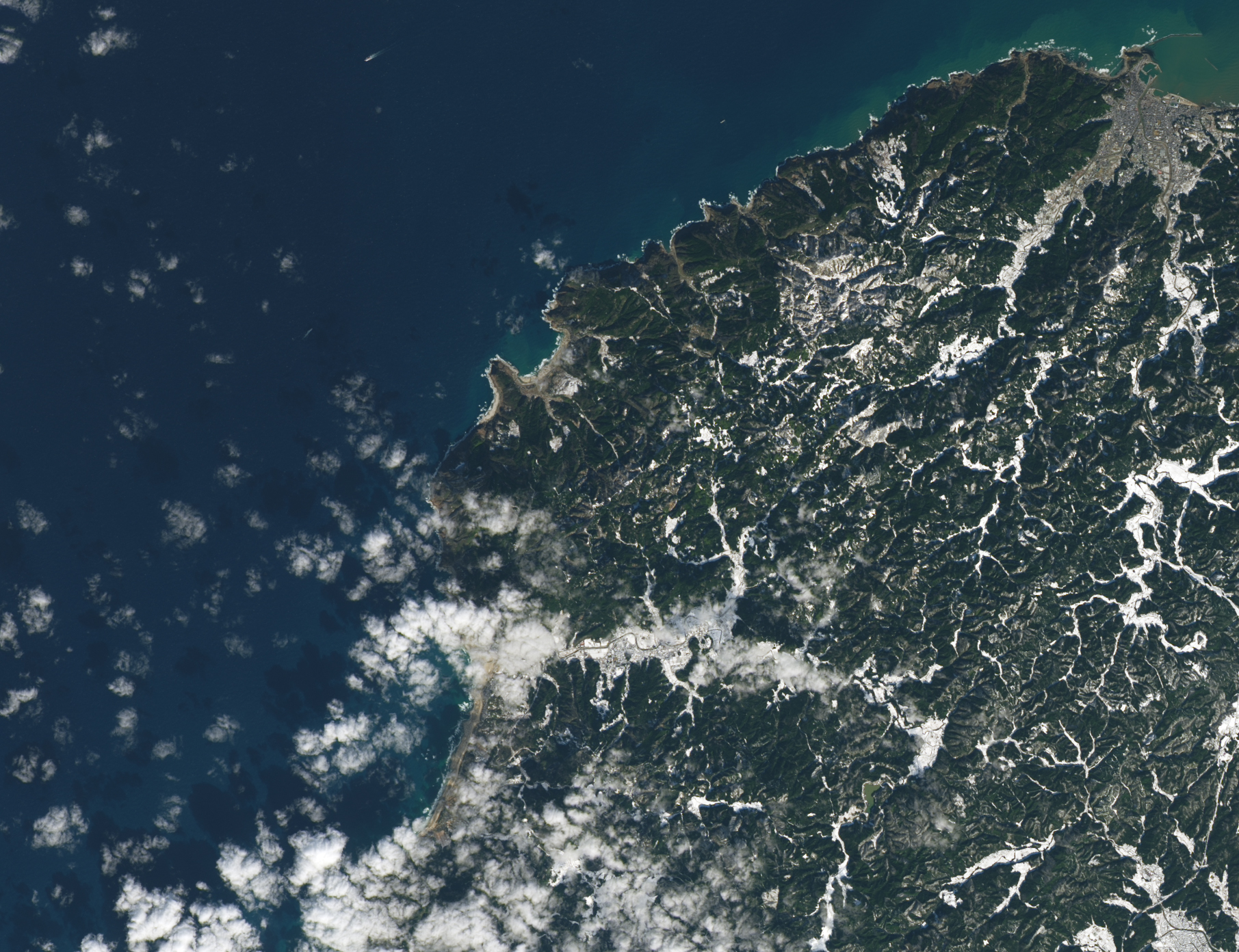
The earthquake on January 1, 2024, was the strongest to hit Ishikawa Prefecture since 1885 and mainland Japan since the 2011 Tohoku earthquake. Shaking was felt across much of Honshu including Tokyo, located about 300 kilometers southeast of the earthquake’s epicenter. Shaking was most intense in the towns of Suzu, Noto, Wajima, and Anamizu, close to the epicenter on the northern Noto Peninsula. Damage to infrastructure ignited fires that burned through communities. Heavy snow that fell after the quake complicated emergency response efforts, making it difficult for aid to reach some communities.
As first responders reacted to the disaster from the ground, several teams of scientists tracked the situation using satellites. The map above shows the amount of ground displacement—the shifting of the land—caused by the earthquake. Red areas were pushed upward and toward the northwest. The scattered dark blue and red areas around the airport and other cleared areas and settlements throughout the peninsula are likely false signals caused by how the shapes of buildings or other features reflect radar signals.
“The surface moved upward as much as 4 meters (13 feet) on some parts of the north coast of the Noto Peninsula,” said Eric Fielding, a geophysicist at NASA’s Jet Propulsion Laboratory (JPL). “The uplift is large because the fault ruptured close to the surface—at a depth of about 10 kilometers (6 miles). It occurred on a fault with a steep dip angle, and the south side of the fault moved upward—what we call a thrust earthquake.”
Earthquakes occur at a variety of depths. Those that occur between 0 to 70 kilometers are shallow, between 70 and 300 kilometers are intermediate, and between 300 and 700 kilometers are deep. Earthquakes that occur at shallow depths, like this one, tend to be more destructive because the seismic waves generated have less time to lose energy as they travel from the source of a quake to the surface.
The map is based on data from the Advanced Rapid Imaging and Analysis (ARIA) team at JPL and the California Institute of Technology’s Seismological Laboratory, a team that develops state-of-the-art deformation measurements, change detection methods, and physical models for use in hazards science and response. The ARIA team used synthetic aperture radar data from the PALSAR-2 sensor on the Japan Aerospace Exploration Agency’s ALOS-2 (Advanced Land Observing Satellite-2) and a pixel offset tracking technique to measure surface displacement in the line-of-sight between the ground and the satellite.
Additional analysis of ALOS-2 observations by scientists from the Geospatial Information Authority of Japan indicates that the earthquake uplifted land along 85 kilometers (52 miles) of coastline. It shifted the location of the coastline roughly 200 meters seaward at Minazuki Bay, one of the areas that saw the most uplift. They also reported a large amount of uplift and new land in Waijma and Nafune.
Goto Hideaki, a geomorphologist from Hiroshima University, with colleagues from the Association for Japanese Geographers, used aerial photographs and satellite data to estimate that the quake exposed a total of 4.4 square kilometers of land along the coasts of the Nota Peninsula.
Some of the coastline changes around Minazuki Bay are visible in the pair of Landsat images above. The image on the left, from the OLI-2 (Operational Land Imager-2) on Landsat 9 was acquired on January 10, 2022, before the earthquake. The image on the right, from OLI (Operational Land Imager) was acquired on January 17, 2024, after the event. The bay hosts two small fishing ports that were left much higher and drier than usual. More than 15 fishing ports in Ishikawa Prefecture reported uplift, according to The Asashi Shimbun.
Satellite data often proves useful for emergency aid organizations assisting with disaster response immediately after an event because it can be used to rapidly locate the most severely damaged areas. Over longer time spans, satellite data can also help authorities make more informed decisions about recovery and rebuilding as they prepare for the possibility of future events.
NASA Earth Observatory surface displacment map by Lauren Dauphin, using data provided by the ARIA team at NASA’s Jet Propulsion Laboratory and California Institute of Technology. The map is based on ALOS-2/PALSAR-2 data provided by JAXA that was processed by the ARIA team. Dauphin generated the pair of Landsat images using Landsat data from the U.S. Geological Survey. Story by Adam Voiland, with science review by Eric Fielding.


