
The reality of science, statistics, and satellites is that a deep understanding of the causes, effects, and severity of a fire season takes time.
Published Mar 3, 2020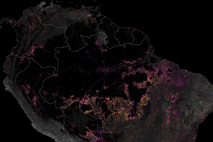
Satellites have played a key role in monitoring and reducing the rate of deforestation in the rainforest.
Published Dec 19, 2019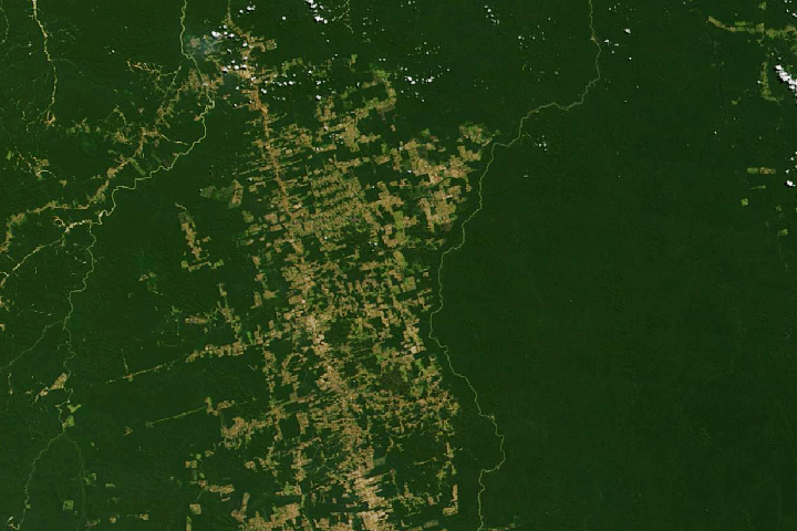
Decades of satellite data make it possible to map how deforestation has evolved over time.
Published Nov 21, 2019
A new tool helped detect water-stressed vegetation near some 2019 Amazon rainforest fires.
Published Nov 8, 2019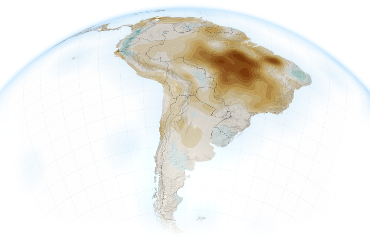
The atmosphere above the rainforest has become drier, increasing the demand for water and leaving ecosystems vulnerable to fires and drought.
Published Nov 6, 2019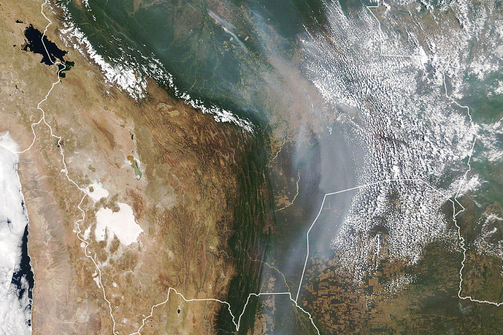
Fires raged in Bolivia’s lowlands throughout much of August and September.
Published Oct 4, 2019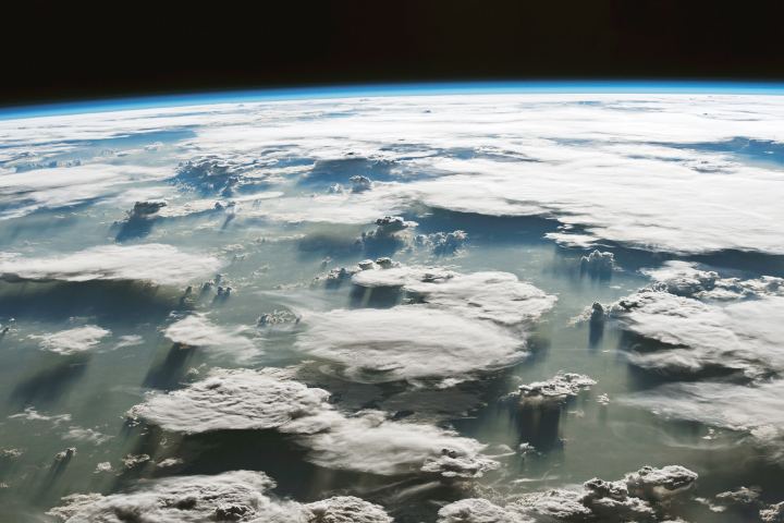
In spite of its clear significance to the planet, the expansive region is a complex and challenging place for remote sensing scientists to study.
Published Sep 26, 2019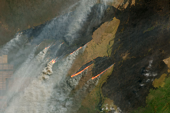
Since the beginning of August 2019, NASA satellites have observed fires burning near the border of Bolivia, Paraguay, and Brazil.
Published Aug 27, 2019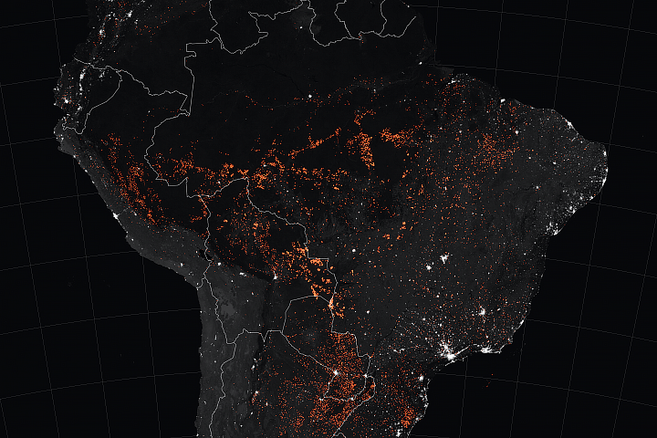
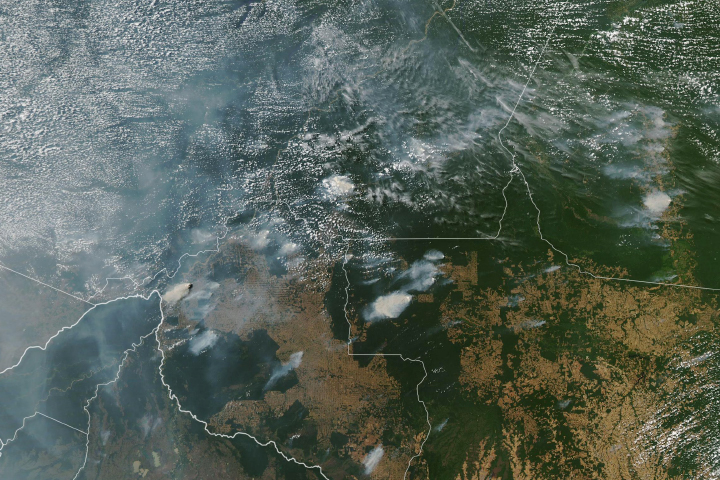
Satellites have detected an increase in fire activity early in the 2019 dry season in the southern Amazon.
Published Aug 23, 2019Image of the Day Atmosphere Heat Land Fires Human Presence Remote Sensing
Satellites begin to detect heightened fire activity in July and August in the Amazon.
Published Aug 16, 2019