Today’s caption further explains an image highlighted in our new feature: A Celebration of Clouds.
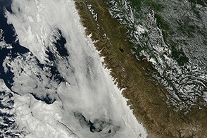
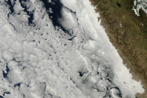
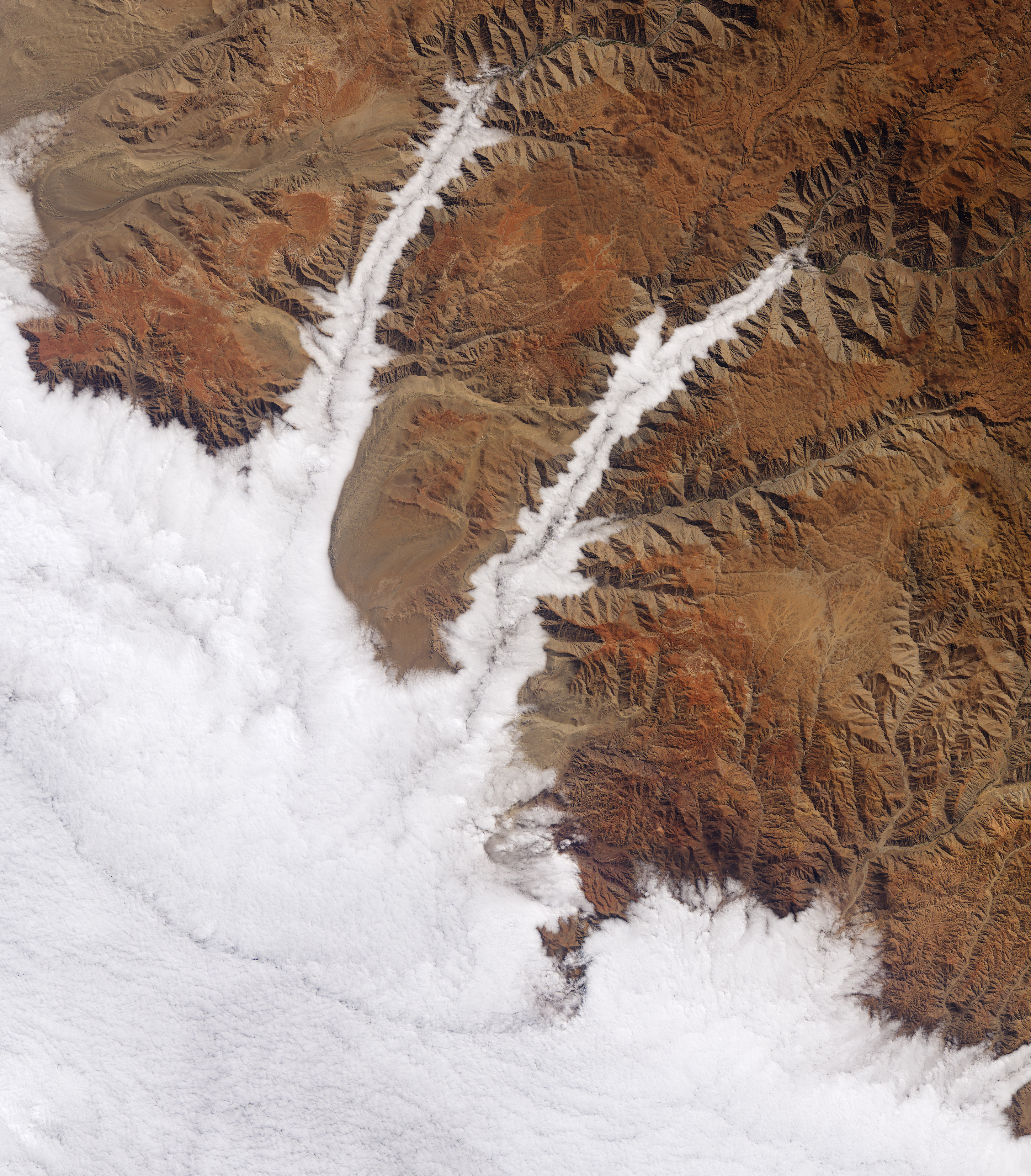
The valleys along Peru’s southern coast are among the deepest on Earth. They are also frequently filled with clouds. On July 26, 2015, the Operational Land Imager (OLI) on Landsat 8 captured this natural-color image of the cloud-filled canyons through which the Yauca and Acarí rivers empty into the Pacific Ocean.
You can’t see it, but the Pacific lies below the clouds in the lower-left of the image. The clouds are marine stratocumulus—a type of low-level cloud so close to the surface that it is essentially fog. According to David Painemal, an atmospheric scientist at NASA’s Langley Research Center, these clouds are a “climatologically persistent feature over the southeast Pacific off the coast of Peru and Chile.”
This cloud type persists here because the region has just the right oceanic and atmospheric conditions. An air circulation pattern known as the Hadley Cell lifts air near the equator and drops it at higher latitudes, including this part of South America. The circulation produces trade winds that draw the deep, cool water of the Humboldt Current to the ocean surface. The cool water also cools the near-surface air, causing the humid air over the Pacific Ocean to condense and form clouds. The descending air of the Hadley Cell also prevents convection, keeping the cloud layer low to the surface and stable.
Marine stratocumulus clouds most frequently develop off of Chile and Peru during the austral winter (June through August) and early spring. On some occasions, prevailing winds can push the clouds inland. Because the marine clouds are low, they are easily blocked by coastal mountains and hills, such as the Andes. But in areas where low valleys open to the ocean—such as the Yauca and Acarí canyons—the clouds find “a free passage eastward,” Painemal said.
Temperature inversions cap the elevation of the fog. Ralf Hesse, a scientist at the State Office for Cultural Heritage in Germany, has used remote sensing to study the phenomenon. He notes that fog in the valleys pictured here traces along the flanks of the mountains at a top elevation of 910 meters. Assuming that the cloud layer extends downward for at least a few hundred meters, there is a zone where conditions are favorable for plants to grow.
“Fog interception by the canopies of shrubs and trees within this zone bring an added source of moisture, producing communities called ‘lomas,’” said Philip Rundel, an ecologist at University of California, Los Angeles. “These are natural fog communities with many endemic plant species.”
Adequate frequency, duration, and density of fog is critical for the establishment and success of vegetation growing in lomas. The fog also must move. “Movement across the surface is necessary for the fog droplets to be ‘combed out’ of the air by plant leaves,” Hesse said. “Stagnant fog is not sufficient.”
NASA Earth Observatory image by Joshua Stevens, using Landsat data from the U.S. Geological Survey. Caption by Kathryn Hansen.