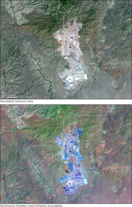
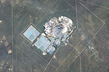
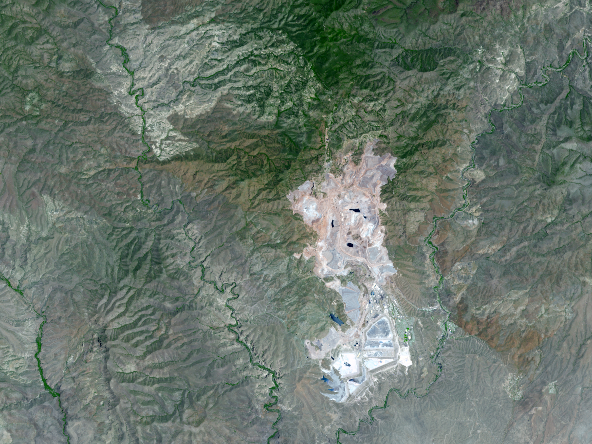
Nearly filling the “V” made by Eagle Creek and the San Francisco River as they flow southward toward the Gila River, the Morenci Open Pit Copper Mine in southeastern Arizona is the largest producer of copper in America. Operating non-stop, processing 700,000 tons of rock a day, and producing about 840 million pounds of copper a year, the mine has clearly left its mark on the land surface. This pair of images from the Advanced Spaceborne Thermal Emission and Reflection Radiometer (ASTER) on NASA’s Terra satellite shows how the Morenci Mine looks in photo-like, natural color as well as in infrared wavelengths of light that are invisible to our eyes.
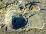
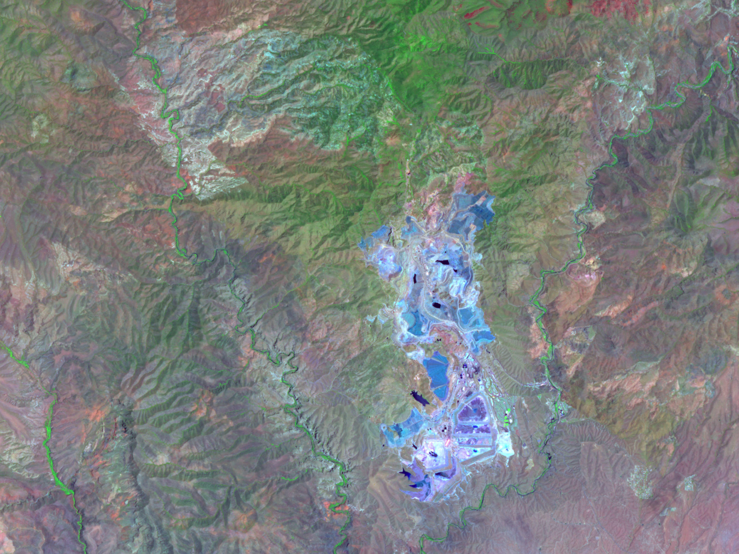
In the top image, the bare rock surfaces of both the mine (center) and natural rock outcrops along the creeks that feed into Eagle Creek near Juniper Flat (upper left) have a somewhat similar appearance. In contrast to dark green vegetation in riparian areas along streams and on mountains slopes north of the mine, the exposed ground of the mine and around Juniper Flat have shades of gray and white in common. The infrared version of the scene reveals their striking differences. The processed ores at the mine give the entire mine site a bright blue color. At the southern end of the mine, where the water used to process the ore is reclaimed in giant reservoirs and tailings ponds, the landscape appears darker blue or purple. The naturally bare rock of the Eagle Creek tributaries near Juniper Flat appears much the same in the infrared version of the scene as it does in natural color. The image was captured on July 14, 2007.
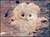
The ability to use visible and infrared light to generate different images of the Earth’s surface (see another image of the Morenci Mine) can help scientists do research that might at first seem to be impossible from space, including fossil-hunting and prospecting for metals and valuable mineral ores.
Massive-scale natural resource extraction like open-pit mining rarely proceeds without controversy. Among the more recent controversies involving Arizona copper mines is the decision by the Bureau of Land Management in 2005 to accept a land swap with Phelps Dodge, the company which operates the Morenci Mine. In exchange for just under 4,000 acres of ecologically important lands that the company owns in various parts of Arizona, Phelps Dodge will gain about 16,000 acres of land southwest of the Morenci Mine. The company plans to open a second open-pit copper mine on the land in 2008. Worried about pollution and long-term land degradation, the San Carlos Apache Tribe, whose reservation is adjacent to the proposed mine site, as well as several environmental groups protested the decision.
You can download a 15-meter-resolution KMZ file of the Morenci Mine showing natural and false color imagery that is suitable for use with Google Earth.
Nearly filling the “V” made by Eagle Creek and the San Francisco River as they flow southward toward the Gila River, the Morenci Open Pit Copper Mine in southeastern Arizona is the largest producer of copper in America. Operating non-stop, processing 700,000 tons of rock a day, and producing about 840 million pounds of copper a year, the mine has clearly left its mark on the land surface. This pair of images from the Advanced Spaceborne Thermal Emission and Reflection Radiometer (ASTER) on NASA’s Terra satellite shows how the Morenci Mine looks in photo-like, natural color as well as in infrared wavelengths of light that are invisible to our eyes.
In the top image, the bare rock surfaces of both the mine (center) and natural rock outcrops along the creeks that feed into Eagle Creek near Juniper Flat (upper left) have a somewhat similar appearance. In contrast to dark green vegetation in riparian areas along streams and on mountains slopes north of the mine, the exposed ground of the mine and around Juniper Flat have shades of gray and white in common. The infrared version of the scene reveals their striking differences. The processed ores at the mine give the entire mine site a bright blue color. At the southern end of the mine, where the water used to process the ore is reclaimed in giant reservoirs and tailings ponds, the landscape appears darker blue or purple. The naturally bare rock of the Eagle Creek tributaries near Juniper Flat appears much the same in the infrared version of the scene as it does in natural color. The image was captured on July 14, 2007.
The ability to use visible and infrared light to generate different images of the Earth’s surface (see another image of the Morenci Mine) can help scientists do research that might at first seem to be impossible from space, including fossil-hunting and prospecting for metals and valuable mineral ores.
Massive-scale natural resource extraction like open-pit mining rarely proceeds without controversy. Among the more recent controversies involving Arizona copper mines is the decision by the Bureau of Land Management in 2005 to accept a land swap with Phelps Dodge, the company which operates the Morenci Mine. In exchange for just under 4,000 acres of ecologically important lands that the company owns in various parts of Arizona, Phelps Dodge will gain about 16,000 acres of land southwest of the Morenci Mine. The company plans to open a second open-pit copper mine on the land in 2008. Worried about pollution and long-term land degradation, the San Carlos Apache Tribe, whose reservation is adjacent to the proposed mine site, as well as several environmental groups protested the decision.
You can download a 15-meter-resolution KMZ file of the Morenci Mine showing natural and false color imagery that is suitable for use with Google Earth.
NASA image created by Jesse Allen, using data provided courtesy of NASA/GSFC/METI/ERSDAC/JAROS, and U.S./Japan ASTER Science Team.

