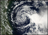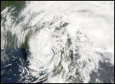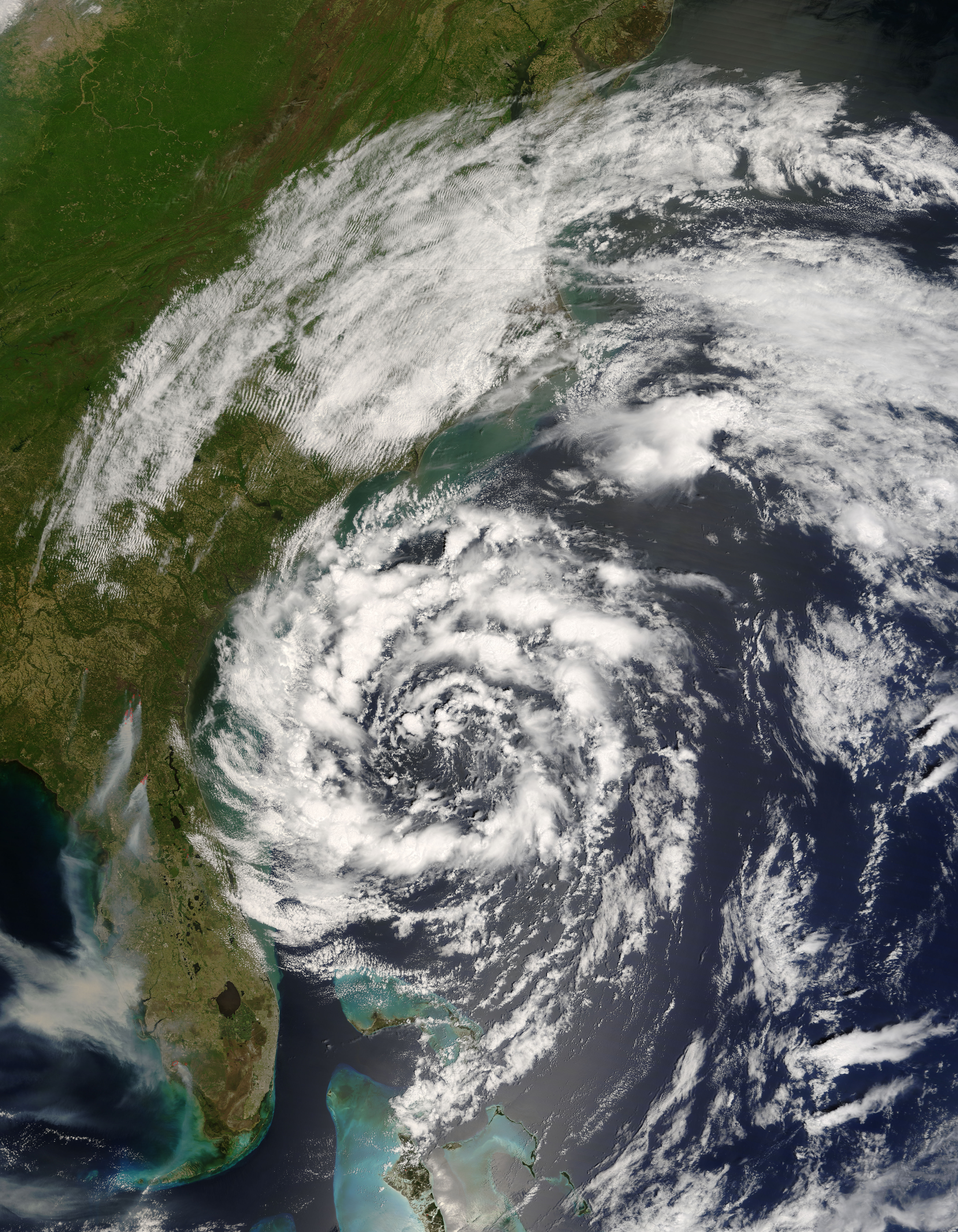
The circling clouds of an intense low-pressure system sat off the southeast coast of the United States on May 8, 2007, when the Moderate Resolution Imaging Spectroradiometer (MODIS) on NASA’s Terra satellite captured this image. By the following morning, the storm developed enough to be classified as a subtropical storm, a storm that forms outside of the tropics, but has many of the characteristics—hurricane-force winds, driving rains, low pressure, and sometimes an eye—of a tropical storm.
Although it arrived several weeks shy of the official start of the hurricane season (June 1), Subtropical Storm Andrea became the first named storm of the 2007 Atlantic hurricane season. The storm has the circular shape of a tropical cyclone in this image, but lacks the tight organization seen in more powerful storms. By May 9, the storm’s winds reached 75 kilometers per hour (45 miles per hour), and the storm was not predicted to get any stronger, said the National Hurricane Center.
Though Subtropical Storm Andrea was expected to remain offshore, its strong winds and high waves pummeled coastal states, prompting a tropical storm watch. The winds fueled wild fires (marked with red boxes) in Georgia and Florida. The wind-driven flames generated thick plumes of smoke that concentrated in a gray-brown mass over Tampa Bay, Florida. Unfortunately for Georgia and Florida, which are experiencing moderate to severe drought, Subtropical Storm Andrea was not predicted to bring significant rain to the region right away, according to reports on the Washington Post Website.
NASA image courtesy Jeff Schmaltz, MODIS Land Rapid Response Team at NASA GSFC