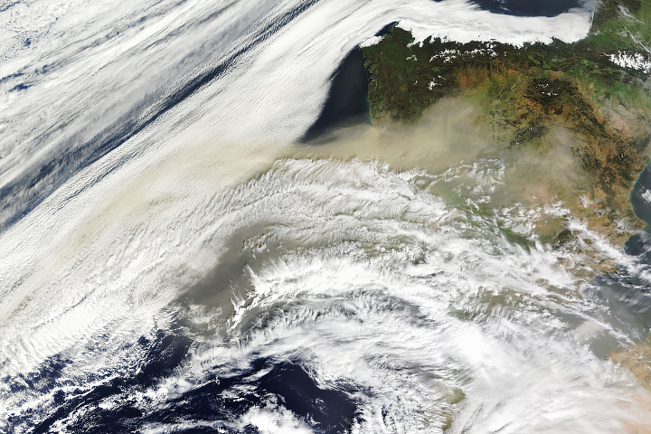
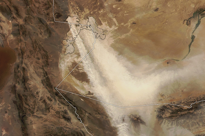
A large plume of dust from the Sahara Desert blew west over the Atlantic Ocean and then curled north toward Europe in late January 2024. Along its path, the suspended particles brought haze and poor air quality to Cabo Verde and the Canary Islands. Some of the dust that reached the United Kingdom mixed with clouds and fell to the ground with passing rain.
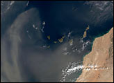
This animation shows the progression of the dust from January 24 to January 28. The images were acquired by the VIIRS (Visible Infrared Imaging Radiometer Suite) sensor on the NOAA-20 satellite. A large dust cloud expanded to the west over the ocean on January 24 and 25 before being redirected by strong southerly winds.
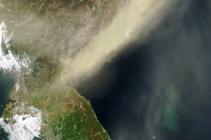
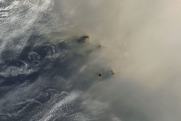
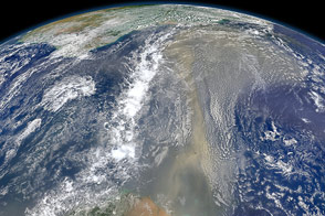
A detailed image from January 25 (below) shows the dense dust cloud reaching the Cabo Verde archipelago, located approximately 550 kilometers (340 miles) off the coast of Africa, west of Dakar, Senegal. The topography of the islands disrupts air flowing past them, producing swirling patterns on their leeward sides. This image was acquired by the MODIS (Moderate Resolution Imaging Spectroradiometer) on NASA’s Terra satellite.

On January 24, authorities in the Canary Islands alerted residents to the threat of a dust event that could make the air “unbreathable” and reduce visibility, according to news reports. Known to islanders as “La Calima,” this type of event is prevalent in the winter and can last several days. Conditions on the islands intensified through January 26, and residents were advised to keep windows closed and avoid outdoor activity.
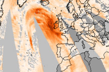
Strong sustained upper-level winds out of the south blew the dust toward Europe in the following days, and it crossed the U.K. on January 28 and 29. Models showed a band of dust moving across the U.K. and hooking around northwest Europe. According to the Met Office, Saharan dust may reach the U.K. several times per year, when big dust storms coincide with southerly wind patterns.
Large plumes of Saharan dust can arise at any time of year, but their fates depend on the season. In late spring through early fall, the Saharan Air Layer carries dust high in the atmosphere westward across the Atlantic Ocean and can suppress the formation and intensity of tropical cyclones. In contrast, dust that emerges from the continent during winter and spring tends to stay at lower altitudes and is carried by the northeast trade winds.
NASA Earth Observatory images by Lauren Dauphin, using VIIRS data from NASA EOSDIS LANCE, GIBS/Worldview, and the Joint Polar Satellite System (JPSS) and MODIS data from NASA EOSDIS LANCE and GIBS/Worldview. Story by Lindsey Doermann.