Today’s story is the answer to the February 2023 puzzler.
Millions of years ago, during the Miocene, a series of volcanic eruptions created a chain of islands in the Indian Ocean between Madagascar and the African mainland. These islands are now known as the Comoros archipelago.
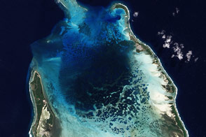
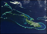
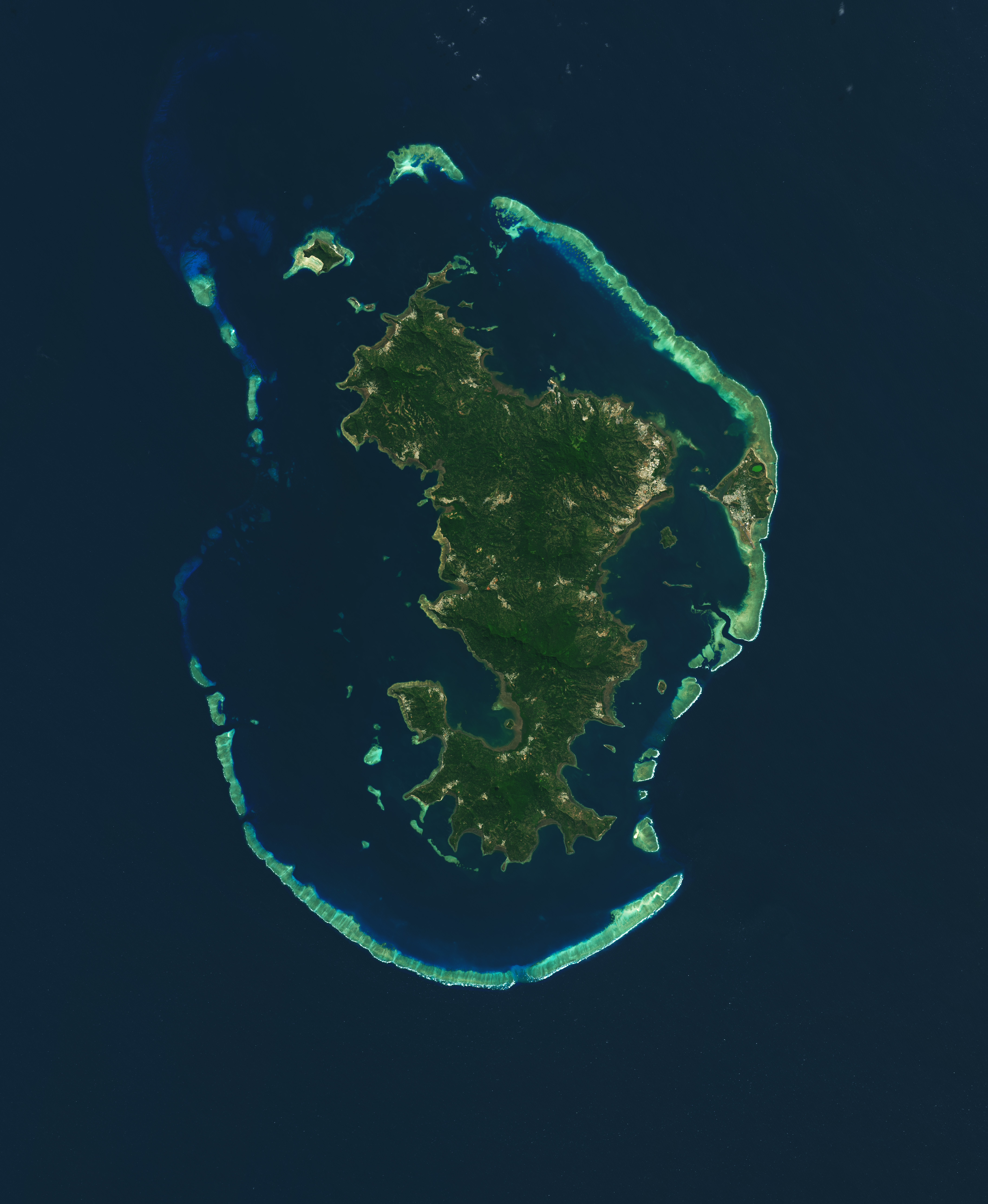
The oldest and easternmost islands in the archipelago comprise a territory known as Mayotte. Mayotte consists of two principal islands, the main island (known as Grande Terre) and a smaller island to the east, known as Pamandzi or Petite Terre. This image, captured by the Operational Land Imager (OLI) on Landsat 8, shows the main island in the center of an outer ring of barrier reefs and small islets, which form a lagoon rich in marine biodiversity. Corals and mangroves also fringe the coasts of the main island.
Mayotte’s lagoon is home to a diversity of marine life, including corals, clownfish, and green sea turtles. But overfishing and coral bleaching threaten the health of the ecosystem. A 2022 study of corals in the western Indian Ocean found that the Comoros islands corals were at risk of collapse in response to warming water temperatures. A marine park, which covers all of Mayotte and surrounding waters, was established in 2010 to protect its aquatic life.
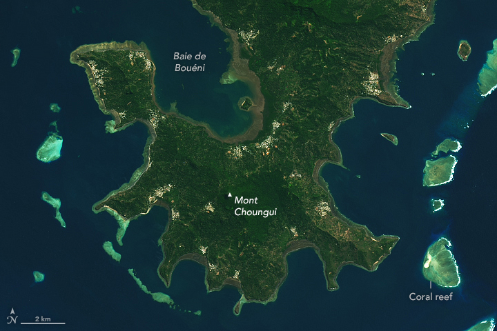
A string of volcanic mountains span the length of the main island. The tallest peak is Mount Bénara, with a height of 660 meters (2,170 feet). Just south of this peak is Mount Choungui, which with a height of 593 m (1,946 ft) is the island’s second-tallest mountain. Both of these mountains are home to several species of birds that are vulnerable to extinction, including the yellow-billed Comoros olive pigeon (Columba pollenii) and the glossy black Mayotte drongo (Dicrurus waldenii).
Geologic activity continues to shape the islands. Although the islands went many years without significant earthquakes and volcanic eruptions, multiple earthquakes a day shook Mayotte between May 2018 and July 2019, and more than a dozen in that year were magnitude of 5 or more. Landslides and other natural hazards followed the earthquakes. The cause, scientists discovered, was the birth of an undersea volcanic ridge and edifice, just 5 kilometers east of Pamandzi. Using data from the global navigation satellite system (GNSS), scientists learned that this seismic activity caused the main island of Mayotte to shift eastward about 21 to 25 cm and sink approximately 10 to 19 cm.
The capital of Mayotte, Mamoudzou, is located on the eastern coast of the main island and looks across a 2 km channel to Pamandzi. Most of Mayotte’s population lives on the main island, but the airport is located on southern tip of Pamandzi, shown in the image below.
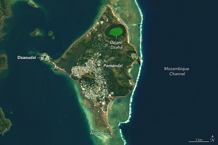
A lake on Pamandzi, called Dziana Dzaha, stands out as a bright green oval in the north. Dziana Dzaha is a crater lake with salt concentrations higher than that of seawater. The salty, oxygen-poor lake is considered a modern analogue to environments of the Precambrian, when multi-cellular life began to form. Researchers have studied the lake to understand the types of microbes that flourish in extreme environments.
NASA Earth Observatory images by Lauren Dauphin, using Landsat data from the U.S. Geological Survey. Story by Emily Cassidy.