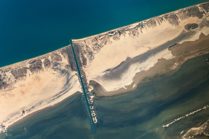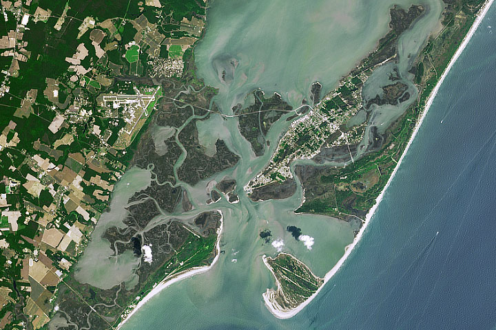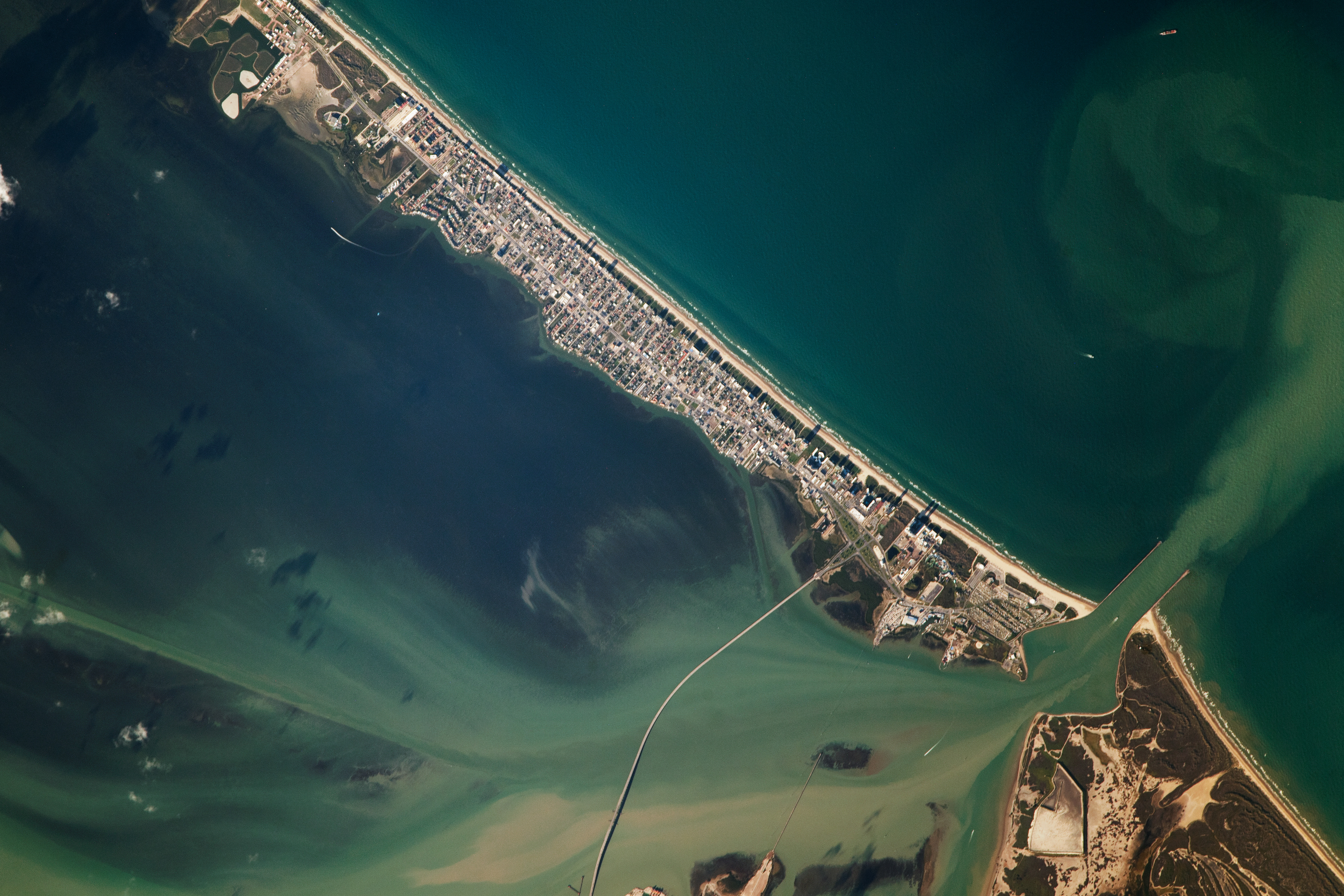
While orbiting over the Gulf of Mexico, an astronaut aboard the International Space Station captured this image of South Padre Island, a barrier island along the coast of Texas. The island is part of the greater Padre Island, the longest barrier island in the world, which spans a length of 113 miles (182 kilometers). In 1964, the Port Mansfield Channel (not pictured) was dredged, dividing Padre Island in two, creating South Padre Island. South Padre Island is a popular tourist destination accessible by road via the Queen Isabella Causeway.
The southern portion of Laguna Madre is visible in the bottom-left half of the image. Laguna Madre is a 130-mile-long (210-kilometer) hypersaline lagoon and major estuary on the inshore side of the greater Padre Island coast. About 75 percent of the lagoon’s shores are protected by the Laguna Atascosa National Wildlife Refuge and Padre Island National Seashore. Laguna Madre’s ecosystem is home to numerous species of fish, birds, and seagrass.
The Brazos Santiago Pass connects this portion of Laguna Madre to the Gulf of Mexico. The pass, which separates Brazos Island and South Padre Island, has a navigable water depth of 42 feet (13 meters) and channel length of about 1.15 miles (1.8 kilometers). This natural gap is extended by parallel jetties, which are breakwater structures designed to protect the coastline from erosion. Brown-hued sediment is transported across Laguna Madre, through the pass, and into the blue-green waters of the Gulf of Mexico.
Barrier islands along the Gulf and East coasts of North America play a critical role protecting the mainland from the damaging effects of storms. They bear the brunt of large storm surges and reduce flooding on the mainland. South Padre Island has been hit by multiple major hurricanes over the last century, including hurricane Allen in 1980. That storm resulted in a storm surge that exceeded 8 feet (2.5 meters) and flooded approximately 80 percent of the island.
Astronaut photograph ISS067-E-373246 was acquired on September 19, 2022, with a Nikon D5 digital camera using a focal length of 1150 millimeters. It is provided by the ISS Crew Earth Observations Facility and the Earth Science and Remote Sensing Unit, Johnson Space Center. The image was taken by a member of the Expedition 67 crew. The image has been cropped and enhanced to improve contrast, and lens artifacts have been removed. The International Space Station Program supports the laboratory as part of the ISS National Lab to help astronauts take pictures of Earth that will be of the greatest value to scientists and the public, and to make those images freely available on the Internet. Additional images taken by astronauts and cosmonauts can be viewed at the NASA/JSC Gateway to Astronaut Photography of Earth. Caption by Minna Adel Rubio, GeoControl Systems, JETS Contract at NASA-JSC.