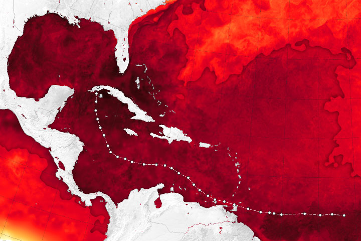
Hurricane Ian grew substantially as it charged across the Caribbean Sea and the Gulf of Mexico in late September 2022. After damaging parts of Cuba and leaving much of the country in the dark, forecasters expected more destruction as the storm reached Florida’s west coast on the afternoon of September 28.
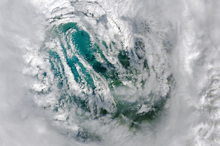
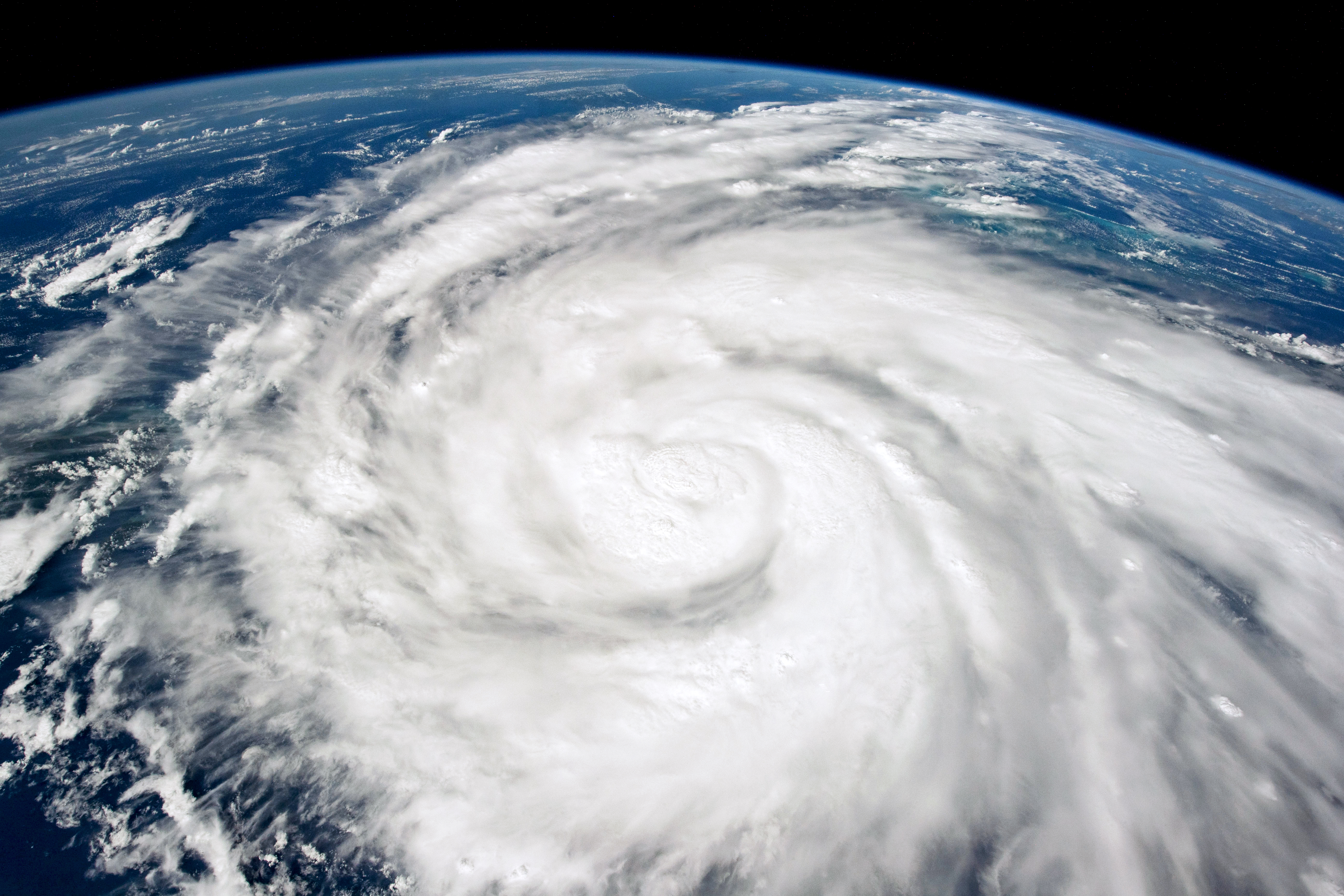
A crew member onboard the International Space Station took this photograph of Hurricane Ian on September 26 while orbiting more than 400 kilometers (250 miles) above Earth’s surface. At the time, the space station was located over the Caribbean Sea east of Belize, and Hurricane Ian was just south of Cuba. Over the course of the day, it grew from a tropical storm to a category-2 hurricane.
Ian continued to strengthen and made landfall in western Cuba on September 27 as a category-3 storm. Next the storm entered the Gulf of Mexico and headed toward Florida. Forecasters expected that warm waters in the Gulf of Mexico would help the hurricane regain strength before making landfall along the west coast of Florida. They were correct.
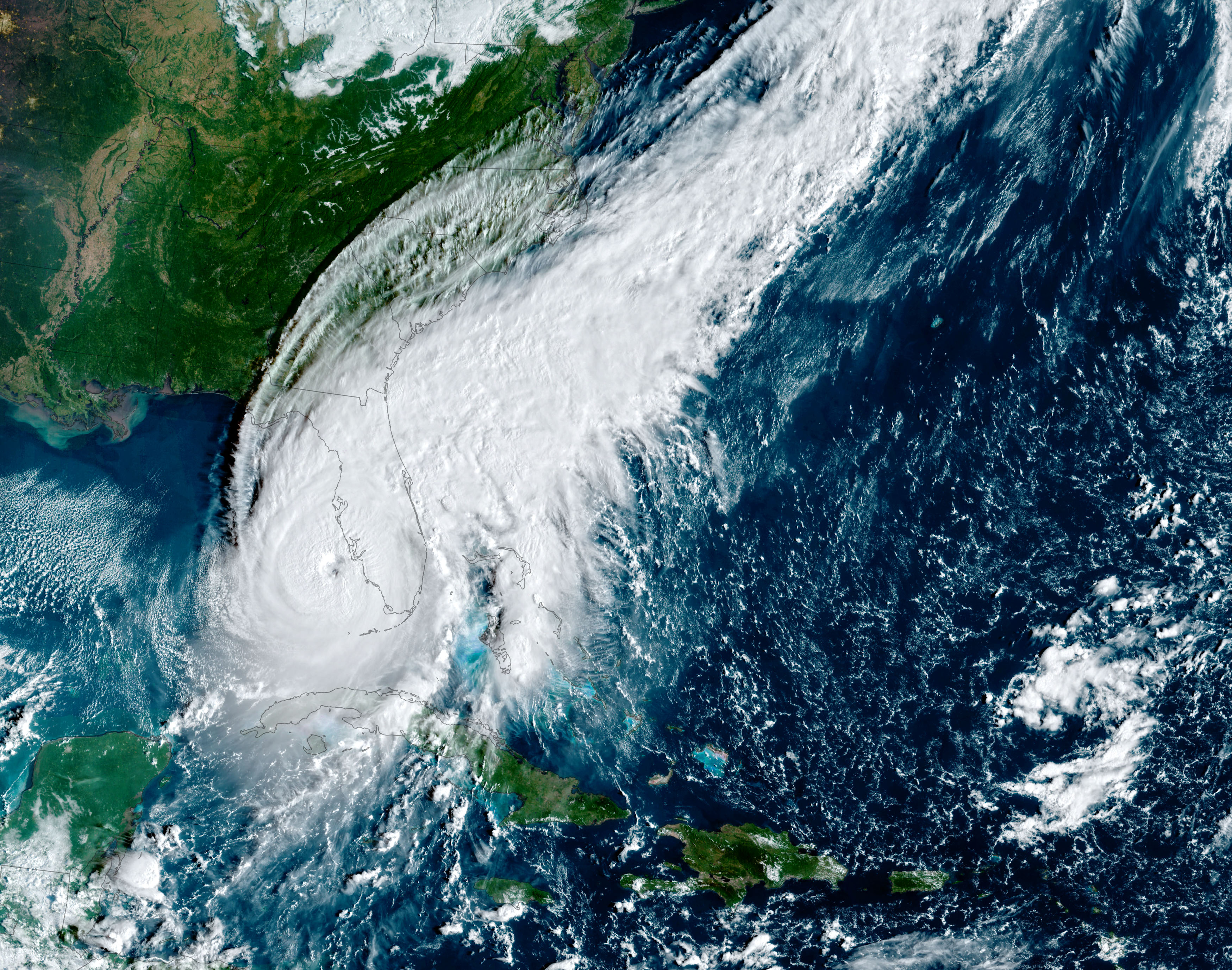
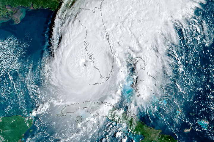
The simulated natural-color image above was acquired at 9:10 a.m. local time (13:10 Universal Time) on September 28, 2022, by the Advanced Baseline Imager (ABI) on the Geostationary Operational Environmental Satellite 16 (GOES-16). The satellite is operated by the National Oceanic and Atmospheric Administration (NOAA); NASA helps develop and launch the GOES series of satellites.
At about the time of the GOES image, the storm had sustained winds of 155 miles (250 kilometers) per hour—making it a major category-4 hurricane and putting it near the threshold of a category-5 storm. Cloud bands already covered much of Florida. By afternoon, the category-4 storm made landfall near Cayo Costa in southwest Florida, according to the National Hurricane Center.
In Cuba, about 11 million people were left without power, according to news reports. Winds and floodwaters destroyed buildings, farms, and left many roads impassable. As the storm approached Florida, the U.S. hurricane center warned of potentially catastrophic storm surges and wind damage along the southwest coastline and life-threatening flooding across some central parts of the state.
NASA Earth Observatory image by Joshua Stevens, using GOES 16 imagery courtesy of NOAA and the National Environmental Satellite, Data, and Information Service (NESDIS). Astronaut photograph ISS067-E-31826990 was acquired on September 26, 2022, with a Nikon D5 digital camera using an 20 millimeter lens and is provided by the ISS Crew Earth Observations Facility and the Earth Science and Remote Sensing Unit, Johnson Space Center. The image was taken by a member of the Expedition 67 crew. The image has been cropped and enhanced to improve contrast, and lens artifacts have been removed. The International Space Station Program supports the laboratory as part of the ISS National Lab to help astronauts take pictures of Earth that will be of the greatest value to scientists and the public, and to make those images freely available on the Internet. Additional images taken by astronauts and cosmonauts can be viewed at the NASA/JSC Gateway to Astronaut Photography of Earth. Story by Kathryn Hansen.