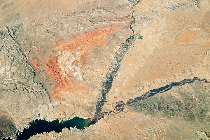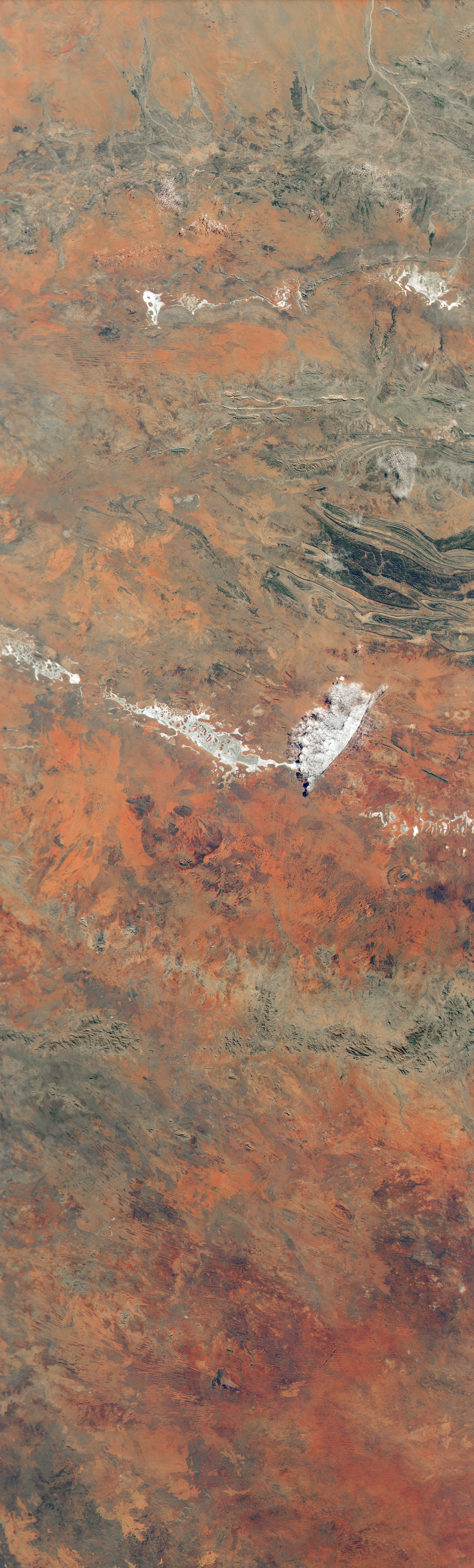
When viewed from above, the red landscapes found in the center of Australia can make you think you are looking at Mars. Red and orange dominates this natural-color image acquired by the HawkEye sensor on the SeaHawk CubeSat, for instance.
The image highlights the vivid red deserts around Uluru and Kata-Tjuta, famous rock formations in the southern part of Northern Territory. The white salt pan of Lake Amadeus lies just to the north, as well as Lake Neale. They are part of a line of salt lakes that stretch hundreds of kilometers from Lake Hopkins in the west to the Finke River in the east.
All of these features lie on Aboriginal land and are considered sacred. According to the mythology of the Anangu people, blood spilled during a fierce battle between two deities—one that had taken the form of a gecko and the other in the form of a dingo—turned the landscape of Uluru and its surroundings red.
Geologists have a different explanation. In their telling, many of the rocks in this area contain significant amounts of iron-bearing minerals that become red as they rust due to exposure to oxygen. As small bits erode and flake off from their source rocks, red particles accumulate in the soils over time. Their presence gives the area's deserts their striking hues.
The presence of vegetation also influences the colors seen in the image. Areas with more vegetation generally appear darker and browner than those without much plant life. Some of the brightest red and orange areas likely burned in recent years, exposing the colorful soils more clearly.
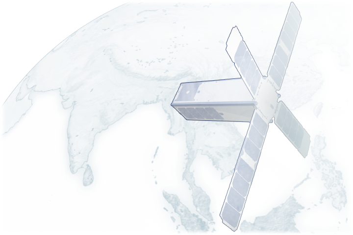
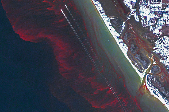
Weighing just 5 pounds, the toaster-sized SeaHawk CubeSat is considerably smaller than previous satellite missions that have measured ocean color, such as NASA’s SeaWiFS mission. But despite its size, the multispectral HawkEye sensor on board will provide ocean color data and imagery of gulfs, bays, fjords, estuaries, and other shallow coastal areas with eight times the resolution of SeaWiFS.
The low cost of the mission means that it could eventually become practical to operate constellations of tens to hundreds of similarly-equipped SeaHawk Cubesats at once to provide more continuous and comprehensive monitoring of coastal areas.
NASA image by Alan Holmes/NASA's Ocean Color Web, using data from SeaHawk/HawkEye. Story by Adam Voiland.