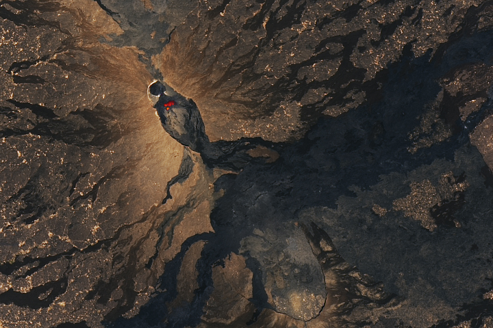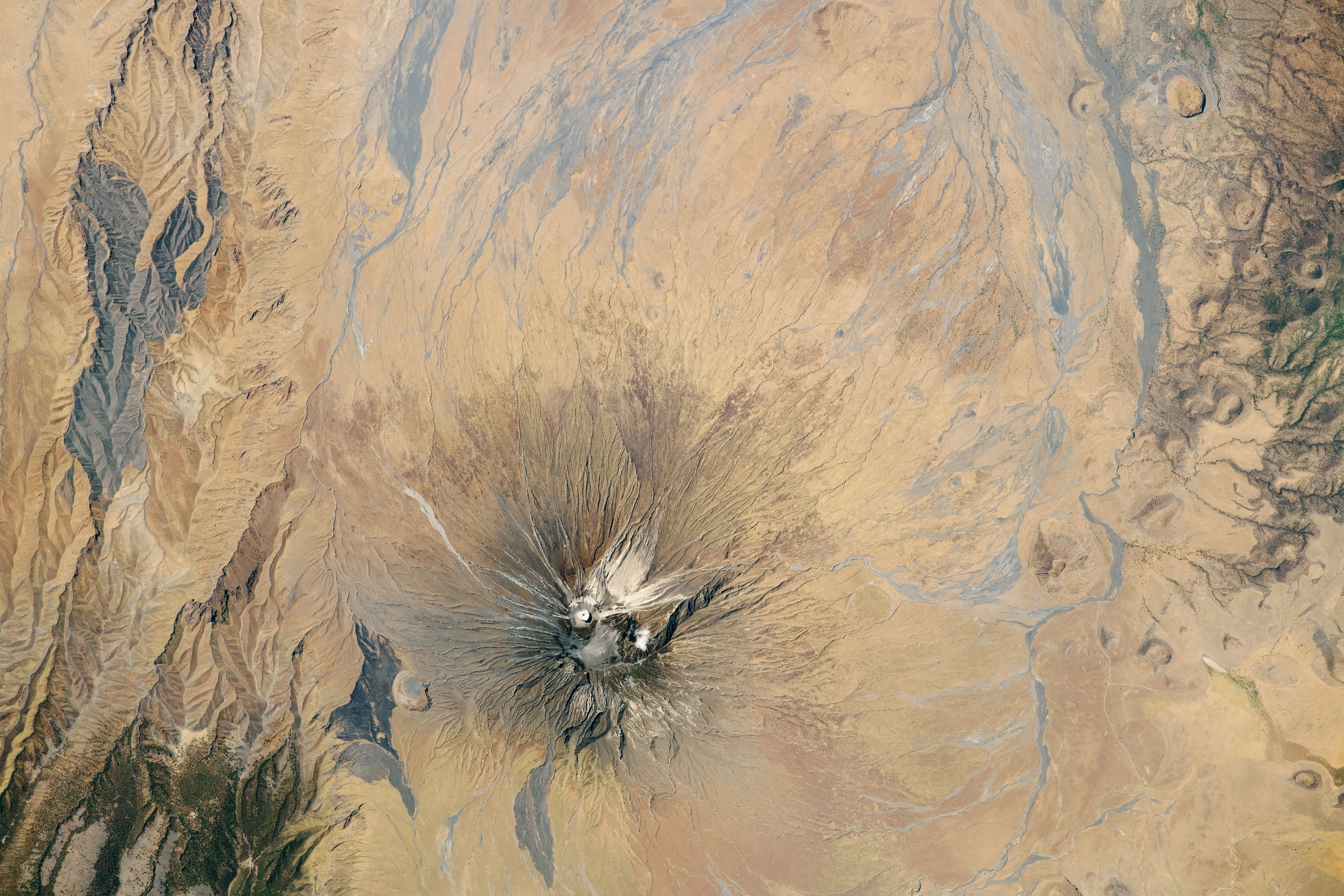
Ol Doinyo Lengai—known to the local Maasai people as the “Mountain of God”—is a stratovolcano in Tanzania with unique geological characteristics. This photograph, taken by an astronaut from the International Space Station (ISS), captures the symmetric volcano as well as canyons and lava flows formed by previous volcanic activity.
The summit of Ol Doinyo Lengai is topped by a light-colored ash cone and crater, the site of the most recent eruptive activity. It also has developed numerous side vents that surround its cone. Active and ephemeral stream channels cut through the volcano’s flanks, with the majority feeding into Lake Natron (just out of frame to the north).
Like many volcanoes in the area, this cone formed in response to the development of the East African Rift system and has been intermittently active for the past 15,000 years. This region of Africa has been tectonically active for more than 25 million years, resulting in highly variable topography compared to much of the continent. This divergent plate boundary caused the building of the two highest peaks in Africa—Mount Kilimanjaro and Mount Kenya—which are located near Ol Doinyo Lengai to the east and north.
Ol Doinyo Lengai is the only active volcano known to emit natrocarbonatites, a rare type of volcanic rock that is rich in sodium, potassium, and calcium carbonate, but low in silica. Lava with less silica has a lower viscosity, leading Ol Doinyo Lengai to have some of the fastest flowing lava in the world. In this photo, the volcano has several light-colored lava flows on its flanks. Initially dark lavas can lighten rapidly due to chemical reactions with rainwater and moisture in the air.
Astronaut photograph ISS063-E-104178 was acquired on October 6, 2020, with a Nikon D5 digital camera using an 800 millimeter lens and is provided by the ISS Crew Earth Observations Facility and the Earth Science and Remote Sensing Unit, Johnson Space Center. The image was taken by a member of the Expedition 63 crew. The image has been cropped and enhanced to improve contrast, and lens artifacts have been removed. The International Space Station Program supports the laboratory as part of the ISS National Lab to help astronauts take pictures of Earth that will be of the greatest value to scientists and the public, and to make those images freely available on the Internet. Additional images taken by astronauts and cosmonauts can be viewed at the NASA/JSC Gateway to Astronaut Photography of Earth. Caption by Sara Schmidt, GeoControl Systems, JETS Contract at NASA-JSC.