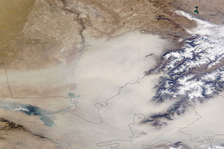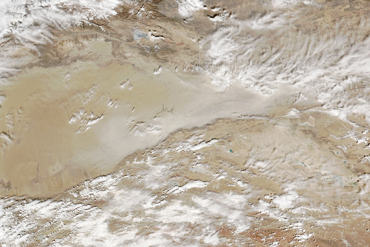
Dust storms commonly occur across Asia in springtime. But meteorological spring is just getting underway, and already an enormous plume of sand and dust has blanketed northern China. It has been called the largest and strongest such storm to strike the region in a decade.
The dust is visible in this natural-color image, acquired on March 15, 2021, with the Moderate Resolution Imaging Spectroradiometer (MODIS) on NASA’s Aqua satellite.
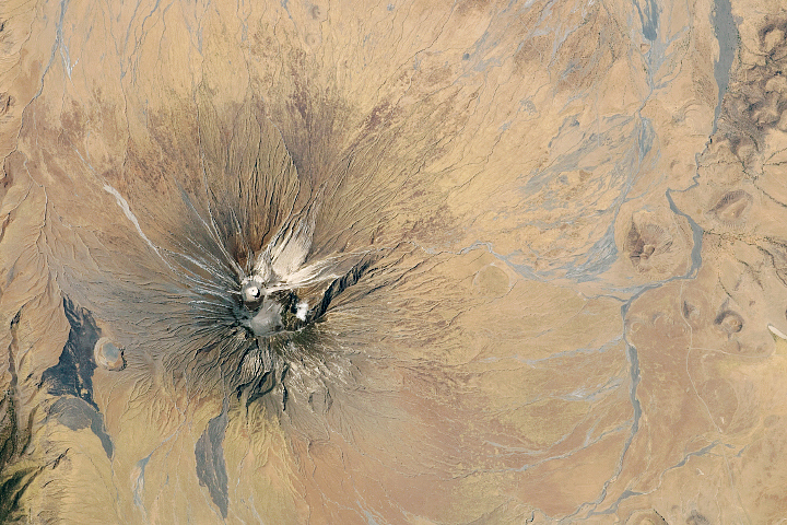
The plume appears to originate from the Taklamakan Desert in northwest China. The dry, barren area is a major source of airborne dust that can travel especially high and far on the strong winds of spring. From the Taklamakan, the dust moved eastward for thousands of kilometers.
“Using NASA’s satellite data, we’re able to track the dust’s pathways,” said Hiren Jethva, a Universities Space Research Association (USRA) scientist based at NASA’s Goddard Space Flight Center. In addition to natural-color imagery, Jethva tracks dust and smoke using satellite measurements of the UV aerosol index. Those data indicate that the dust moved along a west-to-east path. It then turned, following a cyclonic circulation in the atmosphere, and was lofted to an altitude above the cloud layer. Scientists have previously showed that aerosols above the clouds can have important consequences for the climate.
In areas where the dust stays close to the ground, such storms can diminish air quality. That was the case in Beijing, where the high concentration of particles caused air quality to reach well into the “hazardous” level of the Air Quality Index. Dust tinted the sky orange, reducing visibility to less than 1000 meters (3,280 feet).
In addition to the unusual magnitude and early season timing of the event, Jethva noted that it is uncommon for dust storms to grow so large so fast. Satellite images from March 14 show no signs of dust transport; one day later, the event had developed into a widespread, severe storm. News reports called for the dust storm to gradually weaken through the rest of the week.
NASA Earth Observatory image by Joshua Stevens, using MODIS data from NASA EOSDIS LANCE and GIBS/Worldview. Text by Kathryn Hansen.