
A wildfire burning in Los Padres National Park charred more than 500 acres—including the home of Big Sur’s fire chief.
Published Dec 17, 2013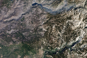
Gray-brown charred land left in the fire’s wake blends with the gray granite peaks and shadowed valleys that make up the central Sierra Mountains.
Published Nov 24, 2013
Smoke billowed from a wildfire burning east of San Francisco on September 9, 2013.
Published Sep 10, 2013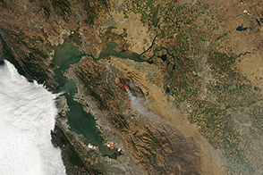
On September 10, 2013, a wildfire burned east of San Fransisco.
Published Sep 10, 2013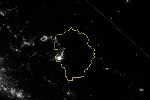
The VIIRS instrument on the Suomi NPP satellite tracked the growth of the fire between August 20 and September 4.
Published Sep 8, 2013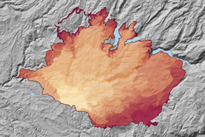
At 369 square miles in size, the Rim Fire is the largest in the United States in 2013.
Published Sep 4, 2013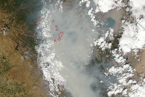
Smoke from the Rim Fire brought unhealthy air to Yosemite National Park and the San Joaquin Valley over the Labor Day Weekend.
Published Sep 3, 2013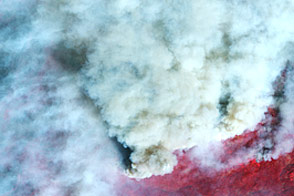
This false-color image shows smoke billowing from the Rim fire on August 30, 2013.
Published Aug 30, 2013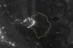
Burning in the northeast corner of Yosemite National Park, the Rim Fire ranks among the largest in California history.
Published Aug 28, 2013
A large wildfire raged near Yosemite National Park in August 2013.
Published Aug 27, 2013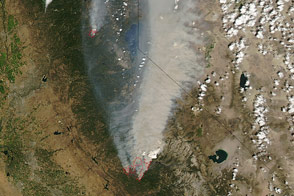
A large wildfire raged near Yosemite National Park in August 2013.
Published Aug 24, 2013
In August 2013, the Silver Fire burned 20,000 acres near Banning, California.
Published Aug 14, 2013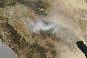
On July 18, 2013, a fierce wildfire threatened Palm Springs, California.
Published Jul 19, 2013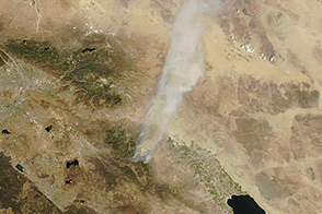
On July 16, 2013, the Aqua satellite captured this image of a fire burning in southern California.
Published Jul 17, 2013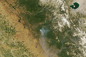
On June 17, 2013, NASA’s Terra satellite captured this image of the Carstens fire burning southwest of California’s Yosemite National Park.
Published Jun 19, 2013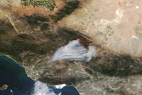
A wildfire burned in steep terrain north of Los Angeles near Palmdale on May 31, 2013.
Published Jun 3, 2013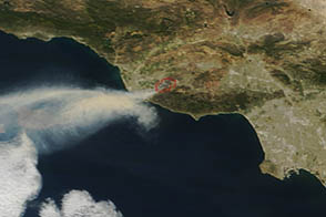
On May 2, 2013, the MODIS instrument on the Terra satellite captured this image of wildfire burning near Los Angeles, California.
Published May 4, 2013
On May 2, 2013, the MODIS instrument on NASA’s Aqua satellite captured this view of wildfires burning near Lassen Volcanic National Park.
Published May 3, 2013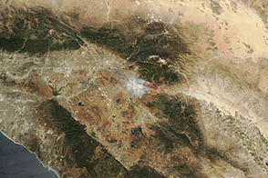
A wildfire burned near Banning, California, on May 1, 2013.
Published May 2, 2013