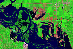
Acquired August 17, 2011, and August 1, 2011, these false-color images document the slow retreat of flood waters along the Missouri River near Blair, Nebraska.
Published Aug 23, 2011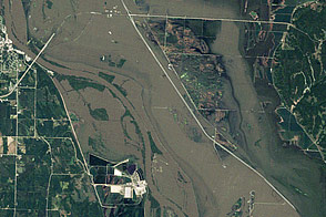
Acquired August 10, 2011, and August 23, 2010, these natural-color images compare conditions along the Missouri River between Nebraska City and Hamburg, Iowa.
Published Aug 16, 2011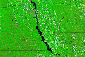
Acquired August 14, 2011, and August 11, 2010, these false-color images compare conditions along the Missouri River, which flooded in 2011.
Published Aug 15, 2011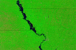
Acquired August 2, 2011, and August 3, 2010, these false-color images compare conditions along part of the Missouri River, which flooding in the summer of 2011.
Published Aug 5, 2011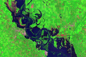
Accessed August 1, 2011, these images provide false- and natural-color views of lingering floods along the Missouri River around Blair, Nebraska.
Published Aug 5, 2011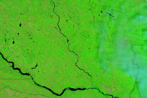
Acquired August 1, 2011, and August 6, 2010, these false-color images compare conditions along the James River, a Missouri River tributary, in South Dakota.
Published Aug 2, 2011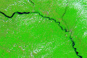
Acquired July 25, 2011, and July 17, 2010, these false-color images compare conditions along the Missouri River, which flooded in 2011.
Published Jul 26, 2011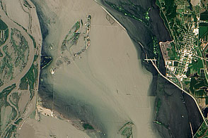
Acquired July 17, 2011, this natural-color image shows flood water lingering near Hamburg, Iowa, which avoided inundation with a new levee.
Published Jul 20, 2011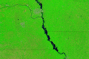
Acquired July 18, 2011, and July 10, 2010, these false-color images compare conditions along the Missouri River, which received record runoff in 2011.
Published Jul 19, 2011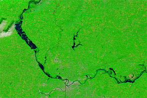
Acquired July 10, 2011, and July 14, 2010, these false-color images compare conditions along the Missouri River in Kansas and Missouri. The Missouri was flooded in the summer of 2011.
Published Jul 11, 2011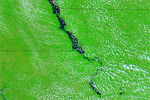
Acquired June 23, 2011, and July 4, 2011, these false-color images compare flood conditions along the Missouri River. Flooding spread noticeably between these dates.
Published Jul 5, 2011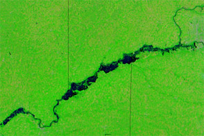
Acquired June 20, 2011, and June 29, 2010, these false-color images compare conditions along the Missouri River, which flooded in 2011.
Published Jul 1, 2011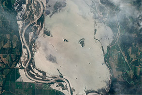
This natural-color image shows flood water from breached levees along the Missouri River near Hamburg, Iowa, on June 24, 2011.
Published Jun 29, 2011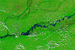
Acquired May 30, 2011, and June 27, 2011, these false-color images show the advance of flood waters down the Missouri River over a four-week interval.
Published Jun 28, 2011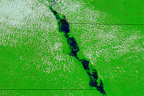
Acquired June 25, 2011, and June 26, 2010, these false-color images compare conditions of the Missouri River along the Nebraska border.
Published Jun 27, 2011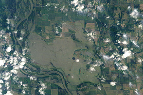
Acquired on June 14, 2011, these images show flooding along the Missouri River near Hamburg, Iowa.
Published Jun 16, 2011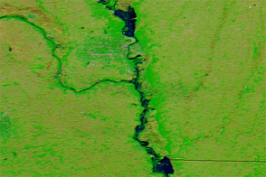
These false-color images compare conditions on the Missouri River along the Nebraska border in June 2011 and June 2010.
Published Jun 16, 2011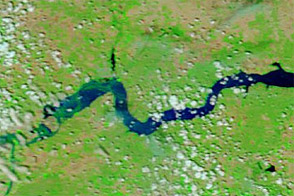
Acquired June 11, 2011, and June 4, 2010, these false-color images compare conditions around Williston, North Dakota, during the 2011 floods and the year before.
Published Jun 13, 2011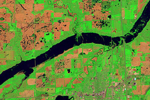
Acquired June 5, 2011, and May 19, 2005, these false-color images compare conditions along the James River near Mitchell, South Dakota.
Published Jun 7, 2011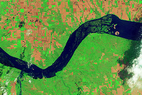
Acquired June 5, 2011, and May 19, 2005, these false-color images compare conditions around Lewis and Clark Lake in South Dakota.
Published Jun 7, 2011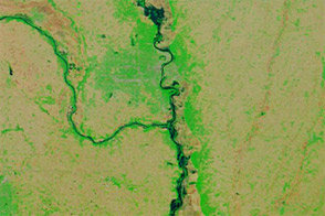
Acquired June 6, 2011, and June 16, 2010, these false-color images compared conditions along the Missouri River in Nebraska, Iowa, and Missouri.
Published Jun 7, 2011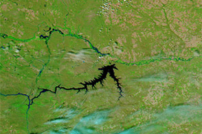
Acquired June 5, 2011, and June 16, 2010, these false-color images compare conditions along the Milk, Souris, and Missouri Rivers in Montana and North Dakota.
Published Jun 6, 2011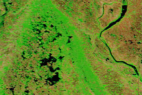
Acquired June 1, 2011, and May 29, 2010, these false-color images compare parts of the James and Little Minnesota Rivers.
Published Jun 2, 2011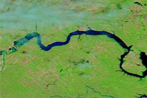
Acquired June 1, 2011, and June 4, 2010, these false-color images compare parts of the Missouri and Souris Rivers.
Published Jun 2, 2011