Scientists at Marshall Space Flight Center use satellite imagery to help meteorologists assess the scope of damage caused by tornadoes.
Published May 6, 2016Image of the Day Land Severe Storms Human Presence Remote Sensing
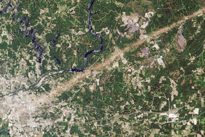
Acquired May 7, 2011, this natural-color image shows part of a tornado track near the town of Berry, Alabama.
Published May 13, 2011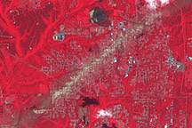
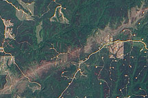
Acquired May 4, 2011, this false-color image shows a tornado track near Birmingham, Alabama.
Published May 5, 2011
Acquired May 2, 2011, this natural-color image shows a tornado track through Tuscaloosa, Alabama, in the wake of a series of violent storms in the U.S. Southeast.
Published May 5, 2011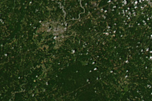
Brown tracks show the paths of tornadoes across and around Tuscaloosa, Alabama, in this image from April 28, 2011.
Published Apr 30, 2011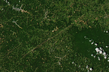
This image, from April 28, 2011, shows the paths of two extremely strong tornadoes across Mississippi and Alabama.
Published Apr 29, 2011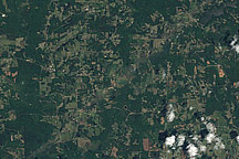
A pale green swath in this Landsat image from April 28, 2011, reveals the path of a tornado outside of Griffin, Georgia.
Published Apr 29, 2011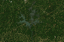
Three tornado tracks reveal the path of storms across Alabama and Georgia in this image from April 28, 2011.
Published Apr 29, 2011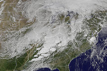
This animation shows powerful thunderstorms moving over the southern United States on April 27, 2011.
Published Apr 29, 2011