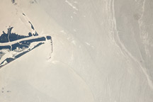
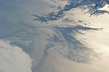
Photograph of a portion the oil slick in the Gulf of Mexico taken by an astronaut aboard the International Space Station on July 23, 2010.
Published Aug 4, 2010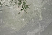
Acquired in the months after the Deepwater Horizon oil spill, this natural-color image shows possible oil patches near the Mississippi Delta.
Published Jul 30, 2010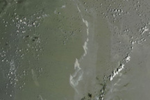
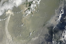
Between scattered clouds, a streak of oil was visible in the Gulf of Mexico on July 20, 2010.
Published Jul 21, 2010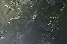
Between scattered clouds, silvery-gray streaks of oil remained visible in the Gulf of Mexico on July 19, 2010.
Published Jul 20, 2010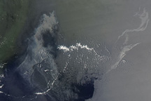
On July 14, 2010, a silvery gray patch of oil stretched across the Gulf of Mexico about 80 kilometers (50 miles) southeast of the tip of the Mississippi River Delta.
Published Jul 15, 2010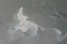
Acquired July 12, 2010, this natural-color image shows the lingering oil slick in the Gulf of Mexico.
Published Jul 13, 2010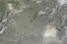
Acquired July 11, 2010, this natural-color image shows an apparent oil slick southeast of the Mississippi Delta.
Published Jul 11, 2010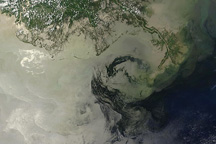
Oil in different locations brightens and darkens the surface waters of the Gulf of Mexico in this photo-like image from July 9, 2010.
Published Jul 9, 2010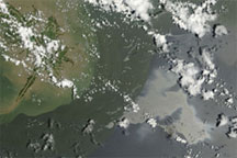
Acquired July 4, 2010, this natural-color image shows the Deepwater Horizon oil slick lingering off the Mississippi Delta.
Published Jul 7, 2010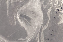
On June 26, 2010, oil was visible in the waters surrounding Horn and Petit Bois Islands following the Deepwater Horizon spill.
Published Jun 29, 2010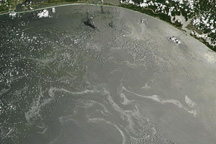
Oil is visible offshore of Alabama and Florida in this photo-like image from June 27, 2010.
Published Jun 28, 2010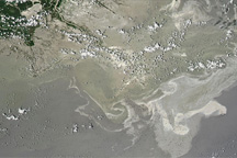
Silvery-gray streaks and patches of oil are visible across a wide area in this image from June 26, 2010.
Published Jun 28, 2010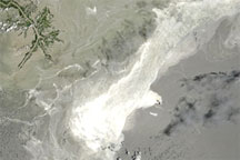
Acquired June 25, 2010, this natural-color image shows the oil slick in the Gulf of Mexico.
Published Jun 26, 2010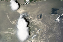
Oil from the leaking well appears as a maze of silvery-gray ribbons in this photo-like image of the Gulf of Mexico on Saturday, June 19, 2010.
Published Jun 22, 2010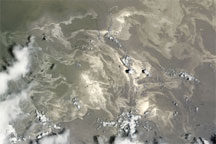
Acquired June 18, 2010, this natural-color image shows the lingering Deepwater Horizon oil slick in the Gulf of Mexico.
Published Jun 19, 2010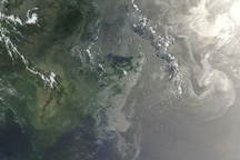
In this photo-like satellite image from June 12, 2010, oil from the leaking Deepwater Horizon well appears to have reached beaches and barrier islands in Alabama and western Florida.
Published Jun 14, 2010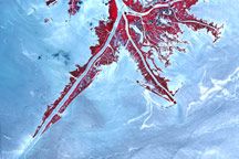
Acquired June 10,2010, this false-color image shows parts of the oil slick from the Deepwater Horizon rig nearing the Mississippi Delta.
Published Jun 11, 2010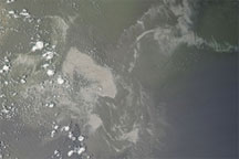
Acquired June 10, 2010, this natural-color image shows the Gulf of Mexico oil slick off the Mississippi Delta.
Published Jun 11, 2010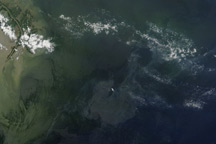
Regions of heavy oil in the Gulf of Mexico are visible in this photo-like image from June 7, 2010.
Published Jun 8, 2010
Beneath scattered clouds, streaks and ribbons of oil brightened the reflection of the Sun off the Gulf of Mexico in this photo-like satellite image from May 31, 2010.
Published Jun 1, 2010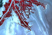
Ribbons of oil that have leaked from the Deepwater Horizon well in the Gulf of Mexico are silver against the light blue color of the adjacent water in this image of the tip of the Mississippi River Delta on May 24, 2010.
Published May 26, 2010
The oil spill in the Gulf of Mexico appeared large and sprawling in this natural-color image from May 25, 2010.
Published May 26, 2010
Acquired May 24, 2010, this natural-color image shows the lingering oil slick off the Mississippi Delta. A small smoke plume along the edge of the slick suggests a controlled burn.
Published May 24, 2010
Acquired May 21, 2010, this natural-color image shows boat wakes in the oil slick south and east of the Mississippi Delta.
Published May 24, 2010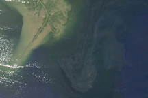
On May 23, 2010, a large patch of oil covered the waters near the site of an offshore oil rig in the Gulf of Mexico.
Published May 24, 2010
Acquired May 22, 2010, this natural-color image shows a dull gray oil slick lingering near the Mississippi Delta, more than a month after the Deepwater Horizon accident.
Published May 23, 2010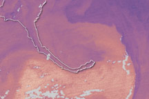
This pair of sea surface temperature images shows how the warm waters of the Loop Current connect the Gulf of Mexico to the Atlantic Ocean and the dynamic northern margin of the current on May 18. On May 18, NOAA reported that oil was very close to, and perhaps already entrained in, the Loop Current.
Published May 20, 2010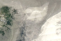
Acquired May 18, 2010, this image shows oil slicks just off the Mississippi Delta.
Published May 19, 2010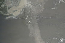
Acquired May 17, 2010, this natural-color image shows the oil slick in the Gulf of Mexico extending a long arm toward the southeast.
Published May 19, 2010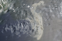
A large, silvery patch of oil is visible in this image of the Gulf of Mexico from May 11, 2010.
Published May 11, 2010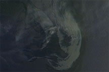
Acquired May 10, 2010, this natural-color image shows an oil sick southeast of the Mississippi Delta.
Published May 10, 2010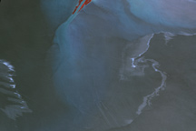
Concentrated patches and streaks of oil appear silvery gray in this high-resolution image of the Gulf of Mexico near the tip of the Mississippi River Delta on May 8, 2010.
Published May 10, 2010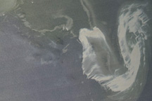
The oil slick from a damaged well in the Gulf of Mexico appeared as a silvery U-shape in natural-color imagery from May 9, 2010.
Published May 10, 2010
Shot by an astronaut looking westward from the International Space Station from a location over the eastern Gulf of Mexico, this May 4, 2010, photograph shows the Deepwater Horizon oil slick brushing the Chandeleur Islands.
Published May 10, 2010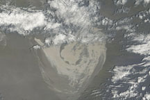
Acquired on May 8, 2010, this natural-color image shows the oil slick in the Gulf of Mexico in two parts: a serpentine slick in the west, and a large, round slick in the east.
Published May 8, 2010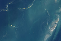
Light tan streamers snake across Chandeleur Sound in this detailed natural color satellite image from May 5, 2010. The streamers are probably ropes of oil from a leaking well in the Gulf of Mexico.
Published May 8, 2010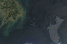
Acquired May 4, 2010, this natural-color image shows the oil slick from the Deepwater Horizon accident lingering off the Mississippi Delta.
Published May 4, 2010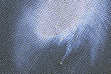
Oil colors the surface of the Gulf of Mexico in this detailed satellite image from May 1, 2010.
Published May 3, 2010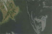
Acquired May 1, 2010, this natural-color image shows the oil slick from the April 20 accident in the Gulf of Mexico nearing the Mississippi Delta.
Published May 1, 2010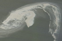
The northwestern tip of the oil slick in the Gulf of Mexico almost touches the Mississippi Delta in this image from April 29, 2010.
Published Apr 30, 2010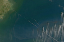
Oil from a leaking well approaches the tip of the Mississippi Delta in this photo-like satellite image from Wednesday, April 28, 2010.
Published Apr 29, 2010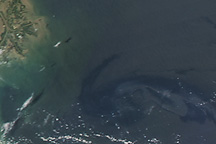
An oil slick approaches the Louisiana coast on April 27, 2010.
Published Apr 28, 2010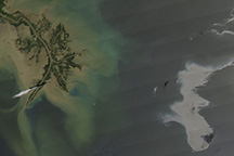
These satellite images were among the first revealing the scope of the Deepwater Horizon spill.
Published Apr 27, 2010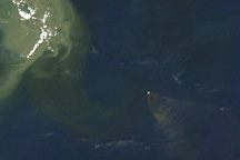
On April 21, 2010, brownish smoke fanned out to the southeast of a burning oil rig in the Gulf of Mexico.
Published Apr 22, 2010