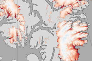
These color-coded maps show ice mass changes in the northern Canadian Arctic Archipelago from 2004 to 2009.
Published Jun 1, 2011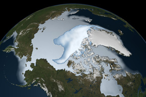
Thick ice that used to last through multiple summers has been in steep decline for three decades.
Published Mar 1, 2012
In 1984, there were 1.86 million square kilometers of old ice spread across the Arctic at its yearly minimum extent. In September 2016, there were only 110,000 square kilometers of old ice left.
Published Nov 4, 2016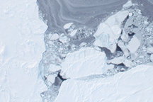
Taken from a low-flying airplane on March 26, 2011, these detailed photos of Arctic sea ice show the richly varied texture in the ice floe.
Published Apr 1, 2011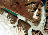
Penny Ice Cap is the southernmost of Canada’s big ice caps. Like other glaciers and ice caps in the Northern Hemisphere, the Penny has been thinning and its valley glaciers have been retreating in recent decades.
Published Sep 18, 2008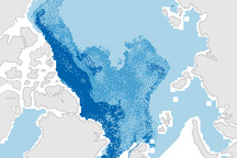
This pair of maps shows how the sea ice covering the Arctic at winter maximum in 2009 is younger than it was in the past.
Published Apr 10, 2009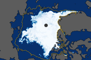
In September 2011, the extent of sea ice covering the Arctic Ocean declined to the second-lowest extent on record.
Published Oct 5, 2011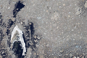
Sea ice from the Foxe Basin tends to be rougher and more stained than other parts of the Arctic.
Published May 24, 2014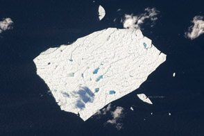
Petermann Ice Island A still behaves like the massive ice sheet it left 14 months ago.
Published Sep 17, 2011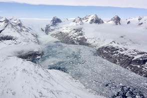
NASA aircraft return to the Arctic to assess the health of the region’s ice.
Published May 3, 2012