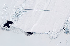
Landsat 8 captures a view of the ice separating from the ice shelf.
Published Nov 15, 2013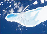
In January, 2004, astronauts on board the International Space Station took this detailed picture of melt water pooled on the surface of iceberg A-39D, a 2-kilometer wide, 11-kilometer long iceberg and drifting near South Georgia Island. The different intensities of blue are interpreted as different water depths. From the orientation of the iceberg, the deepest water (darkest blue) lies at the westernmost end of the iceberg. The water pools have formed from snowmelt—late January is the peak of summer in the Southern Hemisphere.
Published Mar 15, 2004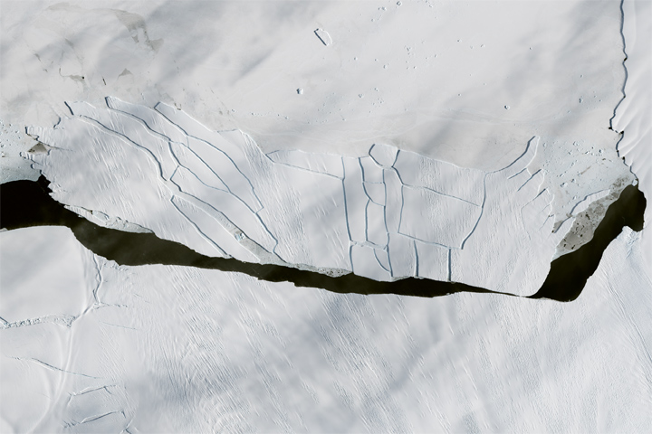
In just a month, a large iceberg from Antarctica’s Pine Island Glacier has disintegrated.
Published Oct 28, 2017
The floating part of Antarctica’s Pine Island Glacier released a new, 185-square-kilometer iceberg.
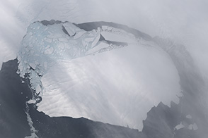
Published Sep 26, 2017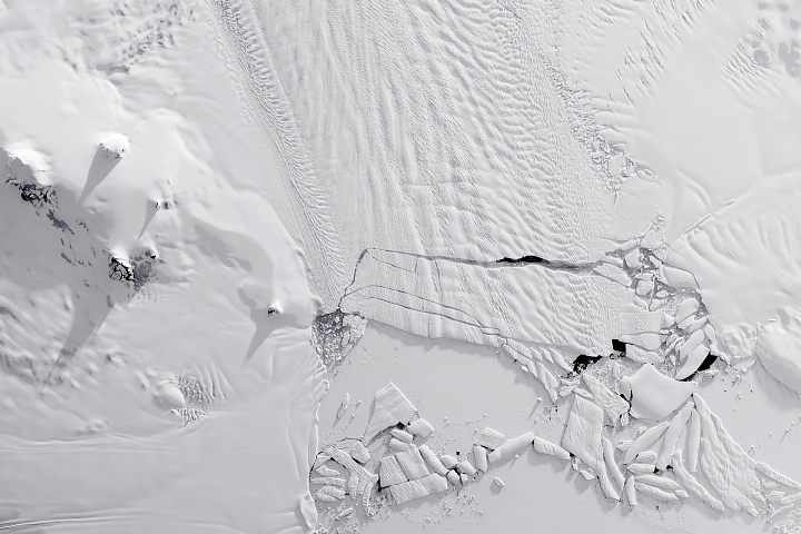
Calving that used to happen about every six years has become a near-annual event.
Published Nov 8, 2018Image of the Day Snow and Ice Remote Sensing Sea and Lake Ice
Three polynyas—circular areas free of sea ice—provide tantalizing clues as to why Antarctica’s Pine Island Glacier is melting at an astonishing 100 meters per year.
Published Nov 18, 2011
Thermal infrared imagery spots the cracks and a new ice island through the dark of the Antarctic winter night.
Published Jul 28, 2013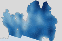
Scientists discovered a deepwater channel that could funnel warm water to the glacier's underbelly and melt it from below.
Published Jan 19, 2011
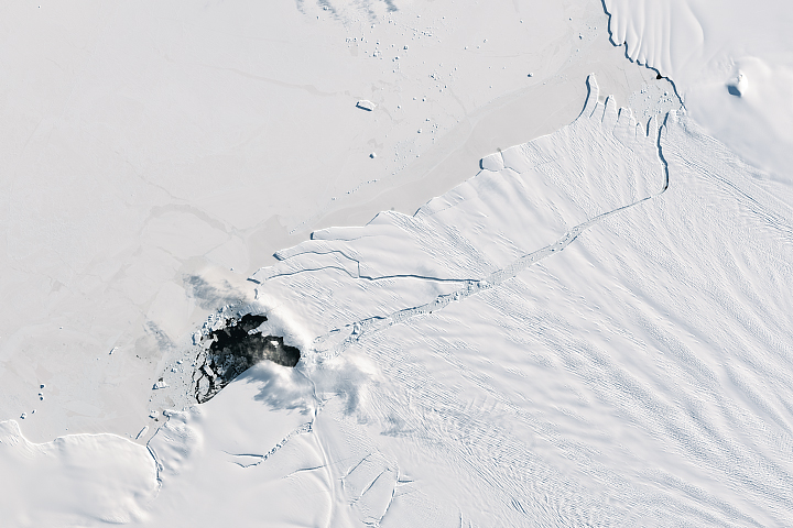
The 185-square-kilometer hunk of ice is afloat in the Amundsen Sea, off the coast of West Antarctica.
Published Oct 3, 2017
Natural vegetation and irrigated farmland along the Snake River Plain in Idaho use dramatically different amounts of water during the growing season.
Published Jan 26, 2010