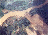
In the wake of the May 12, 2008, earthquake in China, a series of landslides blocked the Jiangjiang River, creating swollen reservoirs that threatened to break through and flood catastrophically. The largest of these lakes, Tangjiashan Lake, threatened roughly 1.3 million people.
Published Jun 11, 2008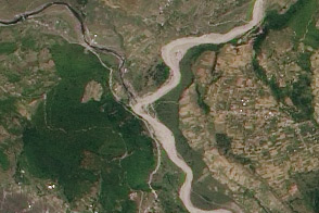
Fresh, light-colored debris filled the channel of Nepal’s Seti River after a catastrophic flood and debris flow on May 5, 2012.
Published May 29, 2012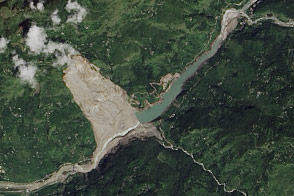
The deadliest landslide Nepal has seen in a decade went on to produce a hazardous barrier lake.
Published Sep 23, 2014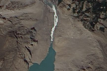
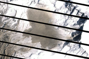
On July 2, 2010, a landslide-dammed lake in Pakistan appeared to have overtopped the dam, and water was streaming out through a man-made spillway.
Published Jul 2, 2010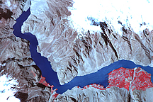
Acquired on May 2, 2010, this false-color image shows a growing landslide lake in the Hunza Valley of Northern Pakistan. A white outline shows the landslide lake’s extent in mid-March 2010.
Published May 11, 2010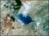
Acquired on April 20 and May 6, 2012, these images compare conditions before and after a landslide in Nepal. The slide likely led to deadly flooding.
Published May 24, 2012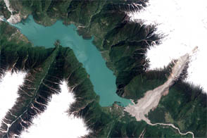
A landslide in eastern Tibet backed up the Yigong River for two months.
Published Jun 16, 2012