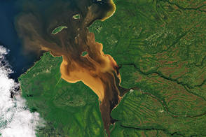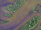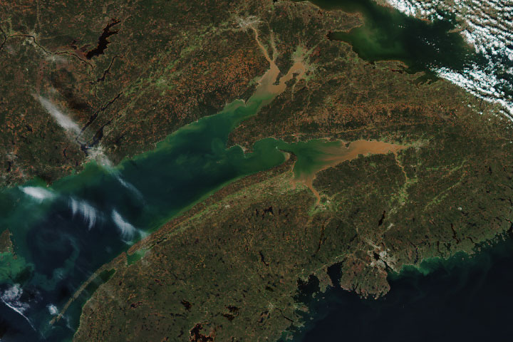
Rupert Bay in Quebec is one of those places where it pays to look at the big picture. Up close, the water might appear relatively homogenous. But from space, wild patterns emerge—evidence of the fluid dynamics that occur when fresh river water meets sea water. The Operational Land Imager (OLI) on Landsat 8 acquired this natural-color image on June 9, 2018.
Water near the shore is light tan with sediments that have been resuspended by waves moving over shallow mud flats. The middle part of the bay is also colored by sediments, but the water is darker due to dissolved organic matter, which dyes the water the color of tea. The organic material comes from the nearby peatlands and is carried to the bay in river runoff. A long tongue of this stained river water—diluted with seawater—extends northwest into James Bay.
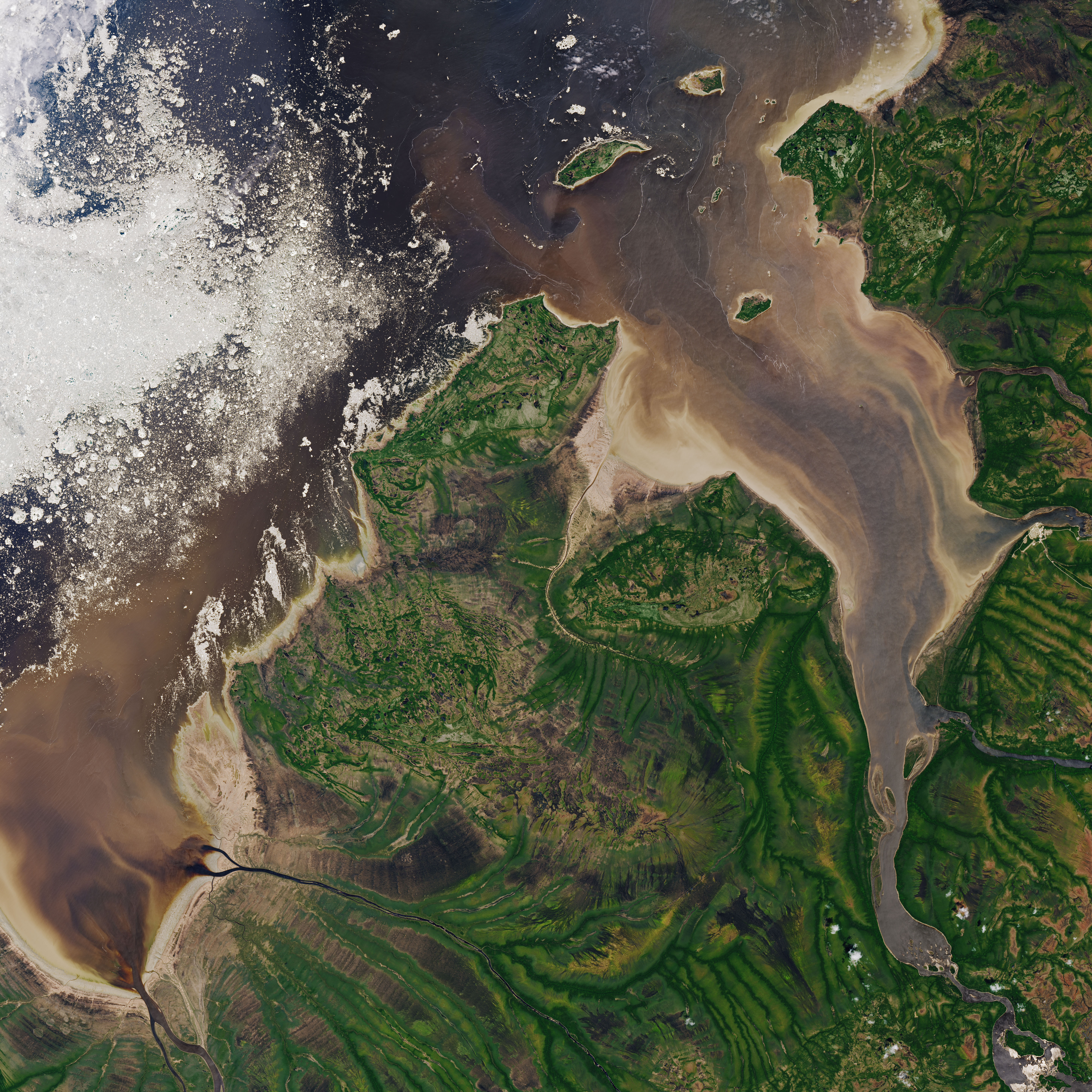
Colorful swirls form where river and sea water collide—influenced by the tides, the shape of the seafloor, and the motion of water as it flows around islands. The phenomenon is common: check out this stunning example from summer 2016.
The image above shows another interesting element—long, white, meandering filaments of foam. According to Greg McCullough, an expert in freshwater and marine coupling at University of Manitoba, these filaments are likely a signature of the boundary between continental fresh water and salty marine water. The turbulence along the interface causes the natural organic films that collect here to form bubbles, “much as soap forms bubbles when stirred vigorously into water,” McCullough said.
Also notice the eddy just southeast of Jacob Island. McCullough notes that ice concentration maps indicate that Rupert Bay was ice-free by mid-May, before this image was acquired. However, the white filaments and patches within the core of this eddy could be fragments of trapped ice that moved from James Bay into Rupert Bay in early spring. The eddy could also contain frozen vegetation and sediment scoured from the seafloor by ice floes.
NASA Earth Observatory image by Joshua Stevens, using Landsat data from the U.S. Geological Survey. Story by Kathryn Hansen with image interpretation by Jennifer Lukovich and Greg McCullough, University of Manitoba.