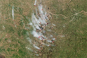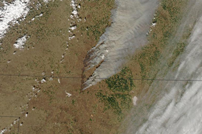
Every spring, the skies in eastern Kansas fill with smoke when ranchers burn their pastures. Fires remove old vegetation, encourage the growth of fresh grass that makes for good forage, and prevent forests from taking over the prairie.
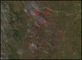
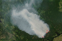
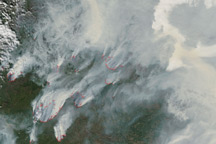
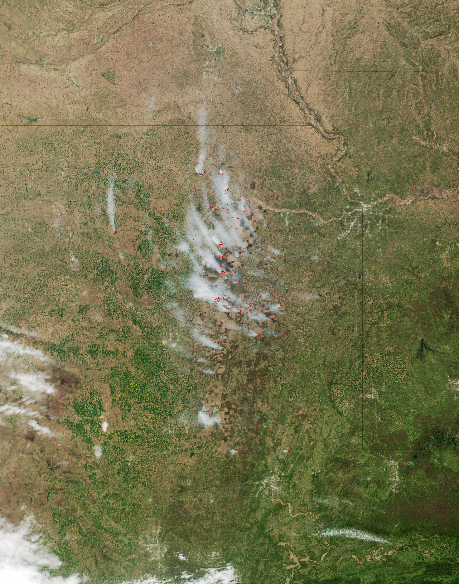
Skies were particularly smoky in spring 2016. The Visible Infrared Imaging Radiometer Suite (VIIRS) on the Suomi NPP satellite acquired this natural-color image of dozens of fires burning throughout the Flint Hills on April 12, 2016. Red outlines indicate hot spots where VIIRS detected warm surface temperatures associated with fires. Winds pushed trails of smoke toward the northwest.
Heavy rains in the summer of 2015 set the stage for the current fires. The rains triggered a growth spurt that made prairie vegetation unusually lush by the fall. After that vegetation died back during a dry winter, the prairie was primed to burn. According to the U.S. Drought Monitor, most of Kansas is either abnormally dry or in a state of moderate drought. Meanwhile, strong winds this spring have intensified the fires and caused some of them to spread out of control.
Smoke is causing a nuisance in Kansas and neighboring states. In Omaha, Nebraska, public health officials said air quality had reached unhealthy levels. Meanwhile, schools in Lincoln, Nebraska, called off outdoor athletic activities because of the smoke.
NASA image by Adam Voiland, LANCE/EOSDIS Rapid Response. Caption by Adam Voiland.