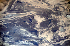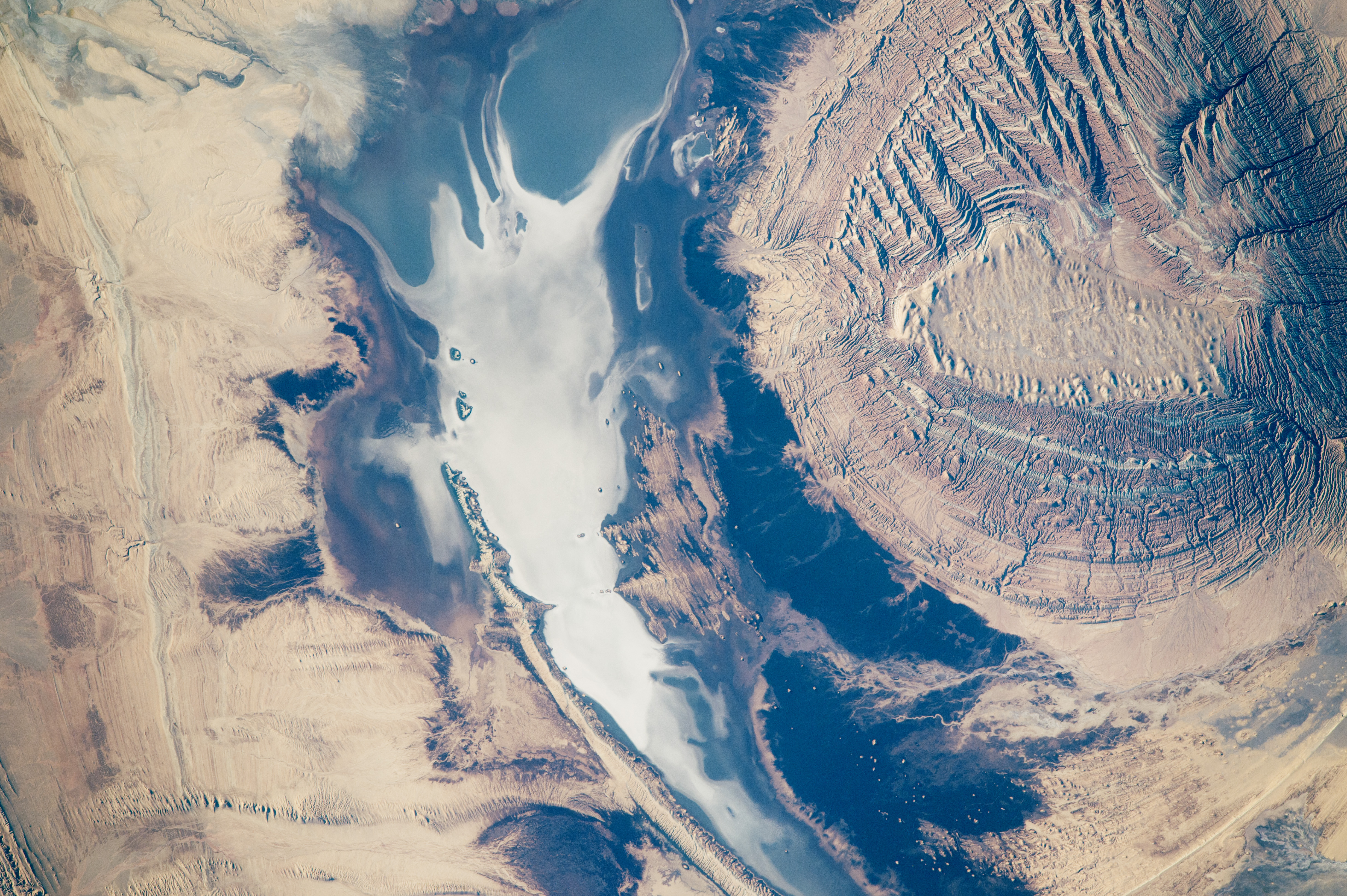
Part of the astronaut experience is observing many different landscapes and geological patterns, especially in deserts where vegetation is rare. A crew member aboard the International Space Station took this photograph of a circular hill in the Kavir Desert in central Iran. Even from 400 kilometers (250 miles) up in space, this long-lens image captures fine details of the small (3.25 kilometer) flat hilltop. Numerous, multi-colored lines on the sides of the hill show that it consists of many thin layers of sedimentary rock.
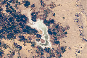
The neighboring dry lake has a white salt-covered surface. By contrast, the darkest areas are shrubby desert vegetation on the lowest slopes of the hill—the only zone where enough water concentrates to allow vegetation to grow.
The astronaut might even be able to tell the difference between the long curved lines on the left of the image. One is an ancient shoreline formed when the lake contained permanent water and had waves strong enough to shape sediments into a smooth beach. The other curved, slightly irregular line is a harder rock layer protruding from the desert floor.
Astronaut photograph ISS046-E-693 was acquired on December 13, 2015, with a Nikon D4 digital camera using an 1150 millimeter lens, and is provided by the ISS Crew Earth Observations Facility and the Earth Science and Remote Sensing Unit, Johnson Space Center. The image was taken by a member of the Expedition 46 crew. The image has been cropped and enhanced to improve contrast, and lens artifacts have been removed. The International Space Station Program supports the laboratory as part of the ISS National Lab to help astronauts take pictures of Earth that will be of the greatest value to scientists and the public, and to make those images freely available on the Internet. Additional images taken by astronauts and cosmonauts can be viewed at the NASA/JSC Gateway to Astronaut Photography of Earth. Caption by M. Justin Wilkinson, Texas State U., Jacobs Contract at NASA-JSC.