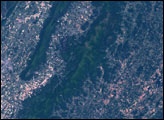
In northern Minnesota, near the Canadian border, is Voyageurs National Park. Established in 1975, the park saw fur traders nearly two centuries earlier, and it supported human inhabitants thousands of years before that. Today, park visitors wanting to experience the park to its fullest must leave their cars behind. Almost a third of the park is water, and travel through the park is usually by boat.
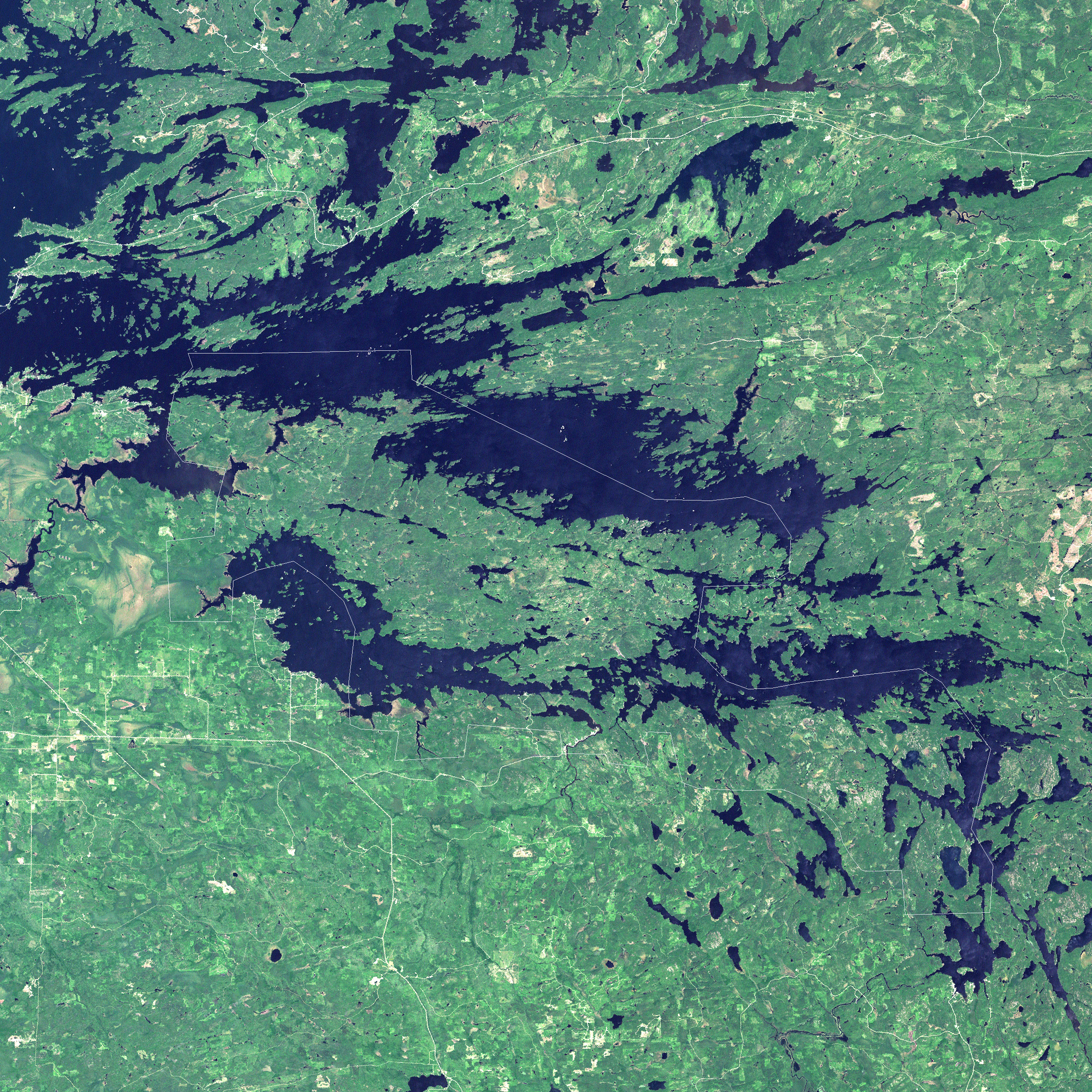
The Landsat 7 satellite captured this image of Voyageurs National Park on July 5, 2001. In this natural-color image, deep blue shows water, while dark green indicates vegetation. Patches of pale beige are areas where bare rock or artificial surfaces interrupt the lush terrain. The park’s boundary appears as a white outline. This park forms part of a larger landscape of forests, swamps, and lakes dotting the landscape of northern Minnesota and Southern Ontario.
The forested land areas buffeted by waterways is just the latest look for this park. Geologists studying the region have uncovered evidence of many landscapes in the ancient past. The rocks underlying Voyageurs National Park are part of the Canadian Shield, an ancient bedrock that formed almost two billion years before the first dinosaur roamed the Earth. In much more recent geologic time, Pleistocene glaciers scraped the area clean, paving the way for re-colonization of the previously frozen landscape with forest. In between the eras of ancient bedrock and the massive glaciers, the area was alternately mountainous, and riddled with volcanoes while buried beneath a shallow sea.
NASA image created by Jesse Allen, Earth Observatory, using data obtained from the University of Maryland’s Global Land Cover Facility.