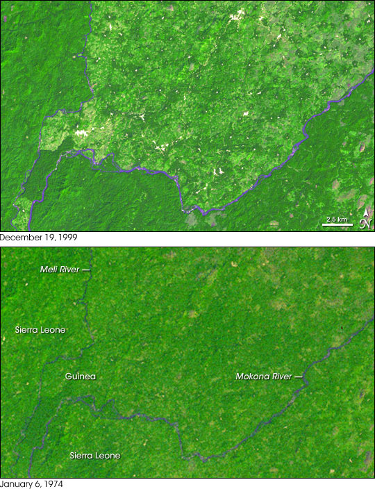
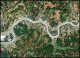
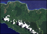
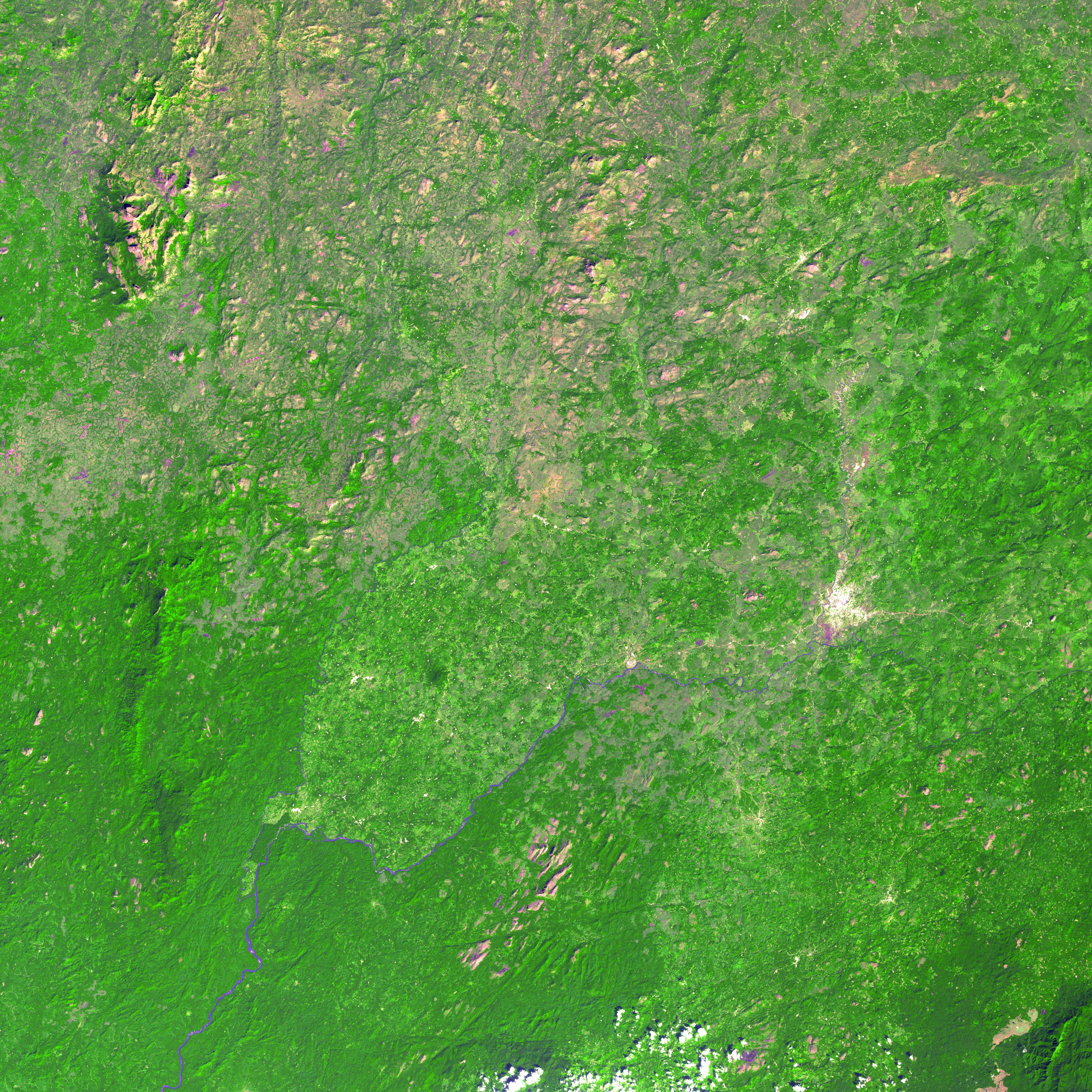
In western Africa, a small part of Guinea juts southward into Sierra Leone just north of that country’s border with Liberia. The region is known as the “Parrot’s Beak” because of the curved point of land between the Meli and Mokona Rivers. According to the United Nations Environment Programme (UNEP), the unique forests of the region have dramatically diminished over the past few decades as civil war in Sierra Leone and Liberia have pushed tens and possibly hundreds of thousands of refugees into the Parrot’s Beak. People have cut down the forests for housing materials, wood for charcoal, and space to grow crops. Some commercial logging also played a role.
This pair of Landsat satellite images illustrates the deforestation that took place between December 19,1999 (top), and January 6, 1974 (bottom). In 1974, deep green forests covered much more of the region than they did in 1999. According to the UNEP book One Planet, Many People: Atlas of Our Changing Environment, refugees to Guinea ”integrated into local villages, created their own family plots, and expanded the [already existing] zones of converted forest area until they all merged�.” Indeed, the 1999 image appears to be the inverse of the 1974 image. In 1974, small village clearings (appearing light green or tan) are surrounded by green forests; in 1999, small islands of dark green forest are surrounded by mostly cleared land.
NASA images created by Jesse Allen, Earth Observatory, using data obtained from the University of Maryland’s Global Land Cover Facility.

