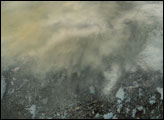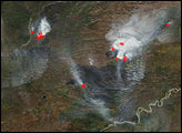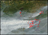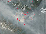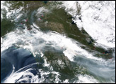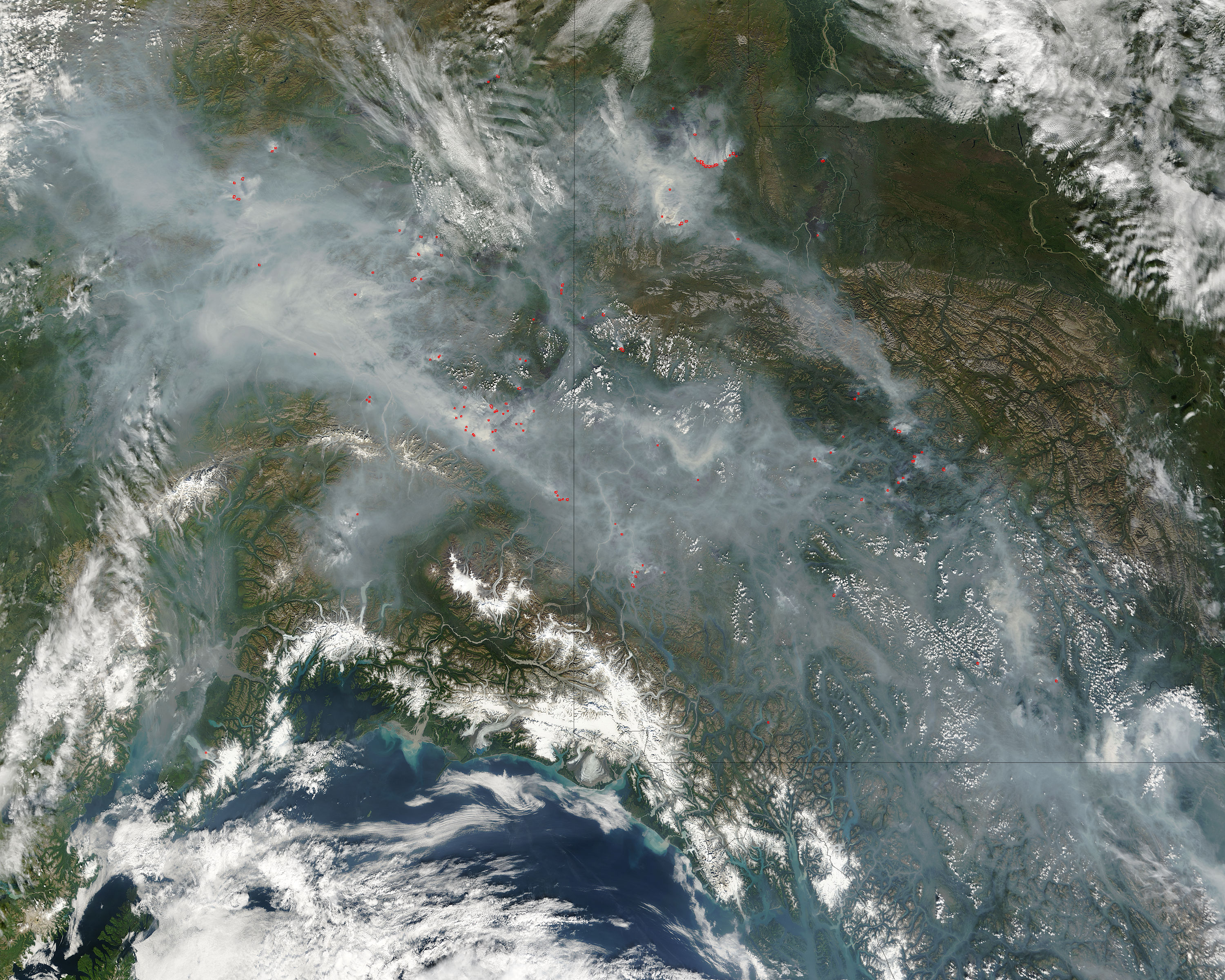
On August 17, 2004, fires (red dots) burned across Alaska and northern Canada, spreading smoke across thousands of square kilometers. This image from the Moderate Resolution Imaging Spectroradiometer (MODIS) on NASA’s Terra satellite spans Alaska (left), Yukon Territory (right), and British Columbia (bottom right). At lower left is the Gulf of Alaska.
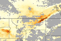
The fire season in Alaska has been very active since mid-June when several days of record-breaking numbers of lightning strikes touched off scores of fires. The particle pollution from these intense smoke plumes has drifted as far away as Texas. In an effort to predict the movement of particle pollution from one region of the country to another, scientists from NASA have partnered with the Environmental Protection Agency (EPA), and the National Oceanic and Atmospheric Administration (NOAA) to develop a particle pollution forecasting system.
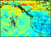
The system relies on satellite observations of aerosols from the MODIS on the Terra satellite, air quality data from EPA monitoring stations, and weather information from NOAA. Called “IDEA,” for Infusing satellite Data into Environmental Applications, the project provides 48-hour prediction maps of the movements of air pollution across North America.
To see the current IDEA particle pollution forecast, visit the IDEA project Website at the Space Science and Enginerring Center at the University of Wisconsin-Madison. To read more about project, read the feature story “A New IDEA in Air Quality Forecasting.”
The high-resolution image provided above is 500 meters per pixel. The MODIS Rapid Response System provides this image at additional resolutions.
Image courtesy Jacques Descloitres, MODIS Rapid Response Team, NASA-Goddard Space Flight Center