Summer sun bakes the Indian landscape, sending columns of heat into the atmosphere. The rising hot, dry air pulls in moist air from the surrounding ocean, and soon rains begin to fall. Summer is monsoon season in south Asia.
While the intense monsoon rains bring deadly floods to India and Bangladesh, they also bring water. Most of India’s rain falls in the monsoon season between June and September. Farmers depend on monsoon rain to water their crops. But by the end of July, the monsoon season of 2009 was off to a disappointing start for much of India and Bangladesh.
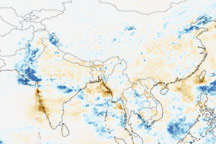
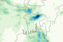
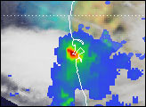
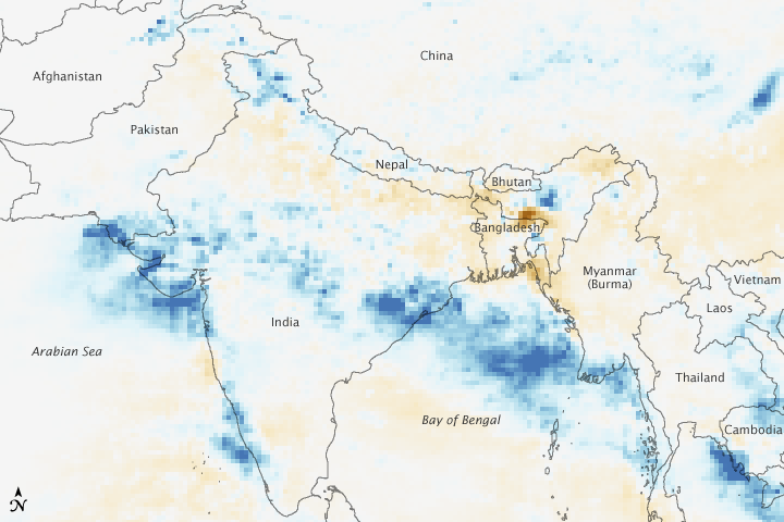
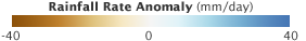
This image shows anomalies in rainfall between July 14 and July 20, 2009. Most of India and Bangladesh are brown, showing that less rain fell than average during the week. One of India’s primary crop areas is in the north, where less rain has fallen. According to BBC News, Bangladesh had received 40 percent less monsoon rain than normal by July 20, triggering fears of food shortages.
Only in a narrow swath of India was rainfall above average, shown in blue. A pocket of heavy rain is centered over eastern India in the state of Orissa. This rain caused floods that killed at least 36 people, reported BBC News. Another pocket of heavy rain is over southeastern Pakistan where the city of Karachi is located. During the week, heavy rain caused floods and power outages, leaving at least 29 people dead.
The image was based on data from the Tropical Rainfall Measuring Mission (TRMM) satellite, which carries a unique space-based precipitation radar. The detailed measurements from TRMM’s precipitation radar are used to calibrate less detailed measurements from other satellites in the Multisatellite Precipitation Analysis, a near-real-time rainfall estimate produced by scientists at NASA’s Goddard Space Flight Center.
The rainfall patterns shown here are reminiscent of those seen during El Niño episodes. In an El Niño, the waters of the eastern tropical Pacific are warmer than normal, changing the distribution of rainfall around the globe. In general, the Indian monsoon tends to be weaker than normal during an El Niño episode. NASA measurements of the Pacific Ocean show signs that El Niño was developing during June 2009. On July 9, 2009, scientists at the National Oceanic and Atmospheric Administration announced that an El Niño had arrived.
NASA image by Jesse Allen, using near-real-time data provided courtesy of the TRMM Science Data and Information System at Goddard Space Flight Center. Caption by Holli Riebeek.