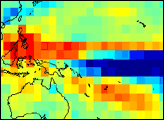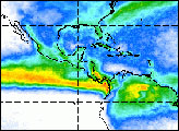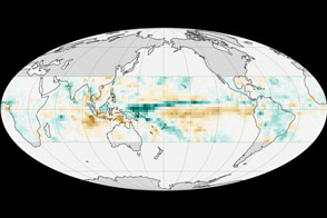
NASA data is helping scientists understand El Niño’s effect on weather. In addition to the change in the amount of rainfall that characterize an El Niño, there is a change in the type of rain, especially over the central Pacific. During an El Niño long periods of steady drizzle—stratiform rain—replace the short-lived thunderstorms that typically occur in the Equatororial Pacific. Stratiform rain pumps heat higher into the atmosphere than thunderstorms, which in turn changes the movement of high-level winds. In this way, El Niño influences global weather patterns, with effects like droughts in Indonesia and floods in Peru.
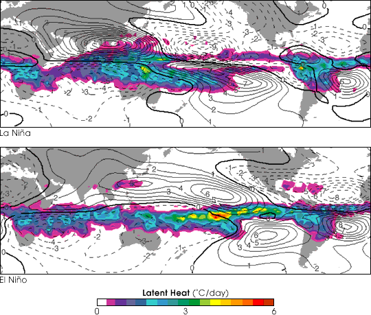
The maps above compare the “latent heating” in the upper troposphere [about 7 kilometers (4.35 miles) high] during a La Niña and an El Niño. (Latent heat is energy released by water when it condenses from a gas to a liquid.) Color represents latent heat, and the contours represent change in airflow. Solid lines represent clockwise rotation (anticyclonic circulation typical of high pressure systems in the northern hemisphere, cyclonic circulation typical of low pressure systems in the southern hemisphere), and dashed lines are counterclockwise. These changes in circulation, driven by latent heat, contribute to the changes in rainfall associated with El Niño around the Pacific.
The latent heat data were derived from Tropical Rainfall Measuring Mission (TRMM) Precipitation Radar data in January-April 1999 (La Niña) and January-April 1998 (El Niño). Streamfunction anomaly contours were calculated by a computer model.
For more information, read: El Niño’s Surprising Steady Pacific Rains Can Affect World Weather
Maps courtesy Courtney Schumacher and Robert A. Houze Jr.