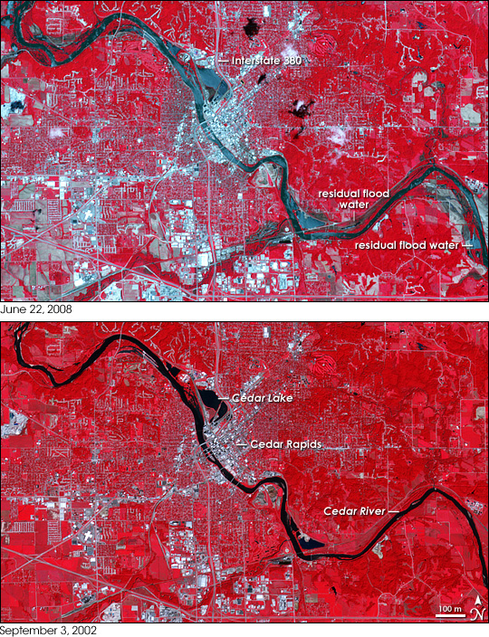
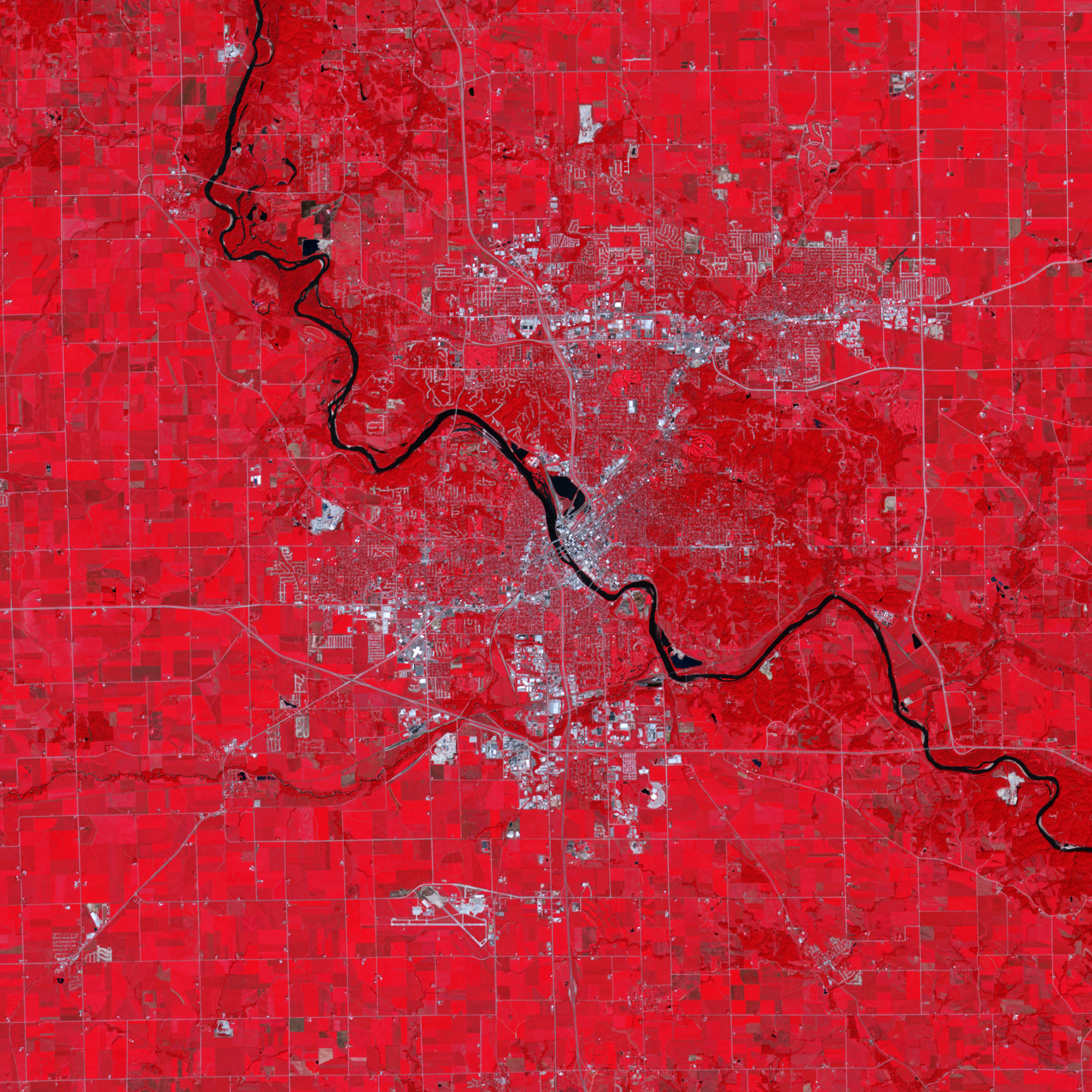
The floods had receded from downtown Cedar Rapids, Iowa, when the Advanced Spaceborne Thermal Emission and Reflection Radiometer (ASTER) on NASA’s Terra satellite captured this image on June 22, 2008, but residual water hints at the scope of the unprecedented flood. Intense spring rains pushed the Cedar River over its banks, covering 9.2 square miles or 1,300 city blocks with water, reported the Associated Press. Traces of blue on the land surrounding the river reveals the river’s extent during the floods. The flood engulfed Cedar Lake, and followed the line of Interstate 380 into the city. The river covered businesses and homes on its southwestern bank as well, according to a flood map published by The Gazette, a local newspaper.
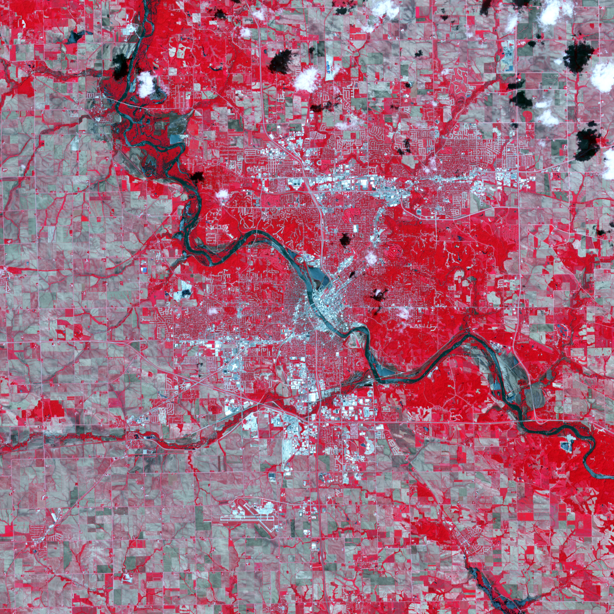
A concentration of silvery white in these false-color images, the city of Cedar Rapids spans the Cedar River. Seven bridges connect the two halves of the city, forming thin white lines against the black and blue of the water. Plant-covered land is dark red in this type of image. Residential neighborhoods form a gray and red grid of streets and lawns. Bare earth is tan. Several of the fields that had been covered with plants in September 2002 (lower image), were bare in June 2008. The difference may be a simple matter of seasons: September is the end of the growing season, when vegetation is lush and dense, while June is towards the beginning of the growing season when plants are still sparse. If these are crop areas, the fields may not have been planted at all, or the crops may have been damaged by the intense rains and floods.
NASA image created by Jesse Allen, using data provided courtesy of NASA/GSFC/METI/ERSDAC/JAROS, and U.S./Japan ASTER Science Team. Caption by Holli Riebeek.


