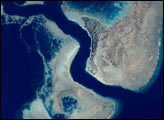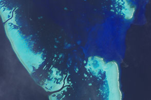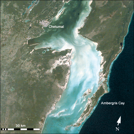
Chetumal Bay lies on the Border between Mexico and Belize. To the east of the bay, Ambergris Cay connects the Belize Barrier Reef to the Yucatan Peninsula. The north of the island is Bacalar Chico Marine Reserve. Here, the barrier reef comes very close to the east side of the island. In 1998, reefs in Belize were hit by two major events that led to heavy coral mortality: El Ni&ntidle;o-related coral bleaching and Hurricane Mitch.
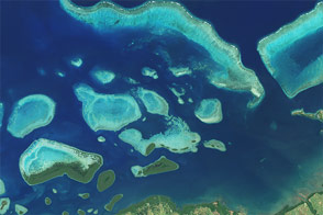
Astronaut photographs of coral reefs are being used to provide perspective on coral reef geography, coastal development, and related land habitats. Numerous photographs taken by astronauts were included in the recently published World Atlas of Coral Reefs (click to read the recent press release). Coral reef images acquired by astronauts can also be used as mapping data in more detailed remote sensing applications.
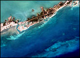
Images of coral reef areas are being acquired by astronauts on Space Station Alpha as part of the Crew Earth Observations Project. Coral reefs are one of the areas selected as a scientific theme for this project (see also the recent Earth Observatory article, Mapping the Decline of Coral Reefs).
ISS001-ESC-5317 was taken January 23, 2001, from Space Station Alpha using a digital camera. The image is provided by the Earth Sciences and Image Analysis Laboratory at Johnson Space Center. Searching and viewing of additional images taken by astronauts and cosmonauts is available at the NASA-JSC Gateway to Astronaut Photography of Earth.
The World Atlas of Coral Reefs was produced by the United Nations Environment Programme-World Conservation Monitoring Centre and published by the University of California Press.
Image courtesy Earth Sciences and Image Analysis Laboratory at Johnson Space Center. Additional images taken by astronauts and cosmonauts can be viewed at the NASA-JSC Gateway to Astronaut Photography of Earth.