The Earth Observatory has published its last Image of the Day on this website. Please join us on our new home at science.nasa.gov/earth/earth-observatory.

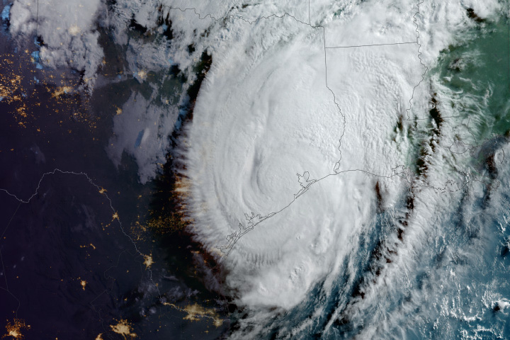
For much of May 2024, a potent heat dome sat over the Caribbean Sea and the Gulf of Mexico, causing sweltering temperatures that broke records in Central America. As air along its northern edge clashed with cooler, drier air in the United States, atmospheric instability and intense thunderstorms formed over the south-central U.S.
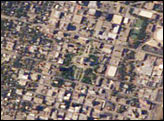
On May 16, 2024, an especially strong and long-lasting band of storms—a derecho—charged across Central Texas and struck Houston. The storm unleashed tornadoes and destructive winds that reached 100 miles (160 kilometers) per hour. It shattered windows, tore roofs off homes, and toppled trees and power lines. Nearly one million homes and businesses in the Greater Houston area lost power, according to news reports.
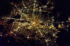
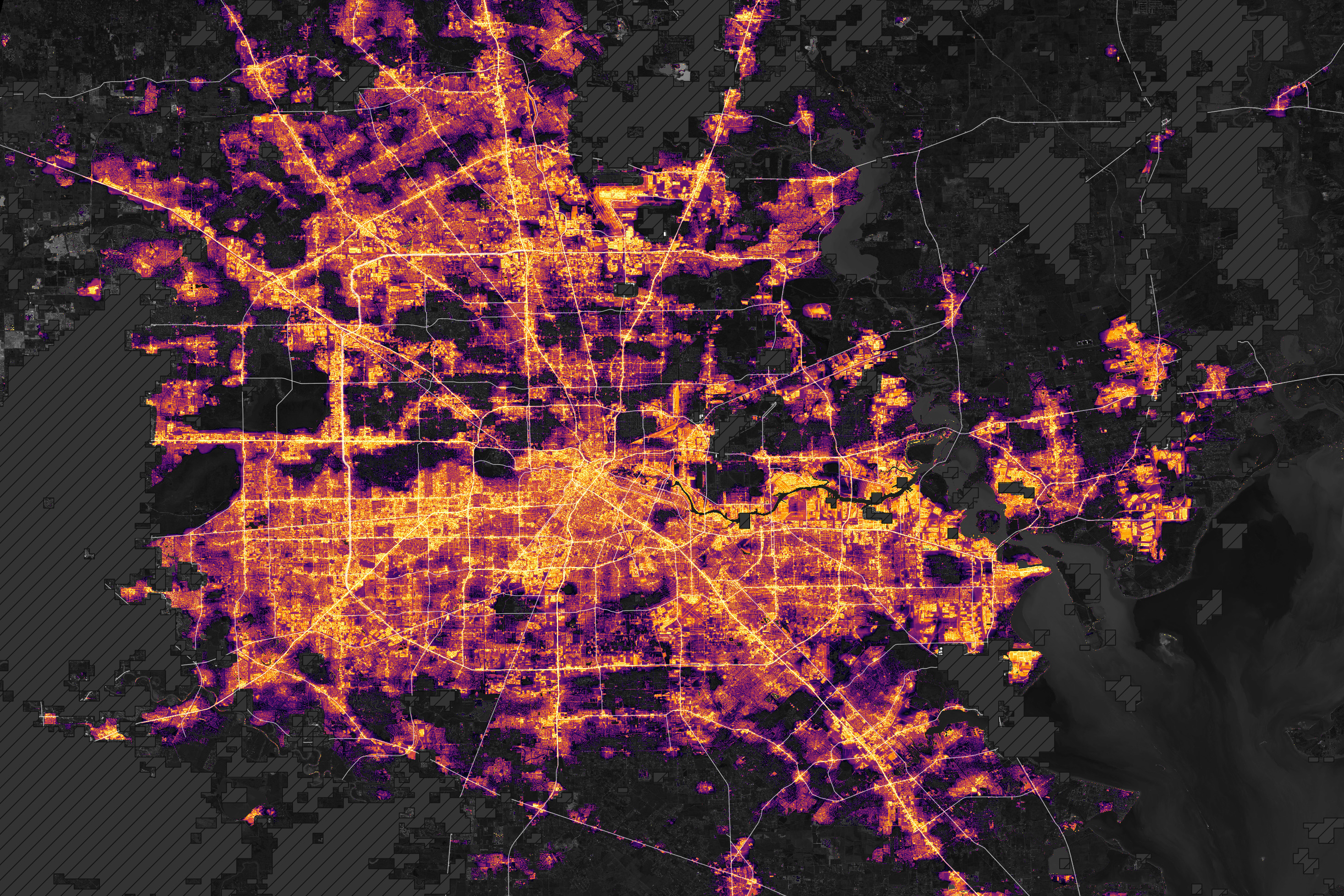
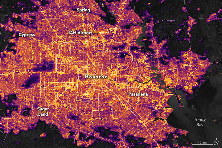
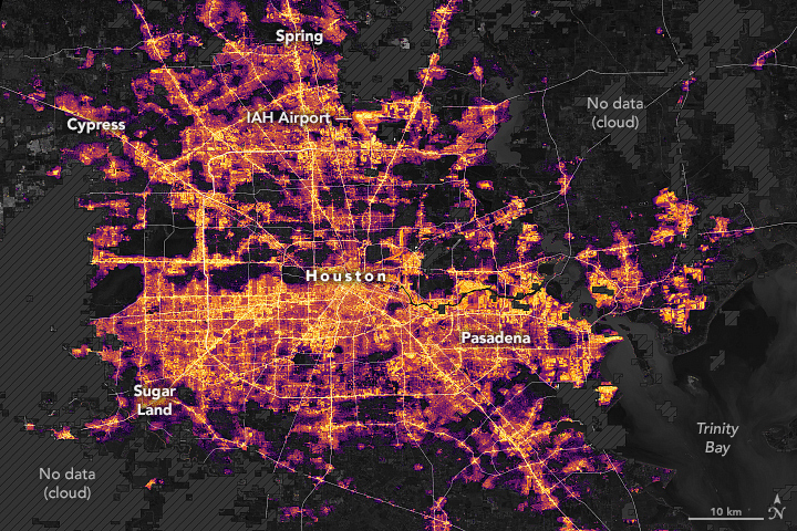
Power outages were widespread enough to be noticeable in nighttime satellite images. The left map above is a composite showing normal night light conditions in April 2024; the right map shows the same area early on May 18, after the derecho. Many outages occurred within the Beltway, especially in neighborhoods in the northern part of Houston and the surrounding suburbs.
The maps are based on data from the Visible Infrared Imaging Radiometer Suite (VIIRS) sensor on the NASA-NOAA Suomi NPP satellite. VIIRS measures nighttime light emissions and reflections via its day-night band. This sensing capability makes it possible to distinguish the intensity of lights and to observe how they change.
The maps come from the Black Marble HD product, provided by Ranjay Shrestha of the NASA Black Marble science team. The base map was built from data collected by Landsat 9. Dark gray areas with hash marks are where cloud cover prevented VIIRS from collecting night lights data. The data were processed by the Black Marble team to account for changes in the landscape, the atmosphere, and the Moon phase, and to filter out stray light from sources that are not electric lights.
The return of electricity to many areas that lost it was apparent in data collected on May 19 and 20. Roughly 50,000 customers in Harris County, Texas, were still waiting for power to be restored on May 22, 2024, according to data compiled by PowerOutage.US from publicly accessible sources.
“The ability of satellite-derived nighttime lights products, such as the Black Marble, to capture widespread outages in a distributed energy system is crucial for immediate response, resource allocation, and damage assessment,” said Shrestha.
Temperatures soared in Texas in the days following the derecho, with highs rising above 90 degrees Fahrenheit (32 degrees Celsius) in Houston. To protect residents without air conditioning from dangerous levels of heat, city authorities set up cooling and charging centers throughout the city.
NASA’s Earth Applied Sciences Disasters program area has been activated to support the Federal Emergency Management Agency’s response to the event. As new information becomes available, the team will be posting maps and data products on its open-access mapping portal.
NASA Earth Observatory images by Lauren Dauphin, using Black Marble data courtesy of Ranjay Shrestha/NASA Goddard Space Flight Center and Landsat data from the U.S. Geological Survey. Story by Adam Voiland.