The Earth Observatory has published its last Image of the Day on this website. Please join us on our new home at science.nasa.gov/earth/earth-observatory.
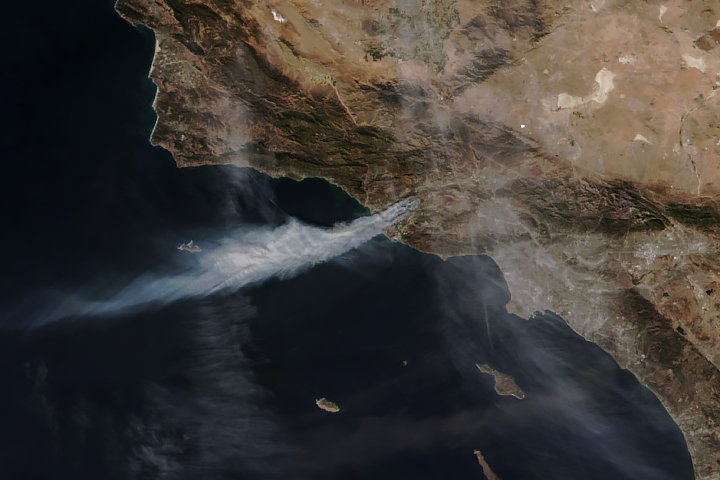
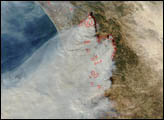
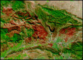
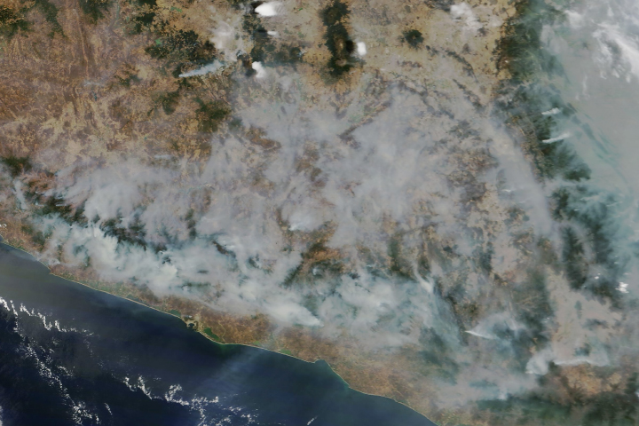
As Mexico entered peak fire season in March 2024, dry and warm conditions helped fuel the flames of more than 100 active blazes across the country. This image shows smoke billowing from one such fire near the border of neighboring states Oaxaca (west) and Chiapas (east) in southern Mexico.
The OLI-2 (Operational Land Imager-2) on Landsat 9 acquired the image at about 10:30 a.m. local time (16:30 Universal Time) on March 27, 2024. The image is natural color (bands 4-3-2) overlaid with pixels from a false-color image to emphasize hot spots associated with the fire front.
According to Mexico’s National Forestry Commission (CONAFOR), there were 120 actively burning fires across Mexico on March 27. Preliminary data indicated that fires that day affected more than 7,000 hectares (27 square miles) across 19 of Mexico’s 31 states.
The fire shown burned across vegetation located about 100 kilometers west of Tuxtla Gutiérrez, the capital and largest city of Chiapas. Past fires this season have burned closer to major urban areas, including a deadly fire that burned near the Oaxacan town of San Lucas Quiaviní, and fires that sent plumes of smoke toward Mexico City, the country’s capital.
Fire season in Mexico generally ramps up in February and peaks around mid-March through May. In February 2024, warm and dry conditions set the stage for burning. Long-term drought saw little relief from rain that month, and the national average temperature was 0.3 degrees Celsius (0.5 degrees Fahrenheit) above normal, making it the 13th warmest February on record, according to the North American Drought Monitor.
The seasonal fire outlook issued in March 2024 called for warm and dry conditions to continue through May, alongside increased fire activity and fire potential expected for all Mexican mountain ranges.
NASA Earth Observatory image by Wanmei Liang, using Landsat data from the U.S. Geological Survey. Story by Kathryn Hansen.