Editor’s note, April 16, 2024: An earlier version of this article included a rounded figure for the Arctic Ocean’s sea ice extent on March 14. The story below has been updated with a more specific figure.
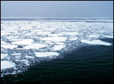
Sea ice at the top of the planet continued to shrink and thin in 2024. The maximum winter ice coverage in the Arctic Ocean is consistent with an ongoing 46-year decline.
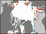
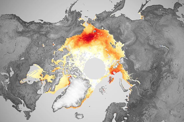
Analysis of satellite observations has revealed that the total area of the Arctic Ocean covered in sea ice reached 5.80 million square miles (15.01 million square kilometers) on March 14. That’s 247,000 square miles (640,000 square kilometers) less ice than the average maximum extent between 1981 and 2010. Overall, the maximum winter ice coverage in the Arctic has shrunk by an area equivalent to the size of Alaska since 1979.
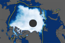
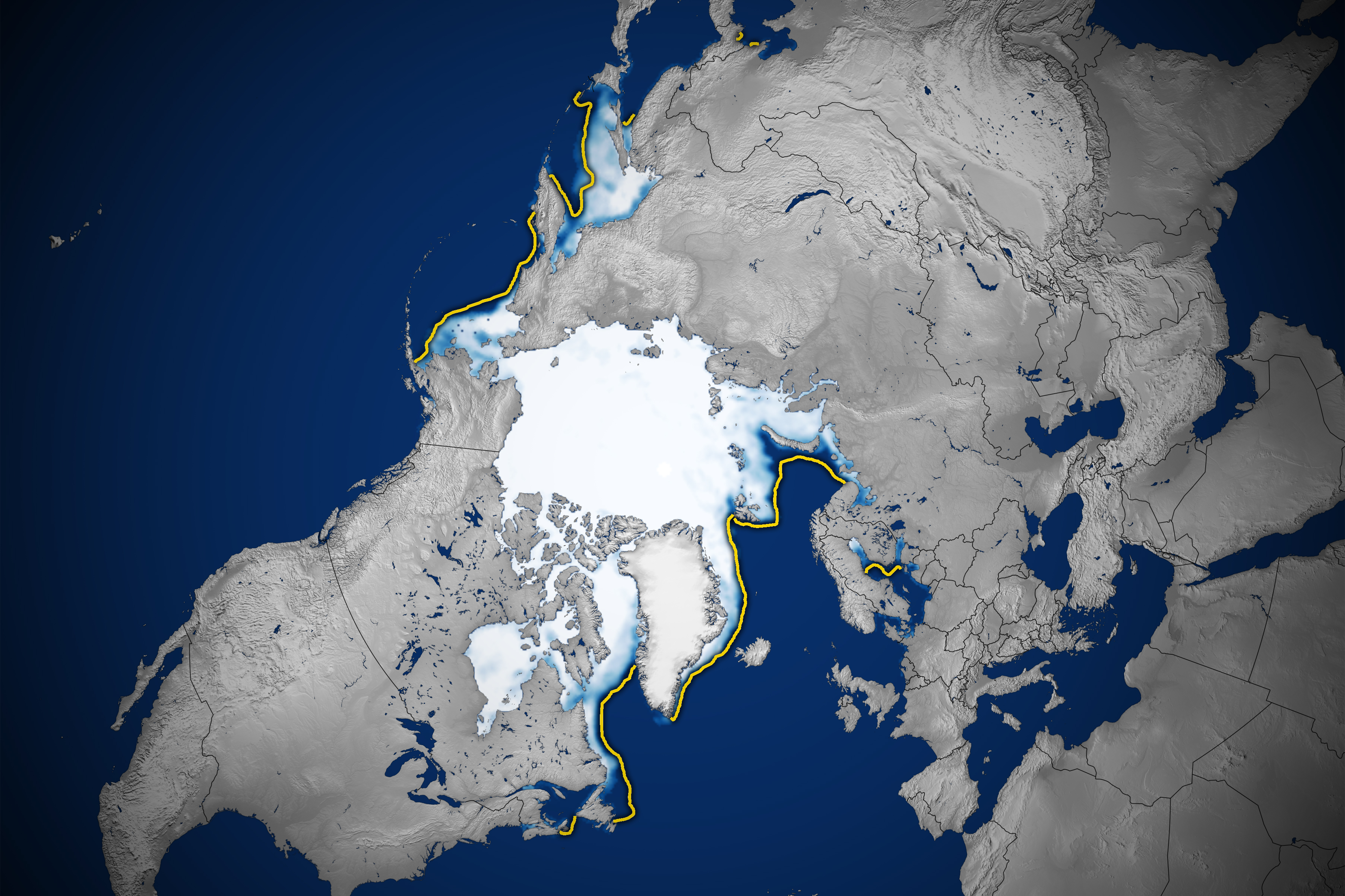
The map above shows the ice extent on March 14, the day of the annual maximum. To determine extent, scientists project satellite observations of sea ice onto a grid and then add up the total area of each cell that is at least 15 percent ice-covered. The yellow outline shows the median sea ice extent for February from 1981 to 2010. A median is the middle value; that is, half of the extents were larger than the yellow line and half were smaller.
The analysis is based on data collected with microwave sensors aboard the Nimbus-7 satellite, jointly operated by NASA and the National Oceanic and Atmospheric Administration (NOAA), along with satellites in the Defense Meteorological Satellite Program.
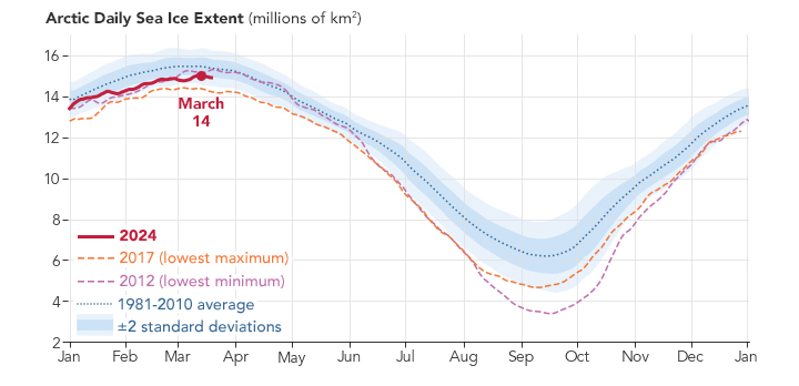
This chart shows the daily sea ice extent through mid-March 2024 (red) compared to the 2017 record low (orange) and the average extent from 1981 to 2010 (blue). This year’s Arctic ice maximum is the 14th lowest on record. Complex weather patterns make it difficult to predict what will happen in any given year.
Scientists with NASA and the National Snow and Ice Data Center (NSIDC) at the University of Colorado, Boulder, track these seasonal and annual fluctuations because sea ice shapes Earth’s polar ecosystems and plays a significant role in global climate.
“The sea ice and the snow on top of it are very reflective,” said ice scientist Linette Boisvert of NASA’s Goddard Space Flight Center. “In the summer, if we have more sea ice, it reflects the Sun’s radiation and helps keep the planet cooler.”
Conversely, shrinking ice makes Earth more susceptible to solar heating. The exposed ocean is darker and readily absorbs solar radiation, capturing and retaining that energy and ultimately contributing to warming in the planet’s oceans and atmosphere.
Sea ice around the poles is more susceptible to the weather than it was a dozen years ago. Ice thickness measurements collected with laser altimeters aboard NASA’s ICESat-2 satellite show that less ice has managed to stick around through the warmer months. This means new ice must form from scratch each year, rather than building on old ice to make thicker layers. Thinner ice, in turn, is more prone to melting than multi-year accumulations.
“The thought is that in a couple of decades, we’re going to have these essentially ice-free summers,” Boisvert said, with ice coverage reduced below 400,000 square miles (1 million square kilometers) and most of the Arctic Ocean exposed to the Sun’s warming glare.
NASA Earth Observatory images by Lauren Dauphin, using data from the National Snow and Ice Data Center. Story by James Riordon/NASA’s Earth Science News Team, adapted for Earth Observatory.