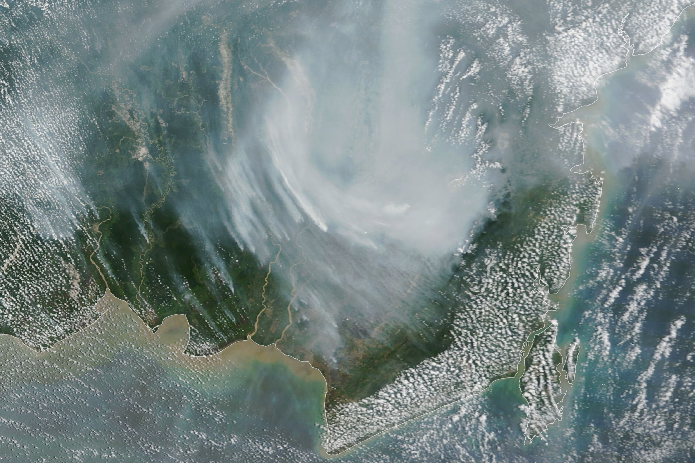
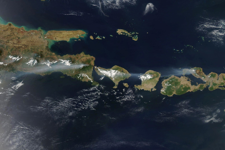
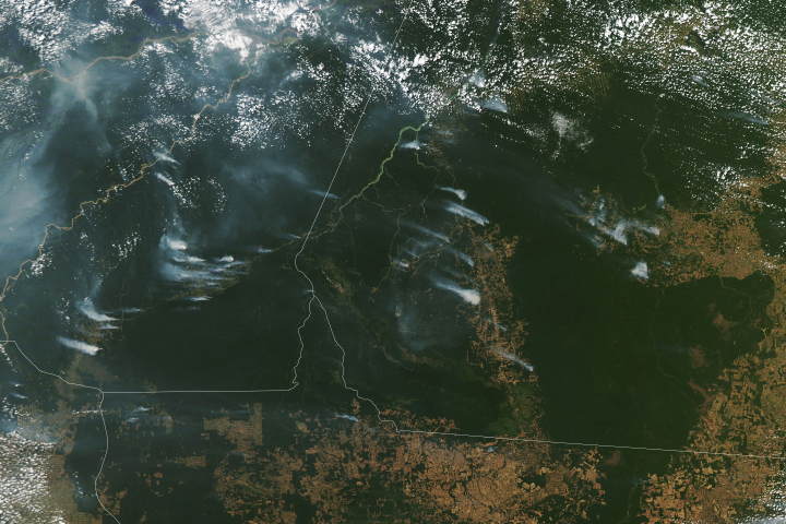
After several years of comparatively quiet fire seasons, Indonesia saw the return of intense, smoky fires in 2023. The blazes have been exacerbated by dry conditions made worse this year by the return of El Niño.
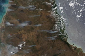
This image shows smoke from fires burning on the island of Borneo, in the Indonesian provinces of South and Central Kalimantan. It was acquired by the MODIS (Moderate Resolution Imaging Spectroradiometer) sensor on NASA’s Terra satellite on October 2, 2023. By that date, fire had burned around 267,900 hectares (662,000 acres) since the start of the year, surpassing the area burned during all of 2022, according to news reports.
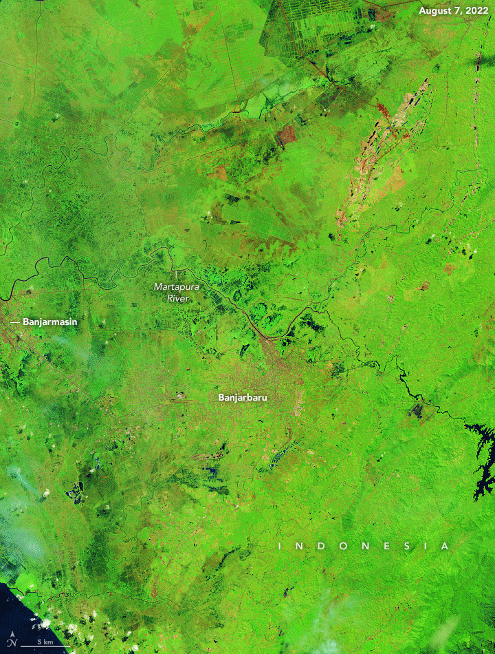
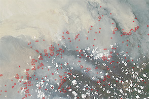
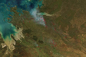
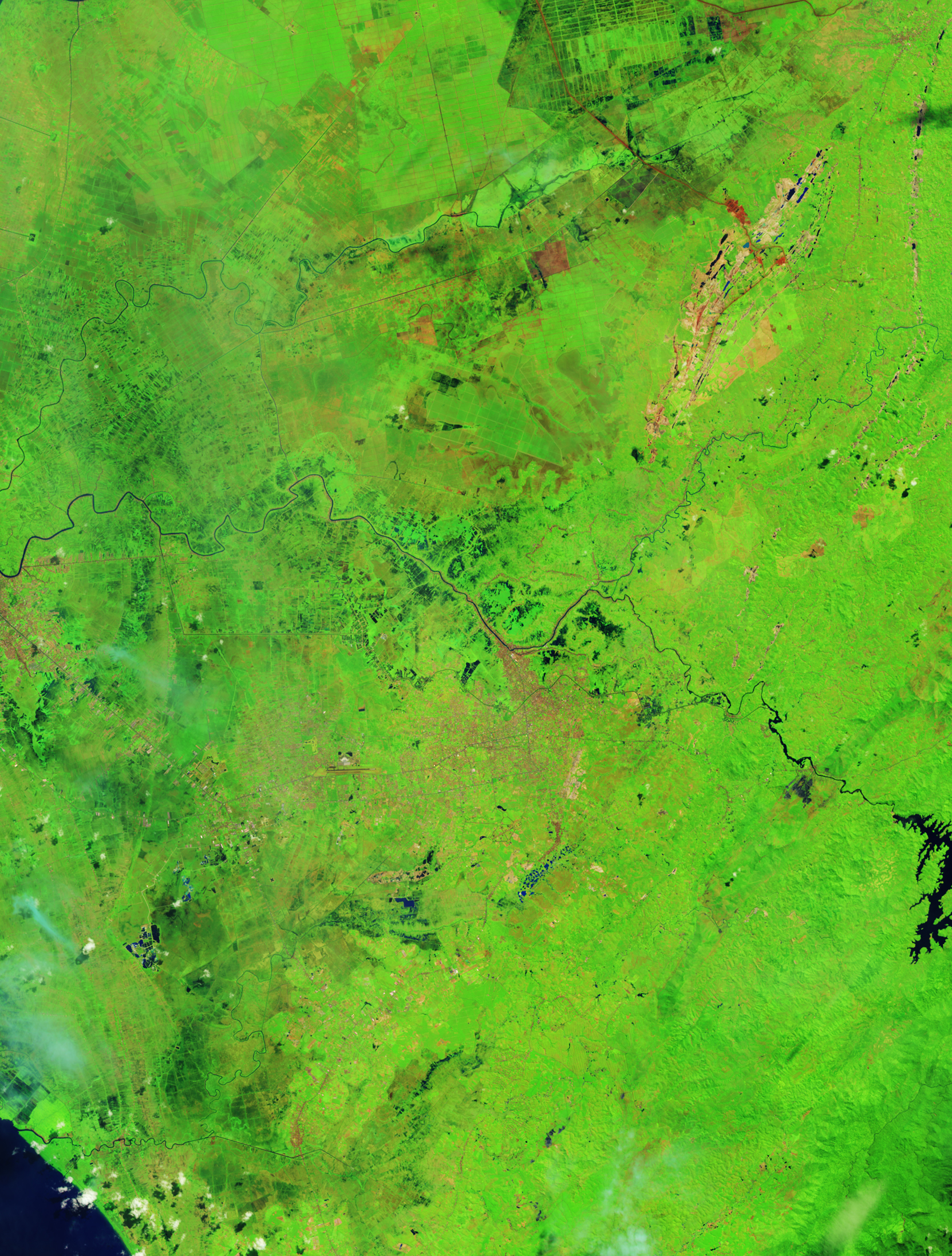
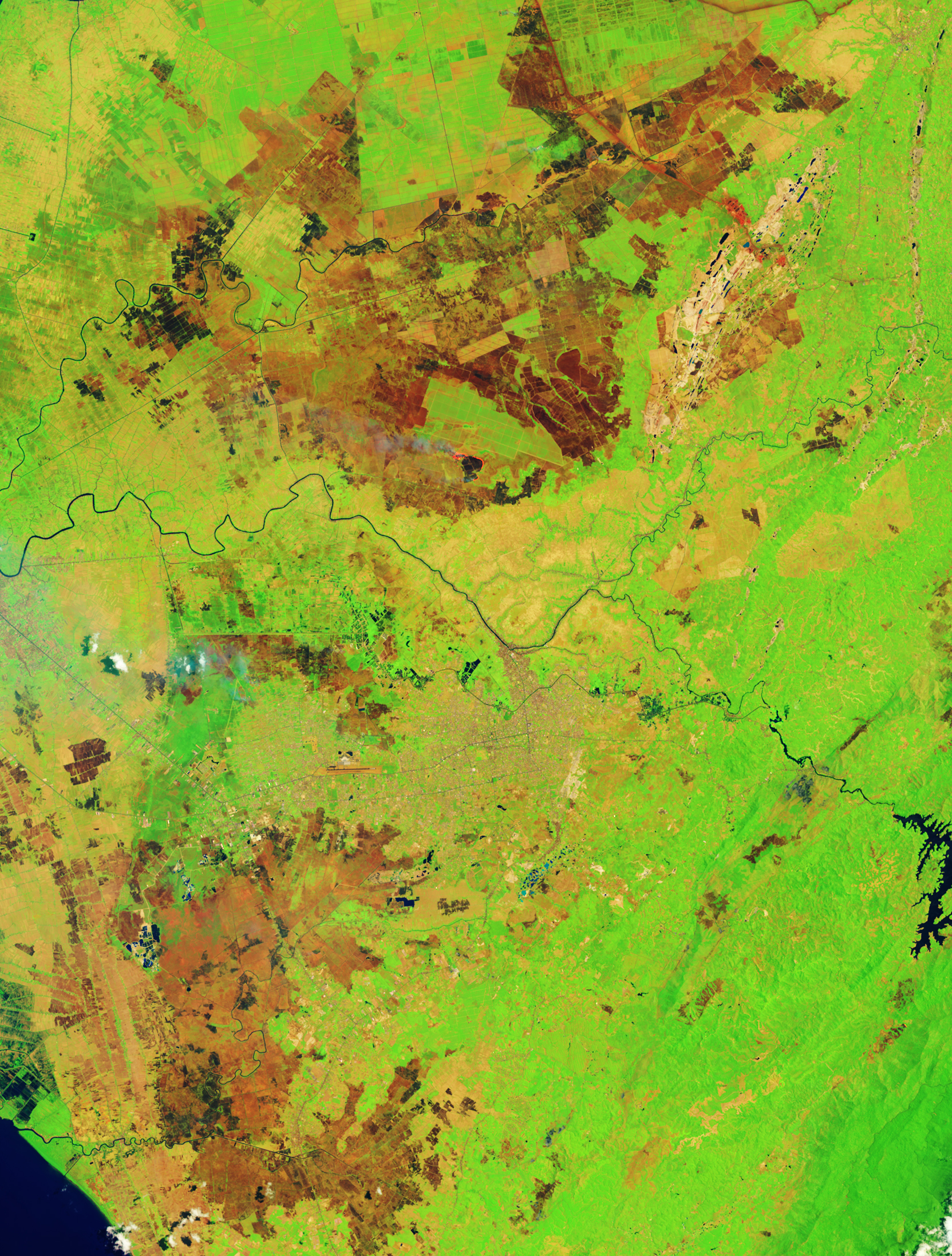
The image below (left) shows burn scars on the landscape near Banjarbaru, the capital city of South Kalimantan, on September 27, 2023. Most of the reds and dark browns are scars from fires that have burned so far during the 2023 fire season. Lighter browns are likely dry vegetation. For comparison, the other image (right) shows the same area on August 7, 2022. Both images are false color and were acquired by the OLI-2 (Operational Land Imager-2) on Landsat 9.
Burning in Indonesia often begins as farmers clear land for crops or grazing animals. Fire that escapes control in Borneo and Sumatra can become difficult to extinguish because of the islands’ large deposits of peat—a soil-like mixture of partly decayed plant material that can fuel smoldering fires for months.
Fires generally correspond with Indonesia’s dry season, which runs from June into December, with fire activity peaking from August into October. This year, scientists think that the natural climate phenomenon El Niño has made the landscape even drier, priming it to burn. During El Niño years, rain that is normally centered over Indonesia and the far western Pacific shifts eastward into the central Pacific, causing parts of Indonesia to experience drought.
“This El Niño has maybe been delayed in drying out the main burning regions,” said NASA and Columbia University scientist Robert Field. “But it is the simplest explanation for the drying, along with a positive Indian Ocean Dipole to the west.”
Josh Willis, an oceanographer and Sentinel-6 Michael Freilich project scientist at NASA’s Jet Propulsion Laboratory, agrees that El Niño is likely playing a role in the dryness this year. Similar scenarios unfolded during El Niño events that ramped up beginning in 1997 and 2015, alongside significant drought in Indonesia. Willis noted that by September of those years, El Niño was already several times stronger than the current one. But that might not matter much when it comes to fire.
“Just because it’s not a huge El Niño doesn’t mean it’s not causing impacts, especially in the tropics,” Willis said. “Indonesia is close to the ocean regions that are the warmest in the world during a neutral or La Niña year. During an El Niño year, even a moderate one, those areas typically dry out.”
The drought is apparent in a map from Indonesia’s meteorological agency provided as part of the Forest and Land Fire Warning System (SPARTAN). SPARTAN uses data from IMERG (Integrated Multi-Satellite Retrievals for GPM)—a product of the GPM (Global Precipitation Measurement) satellite mission—to track regions at high risk of burning, especially from peat fires.
NASA Earth Observatory images by Lauren Dauphin, using MODIS data from NASA EOSDIS LANCE and GIBS/Worldview and Landsat data from the U.S. Geological Survey. Story by Kathryn Hansen.


