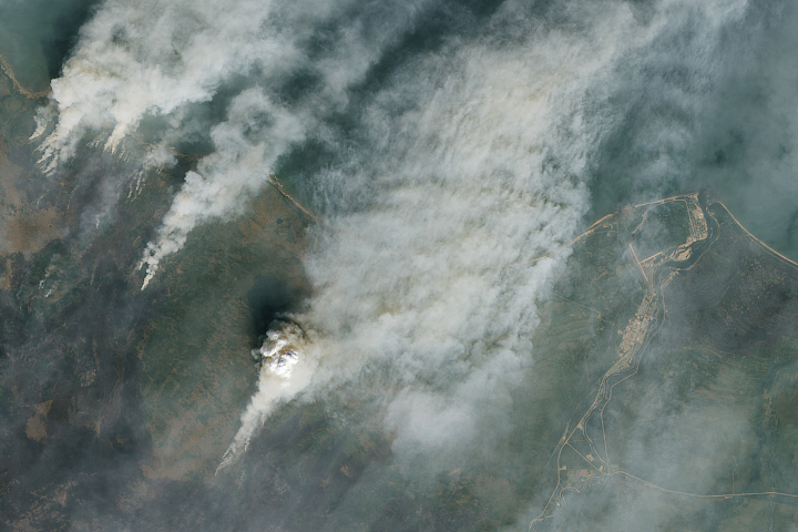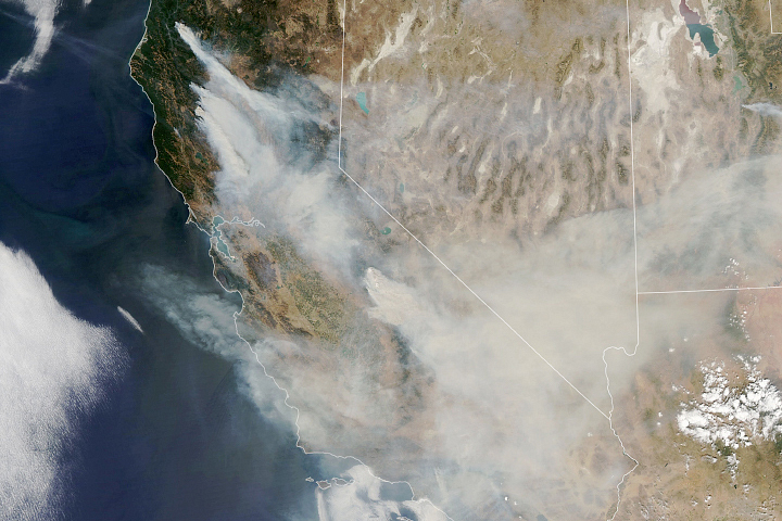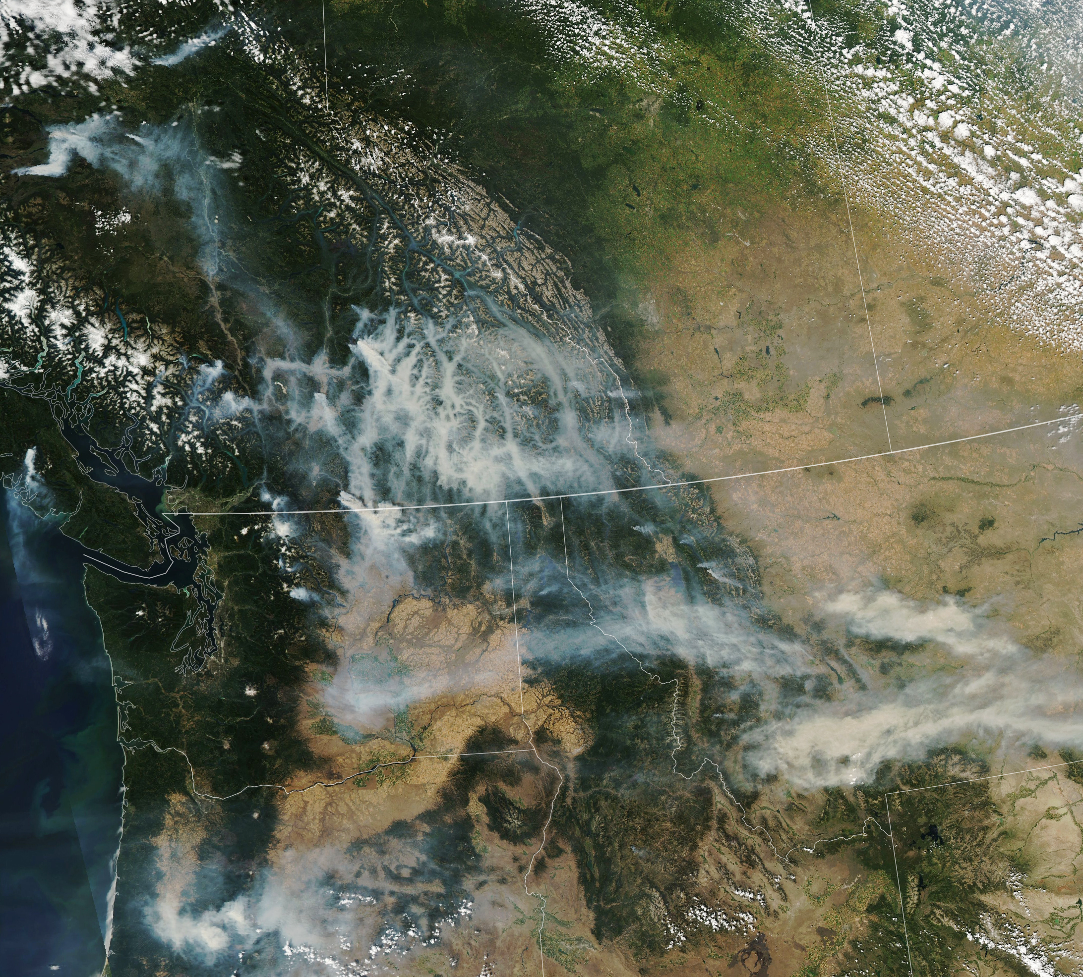
Extreme heat, bouts of strong winds, and a prolonged drought are fueling large forest fires in western Canada and the United States.
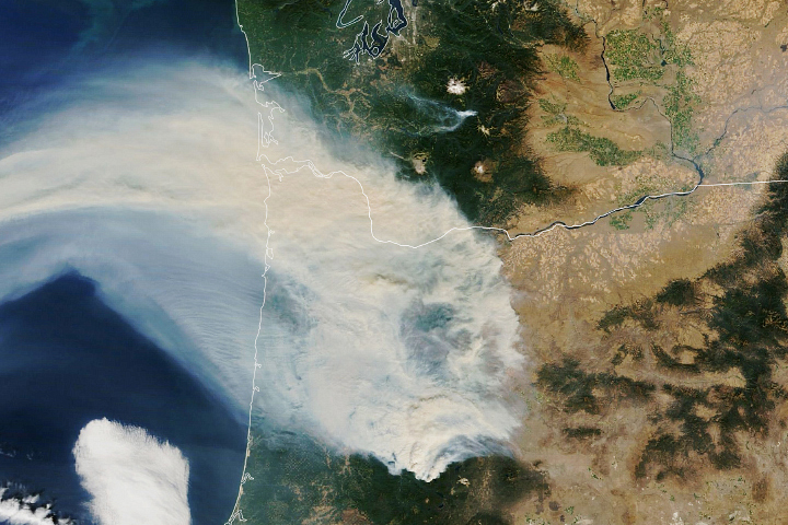
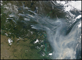
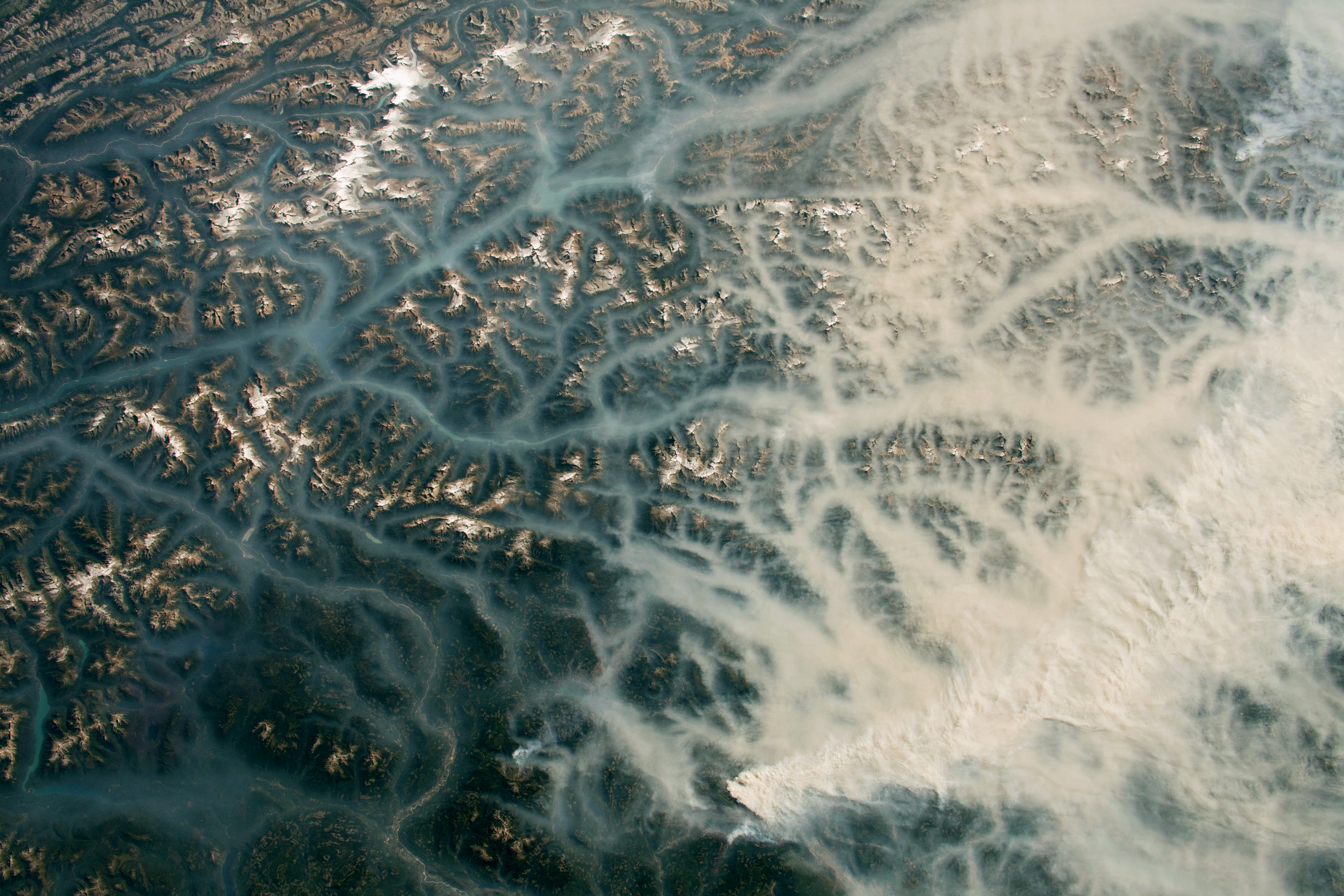
The Moderate Resolution Imaging Spectroradiometer (MODIS) on NASA’s Aqua satellite acquired this image of smoke spreading across parts of British Columbia, Washington, Oregon, and Montana on August 16, 2023. That same day, astronauts aboard the International Space Station captured the detailed photograph below, which shows smoke in valleys in British Columbia near the towns of Golden and Revelstoke.
The surge in fire activity follows the peak of an extreme heat wave that broke dozens of heat records in British Columbia on August 14. But even as temperatures cooled some in the following days, lightning storms triggered new fires, and strong winds turned small blazes into fast-moving, smoky infernos. Authorities in both the United States and Canada issued air quality alerts and, in some cases, calls to evacuate as smoke and fire threatened communities.
The recent heat and winds add to the existing problem of a prolonged drought that has affected the area since last year and primed vegetation to burn. According to the North American Drought Monitor, much of the Pacific Northwest was either abnormally dry or in moderate to extreme drought in mid-August 2023.
Canada is facing one of the worst fire years it has seen in decades, according to data published by the Canadian Interagency Forest Fire Centre. More than 13.7 million hectares (33.9 million acres) had burned as of August 17, more than seven times the 25-year average. The United States has had a quieter wildfire season, with 1.7 million acres burned by mid-August. On average, 4.4 million acres have usually burned by mid-August, according to the U.S. National Interagency Fire Center.
NASA Earth Observatory image by Lauren Dauphin, using MODIS data from NASA EOSDIS LANCE and GIBS/Worldview. Astronaut photograph ISS069-E-61356 was acquired on August 17, 2023, with a Nikon D5 digital camera using an 50 millimeter lens and is provided by the ISS Crew Earth Observations Facility and the Earth Science and Remote Sensing Unit, Johnson Space Center. The image was taken by a member of the Expedition 69 crew. The image has been cropped and enhanced to improve contrast, and lens artifacts have been removed. The International Space Station Program supports the laboratory as part of the ISS National Lab to help astronauts take pictures of Earth that will be of the greatest value to scientists and the public, and to make those images freely available on the Internet. Additional images taken by astronauts and cosmonauts can be viewed at the NASA/JSC Gateway to Astronaut Photography of Earth. Story by Adam Voiland.