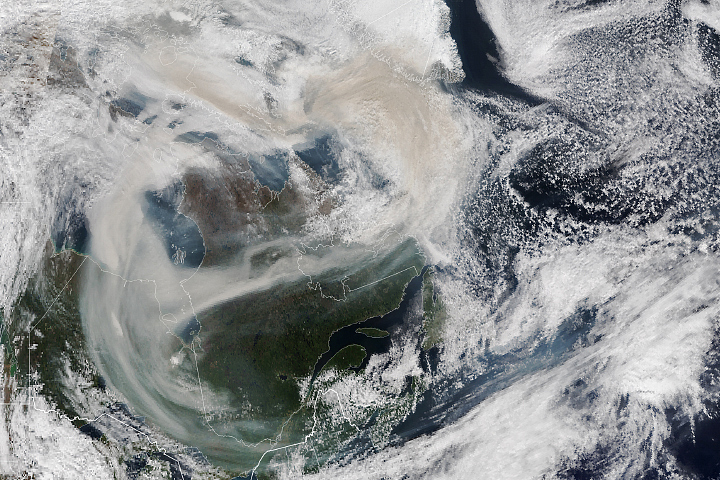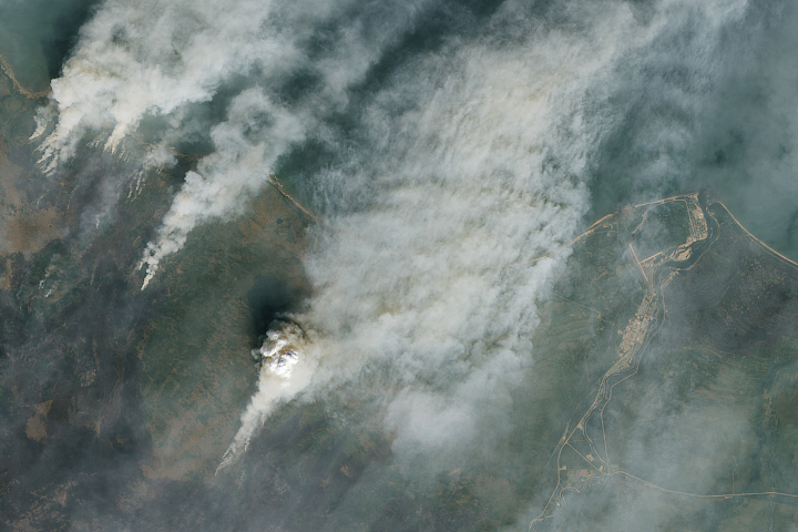
Smoke from intense wildland fires in Canada billowed over the upper Midwest in June 2023, causing hazy skies and hazardous air quality in Canada and across several U.S. states.
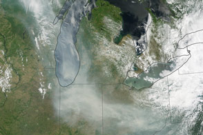
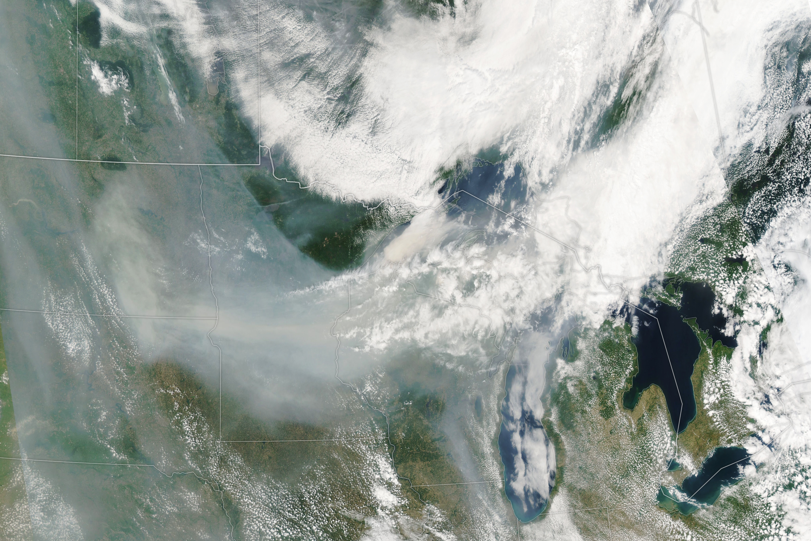
The image above—acquired by the Moderate Resolution Imaging Spectroradiometer (MODIS) on NASA’s Aqua satellite—shows smoke drifting across Minnesota, Wisconsin, and North and South Dakota on June 14, 2023. Most of the smoke blew south from Canada, where blazes continued to rage across several provinces. Over 400 fires were active across the country that day, half of which were classified as out of control, according to the Canadian Interagency Forest Fire Centre (CIFFC).
The image below highlights the density of black carbon particles—commonly called soot—in the smoke as it moved across North America. The black carbon data come from NASA’s GEOS forward processing (GEOS-FP) model, which assimilates data from satellite, aircraft, and ground-based observing systems. In addition to making use of satellite observations of aerosols and fires, GEOS-FP incorporates meteorological data like air temperature, moisture, and winds to project the plume’s behavior. The fine particulate matter (PM2.5) in this pollution can enter the lungs and lead to health problems.
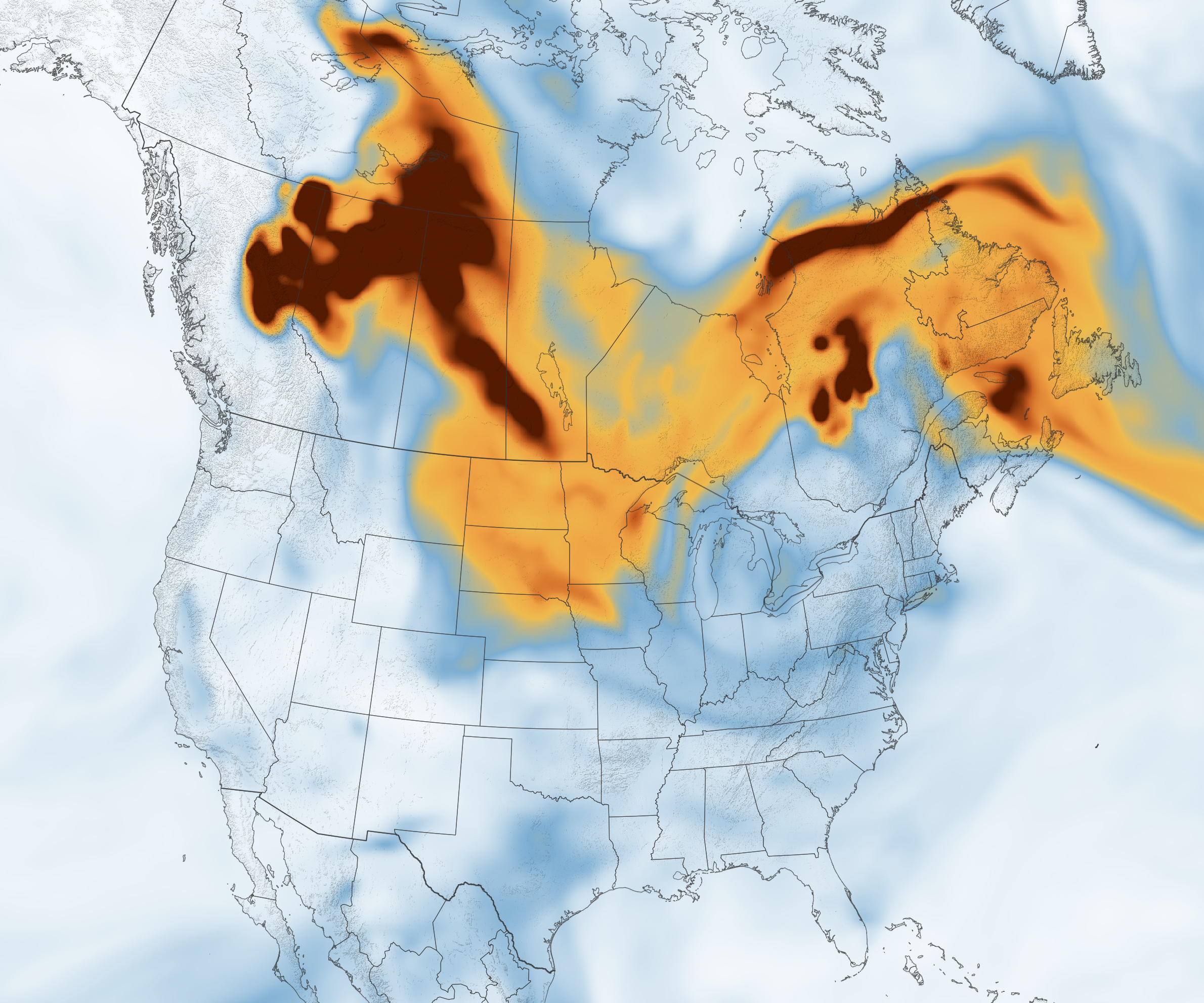
Notice the dense black carbon from fires in the Canadian provinces of British Columbia, Alberta, and Saskatchewan. About 200 of the ongoing fires were active in these three western provinces, contributing to unhealthy air in the region. In western Alberta, air quality monitors on June 14 recorded levels deemed “very unhealthy” (code purple) on EPA’s Air Quality Index (AQI) scale.
Air quality that day was especially poor in Minnesota. The skyline of Minneapolis was blanketed with haze, reminiscent of the skylines in major cities in the Northeast a week prior. At 5 p.m. local time on June 14, air quality monitors in Minneapolis, St. Paul, and St. Cloud recorded levels deemed “very unhealthy” (code purple) on the AQI scale.
Hazy skies in the Midwest were also observed by a global network of ground sensors called the Aerosols Robotic Network, or AERONET, which is comprised of more than 500 carefully calibrated Sun photometer instruments that measure aerosol optical depth (AOD) around the world. AOD is a measure of how much light is absorbed or reflected by particles of dust, natural aerosols, or pollutants in the air.
A clear blue sky would produce a very low AOD value of less than 0.05. An AOD reading of 3 would indicate very hazy skies that would make it difficult even to see the Sun. On June 14, an AERONET sensor in central North Dakota recorded an average AOD of 2.1, and a sensor in Madison, Wisconsin, recorded an average AOD of 1.2. The average AOD value on that day in Madison is 0.3.
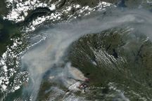
Smoke from the wildfires continued to move south and east on June 15. According to the National Weather Service, air quality alerts for Wisconsin and Minnesota were still in effect on that day.
NASA Earth Observatory images by Lauren Dauphin, using MODIS data from NASA EOSDIS LANCE and GIBS/Worldview and GEOS-5 data from the Global Modeling and Assimilation Office at NASA GSFC. Story by Emily Cassidy.