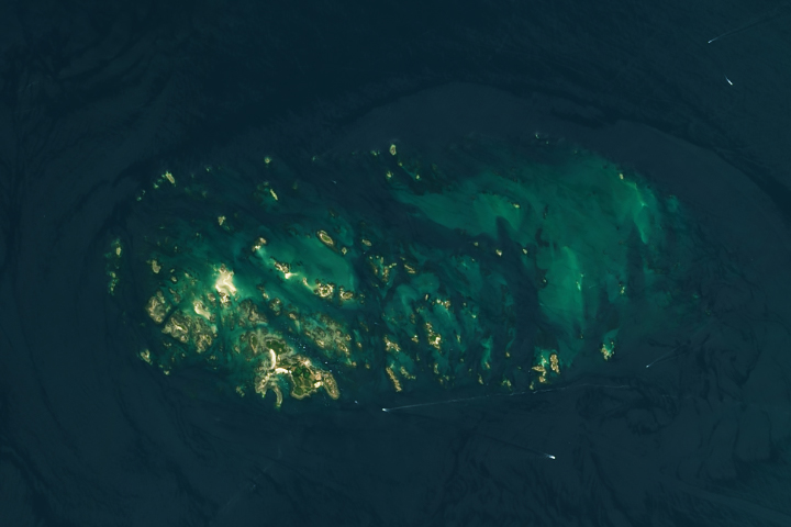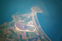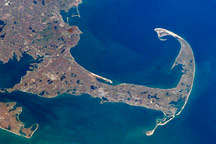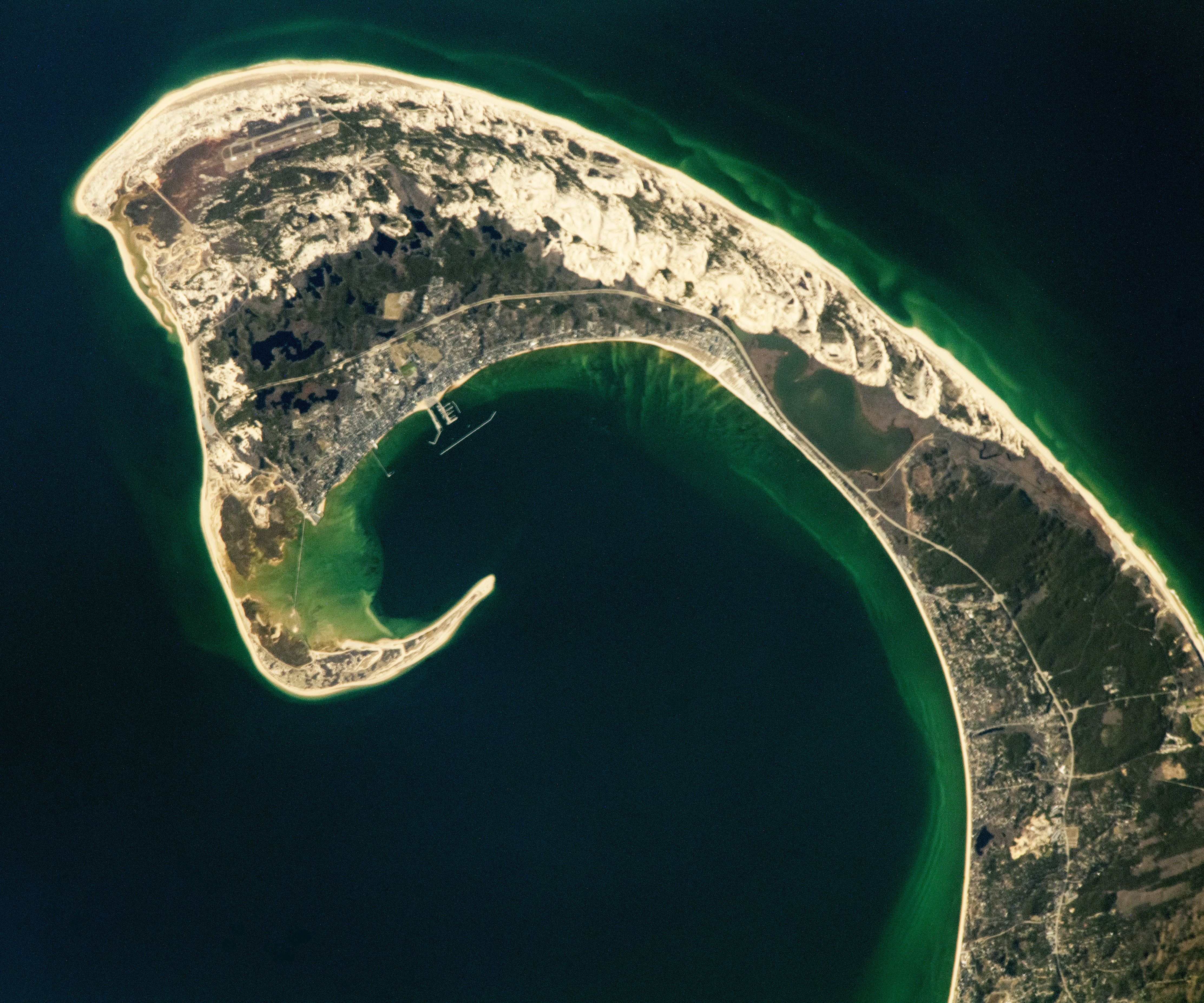
An astronaut aboard the International Space Station took this photograph of the Cape Cod peninsula while orbiting over the northeastern United States. The peninsula extends about 60 miles (100 kilometers) from the mainland of southern Massachusetts where it serves as a natural land barrier between Cape Cod Bay and the Atlantic Ocean.
Since 1842, ferries in Cape Cod Bay have connected Boston (west of this image) to Provincetown. Ferries and other ships sailing through Provincetown Harbor and around the peninsula’s elongated sandbar used the guidance of Long Point Lighthouse, first lit in 1827. The formation of the sandbar and shaping of the peninsula began many thousands of years before those ships set sail.
The Cape Cod peninsula’s distinct hook shape started forming 10,000 years ago by glacial erosion and movement of the Laurentide Ice Sheet. Subsequent natural processes, such as severe storms, waves, wind, and sea level rise have contributed to the shape of the peninsula.
The sand dunes visible in this image started forming after glacial retreat when sediment left by the glaciers was further modified and redeposited by coastal ocean currents. As glacial retreat continued, depressions left in the land surface were filled by groundwater—creating freshwater ponds.
The sand dunes, freshwater ponds, and other land features on the Atlantic-facing side of Route 6 reside in the northern portion of the Cape Cod National Seashore. The 70 square miles (180 square kilometers) of Cape Cod National Seashore support a variety of ecosystems, such as the salt marshes at Long Point near Provincetown and the human-made freshwater lake of East Harbor near North Truro.
The variety of ecosystems within Cape Cod National Seashore sustain over 450 species of amphibians, reptiles, fish, birds, and mammals, including 32 species that are rare or endangered. One of those species is the American oystercatcher, a large shorebird that uses a knife-like bill to eat shellfish.
Astronaut photograph ISS069-E-1403 was acquired on April 9, 2023, with a Nikon D5 digital camera using a focal length of 1150 millimeters. It is provided by the ISS Crew Earth Observations Facility and the Earth Science and Remote Sensing Unit, Johnson Space Center. The image was taken by members of the Expedition 69 crew. The image has been cropped and enhanced to improve contrast, and lens artifacts have been removed. The International Space Station Program supports the laboratory as part of the ISS National Lab to help astronauts take pictures of Earth that will be of the greatest value to scientists and the public, and to make those images freely available on the Internet. Additional images taken by astronauts and cosmonauts can be viewed at the NASA/JSC Gateway to Astronaut Photography of Earth. Caption by Francesca Filippone, Texas State University, JETS Contract at NASA-JSC.