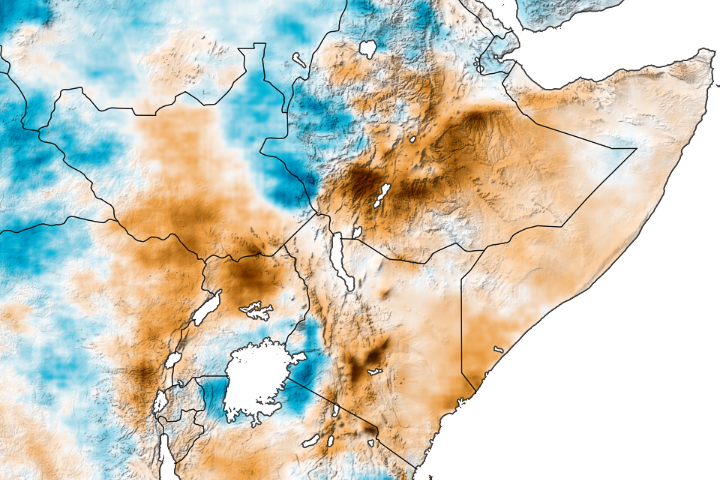
Flash flooding from heavy rains killed dozens and affected 300,000 people in Ethiopia and Somalia in March 2023. The damaging flooding came after the region has experienced almost three years of extreme drought.
In the first 25 days of March, parts of Ethiopia received 5 to 10 centimeters (2 to 4 inches) more rain than is usual for the period, according to a report from Crop Monitor. The Crop Monitor is part of the Group on Earth Observations Global Agricultural Monitoring Initiative (GEOGLAM), which uses satellite data and modeling to produce early warning reports for food shortages. The above-average rainfall ushered in an early start to the long (or gu) rains, which are in March, April, and May in Eastern Africa. The long rains typically contribute up to 60 percent of the total annual rainfall to the Horn of Africa and play a big role in agricultural productivity.
“Normally, the long rains begin in Kenya and move north to Ethiopia and Somalia,” said Caroline Wainwright, a climate scientist at Cardiff University in the United Kingdom. “But this year, the rains started concurrently, and the last two weeks of March were incredibly wet in all three countries.”
Moderate to heavy rains in the Ethiopian highlands overtopped banks of the Shabelle and Juba rivers. Homes, schools, and health facilities were destroyed along the banks of the two rivers, in southern Somalia and eastern Ethiopia, according to the United Nations Office for the Coordination of Humanitarian Affairs (UN OCHA).
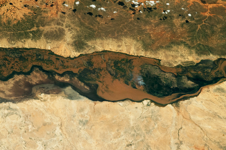
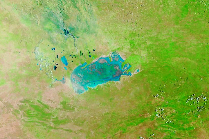
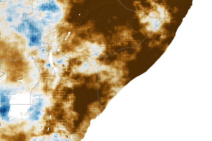
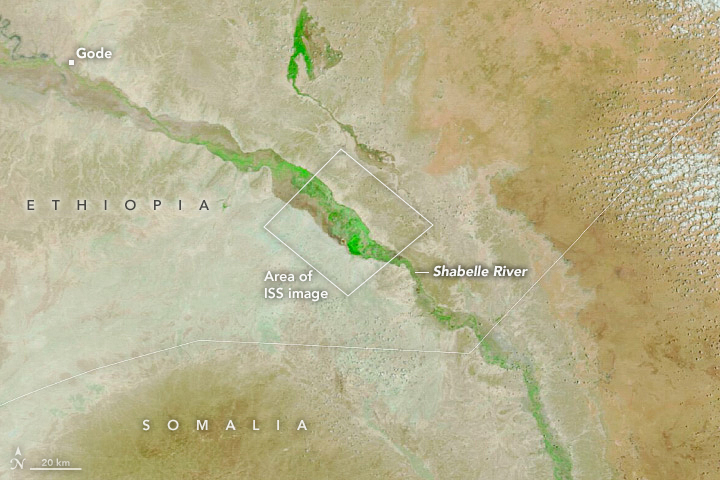
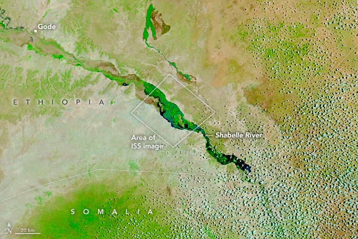
Flooding along the Shabelle River in the Somali region of Ethiopia can be seen in the image (right) above, acquired by the Moderate Resolution Imaging Spectroradiometer (MODIS) on NASA’s Terra satellite. The image is false color which makes the water (dark blue) stand out from its surroundings. Vegetation is green and bare ground is brown. The image on the left shows the same area on March 11, 2023.
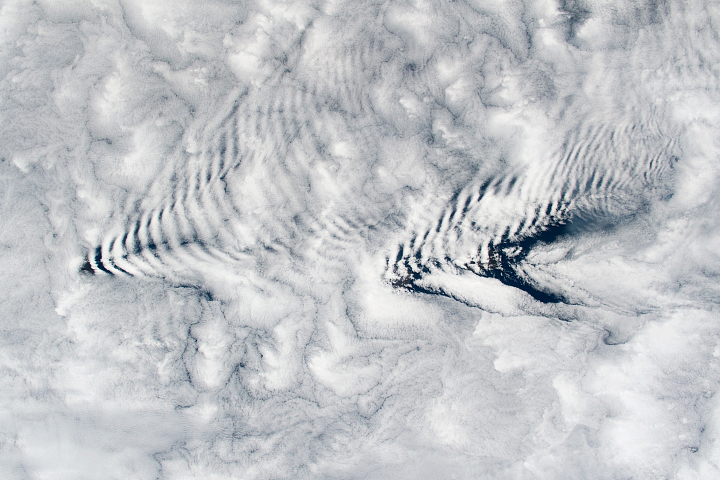
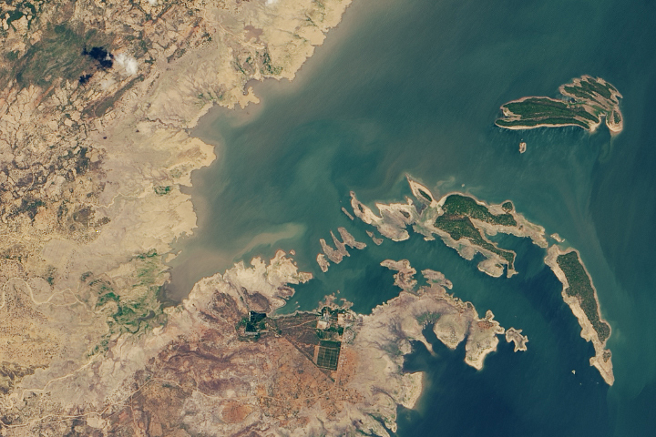
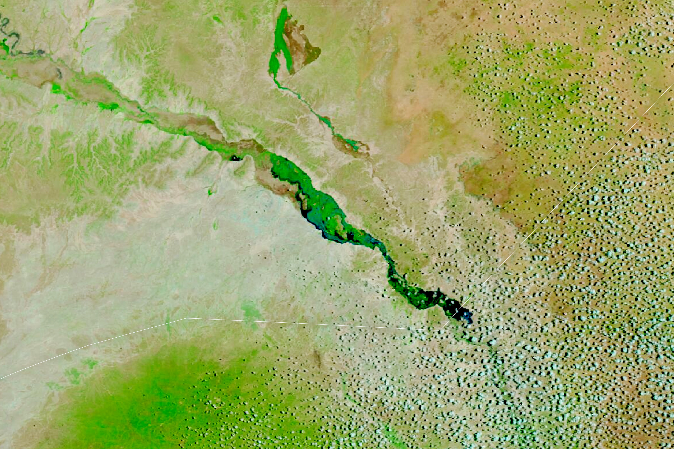
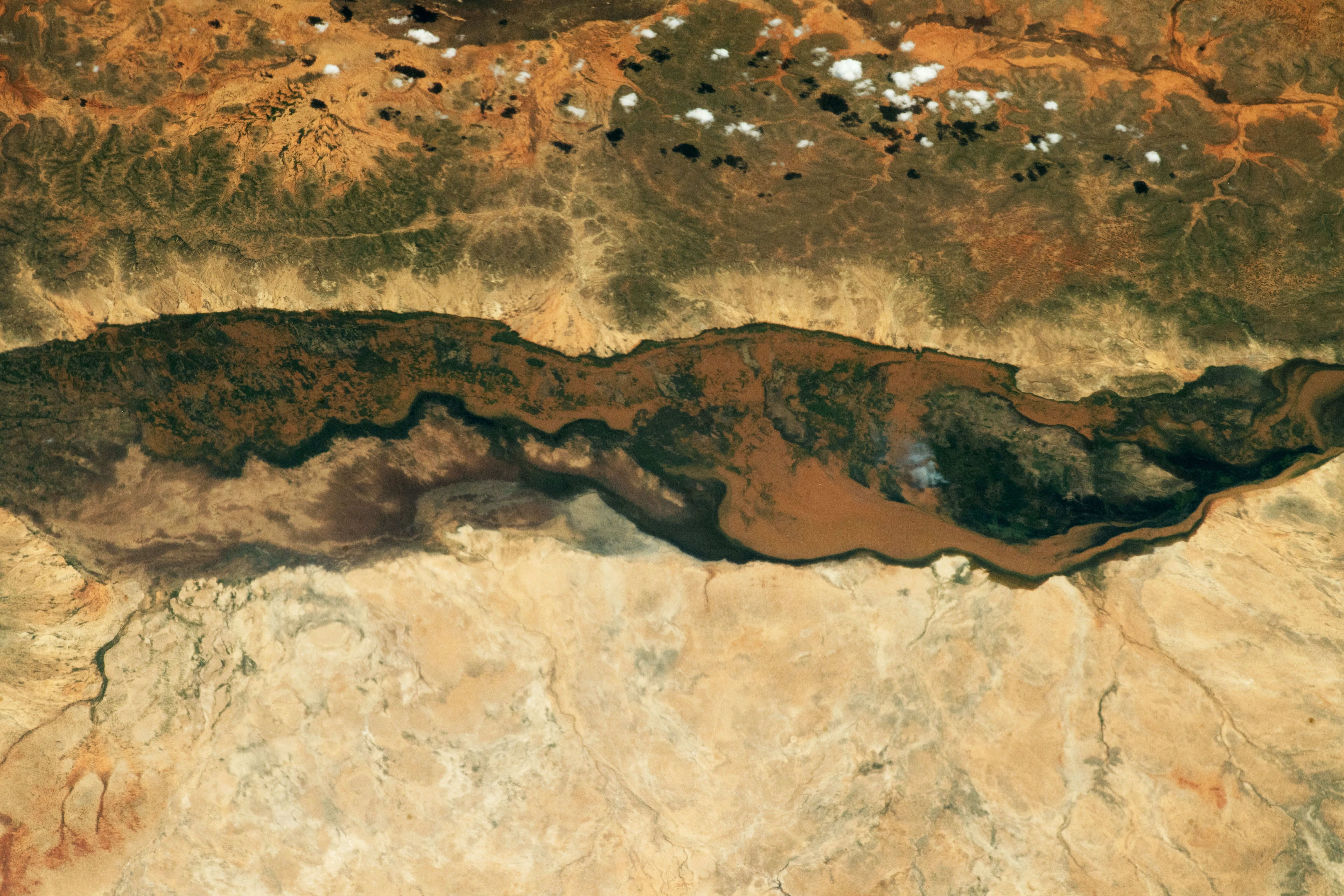
In the photograph below, taken by an astronaut on the International Space Station on April 1, 2023, sediment-rich floodwater can be seen overtopping the banks of the Shabelle near the Ethiopia-Somalia border.
The Horn of Africa has seen almost three years of some of worst drought conditions in history, according to the Famine and Early Warning Systems Network (FEWS NET). Ethiopia and Somalia have had five failed rainy seasons since late 2020, which have displaced 1.4 million Somalis and killed 3.8 million livestock. During this time the Shabelle-Juba river basins saw their lowest rainfall totals since 1981.
“This flooding doesn’t just undo three years of drought,” Wainwright said. Her recent research into the drivers and impacts of rainfall variability in East Africa found that from the mid-1980s to 2010, the long rains have been getting drier. In fact, the research team’s analysis of climate projections found that the short rains could deliver more rainfall than the long rains by 2030–2040.
More than 1,000 hectares of cropland have been swamped by recent rains, challenging the agricultural economies in Ethiopia and Somalia. Agriculture employs 67 and 80 percent of people in these countries, respectively, and much of the farmland in the region is rain-fed. Although rainfall can provide some relief, intense rainfall following extensive drought can wash away crops and topsoil. Most of the farms in the area also lack the infrastructure to store water for future use.
Even with the unexpectedly early and heavy rains in March, climate models project that the long rains this year will be drier than normal and drought conditions are likely to continue.
NASA Earth Observatory images by Lauren Dauphin, using MODIS data from NASA EOSDIS LANCE and GIBS/Worldview. Astronaut photograph ISS069-E-422 was acquired on April 1, 2023, with a Nikon D5 digital camera using an 400 millimeter lens and is provided by the ISS Crew Earth Observations Facility and the Earth Science and Remote Sensing Unit, Johnson Space Center. The image was taken by a member of the Expedition 69 crew. The image has been cropped and enhanced to improve contrast, and lens artifacts have been removed. The International Space Station Program supports the laboratory as part of the ISS National Lab to help astronauts take pictures of Earth that will be of the greatest value to scientists and the public, and to make those images freely available on the Internet. Additional images taken by astronauts and cosmonauts can be viewed at the NASA/JSC Gateway to Astronaut Photography of Earth. Story by Emily Cassidy.