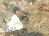
After Antarctica, Australia is the driest continent on Earth. About 70 percent of the mainland receives less than 500 millimeters (20 inches) of rain each year, and 18 percent of the country is desert.
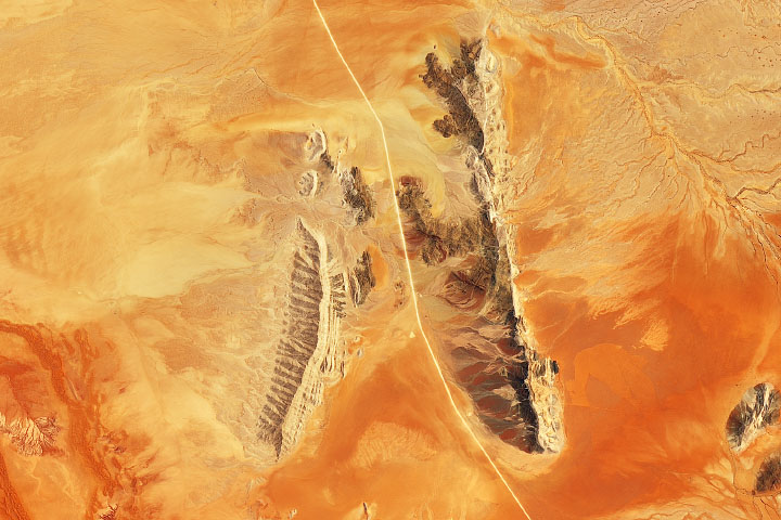
The Simpson Desert, which spans 176,500 square kilometers (68,000 square miles), is the country’s fourth-largest desert. A portion of it has been designated Munga-Thirri–Simpson Desert Conservation Park. With 36,000 square kilometers (14,000 square miles) spread across South Australia, Northern Territory, and Queensland, it is Australia’s largest national park.
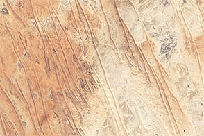
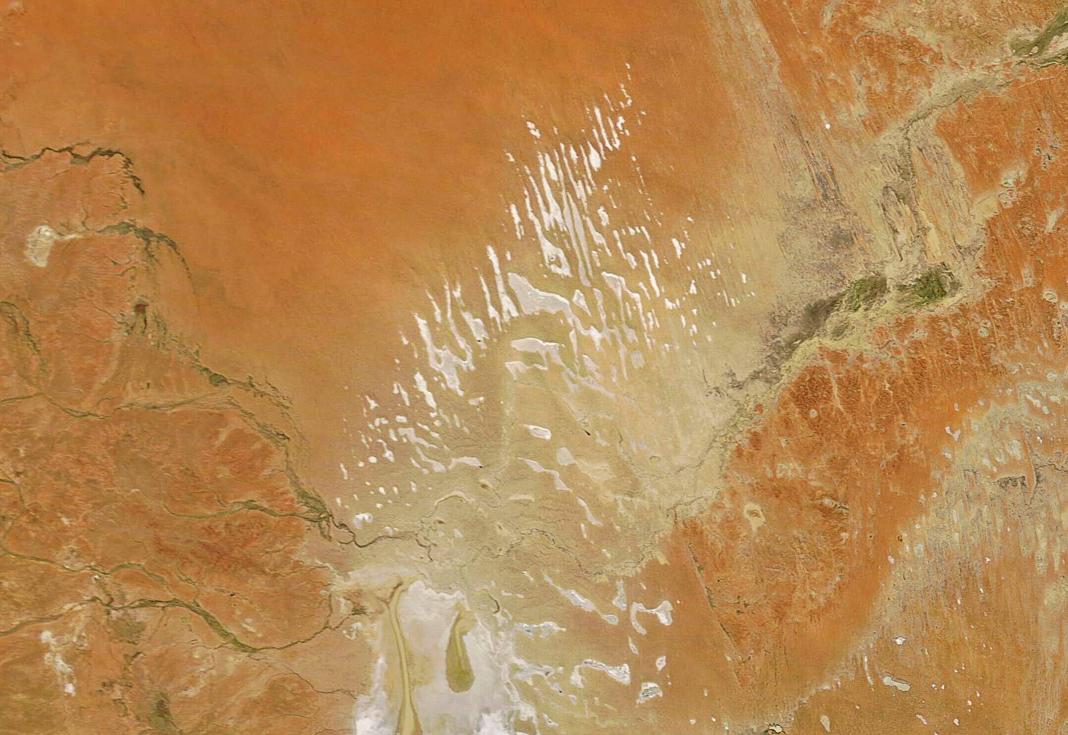
This natural-color image, acquired by the Moderate Resolution Imaging Spectroradiometer (MODIS) on NASA’s Terra satellite on July 14, 2022, shows the sand dunes and white playa lakes lining up in a northwest-southeast direction.
Playas are flat, shallow lake beds that occur in arid and semi-arid climate zones. Intense rains sometimes flood these ephemeral lakes. When the water evaporates, it leaves behind evaporite deposits—layers of mineral salts. The dry lakebeds appear bright white due to the high reflectivity of the salt.
The dunes have formed through wind erosion and sand deposition over thousands of years, and they are anchored by vegetation such as spinifex grasses. Some of the dune ridges stretch more than 100 kilometers (60 miles) in length.
The Simpson Desert overlies part of the Great Artesian Basin, an aquifer stretching more than 1.7 million square kilometers underground across Queensland, New South Wales, South Australia, and the Northern Territory. It is the largest groundwater basin in Australia, holding an estimated 65 million megaliters (15,500 cubic miles) of water. It supplies much of the fresh water available (via wells) to residents of inland Australia.
In 2010, researchers discovered a system of 50-million-year-old paleochannels, ancient dry riverbeds buried as much as 35 meters (115 feet) under the desert surface. “It is now possible to trace a network of topographic lows that are likely to represent paleochannels through the driest desert in Australia and plot the former courses of the world’s oldest rivers prior to their burial,” the researchers wrote in the Australian Journal of Earth Sciences.
Occasional glimpses of the region’s wet past appear in the sporadic floods that fill the desert. In 2009–2010, floodwaters inundated the Simpson Desert with 17 million megaliters (4 cubic miles) of water, filling the playas and bringing a flush of life to the arid land. The desert was briefly carpeted with wildflowers and other vegetation that attracted birds and birders.
NASA Earth Observatory image by Joshua Stevens, using MODIS data from NASA EOSDIS LANCE and GIBS/Worldview. Story by Sara E. Pratt.