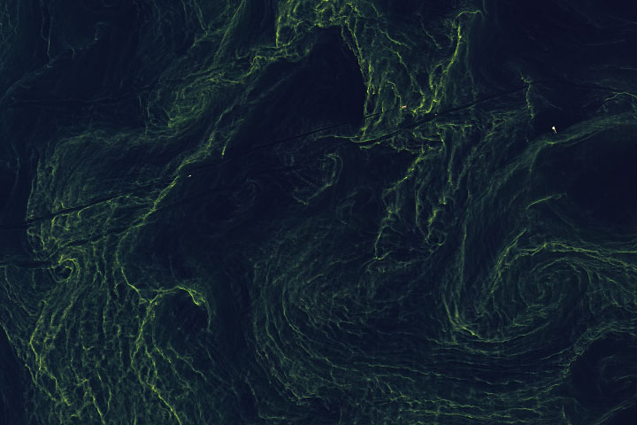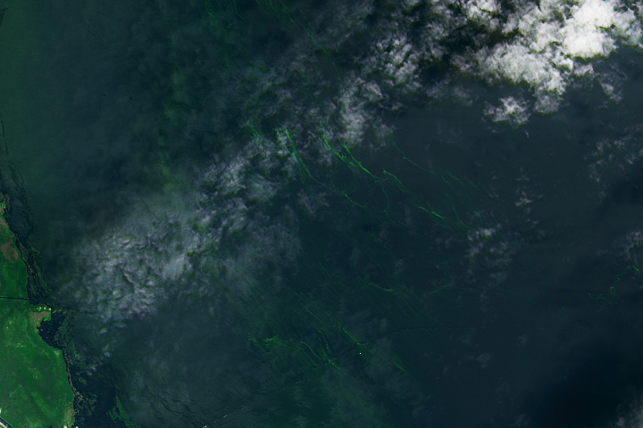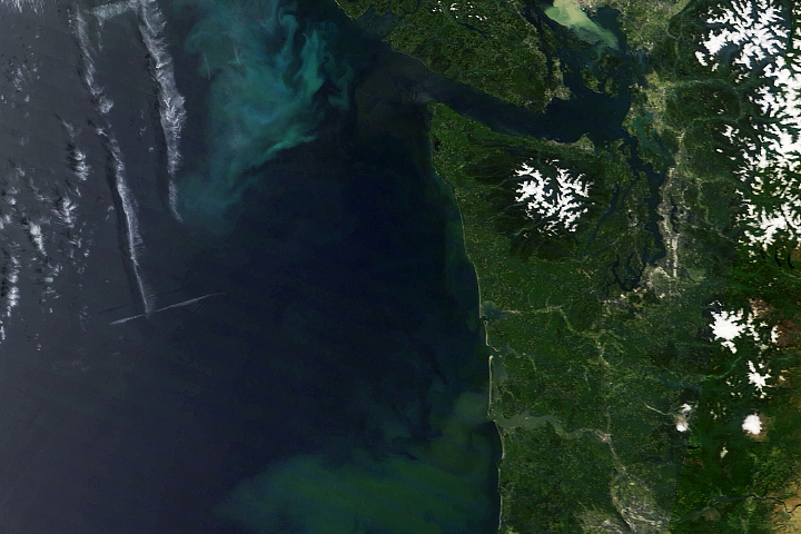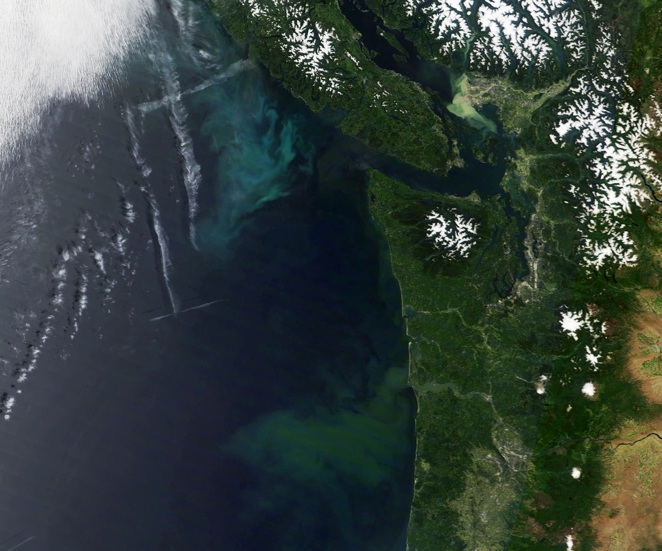
In early summer 2022, a high-pressure system brought warm, clear weather to the Pacific Northwest. The unusually cloud-free skies on June 26 allowed satellites to observe a colorful phenomenon taking shape in the ocean nearby: the proliferation of countless phytoplankton.
Phytoplankton blooms are common in the northeast Pacific Ocean during summer as offshore winds push surface waters away from the coast. This causes cooler, nutrient-rich waters to well up from the depths and fuel the growth of phytoplankton. Research has shown that a significant amount of nutrients are also supplied by the circulation and upwelling that occurs in the Salish Sea, boosting phytoplankton productivity along the continental shelf off Vancouver Island and Washington.
It is less common for skies to be clear enough for satellites to acquire a view of such blooms. But on June 26, the high-pressure weather system and associated sinking air helped prevent clouds from forming over land and offshore. On that morning, the Moderate Resolution Imaging Spectroradiometer (MODIS) on NASA’s Terra satellite acquired this natural-color image.
Phytoplankton are floating, drifting, plant-like organisms that harness energy from the Sun, mix it with carbon dioxide from the atmosphere, and turn it into carbohydrates and oxygen. The organisms supply an important energy source for the oceanic food web, feeding everything from zooplankton to fish and shellfish to whales.
Without a physical sample, it is not possible to say for sure which type of phytoplankton are present in the image. The greenest areas off the Washington and Oregon coasts probably contain diatoms—a microscopic form of algae with silica shells and plenty of chlorophyll. Coccolithophores—a type of phytoplankton armored with calcium carbonate plates—tend to make the water appear more milky-blue and might be present in the bloom southwest of Vancouver Island. There might also be sediment mixed in, especially at the mouths of the Columbia and Fraser rivers.
NASA Earth Observatory image by Lauren Dauphin, using MODIS data from NASA EOSDIS LANCE and GIBS/Worldview. Story by Kathryn Hansen with image interpretation by Michael Behrenfeld/Oregon State University.