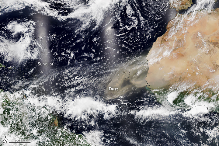
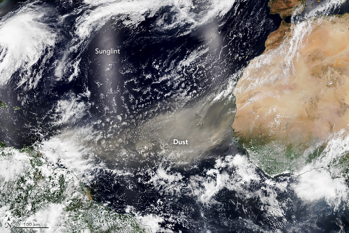
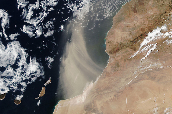
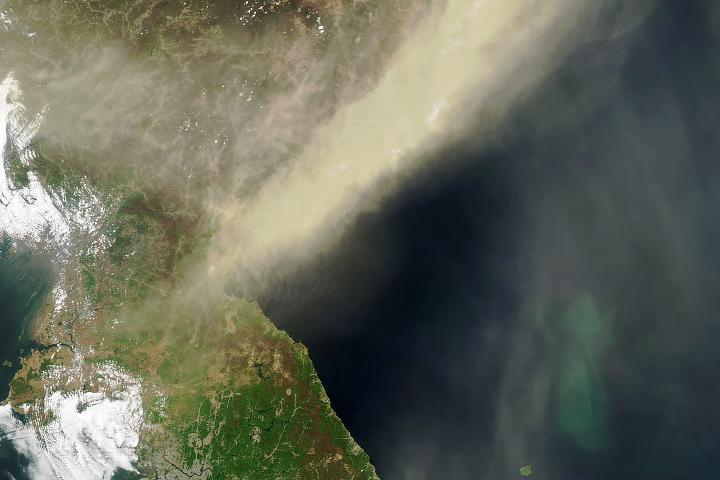
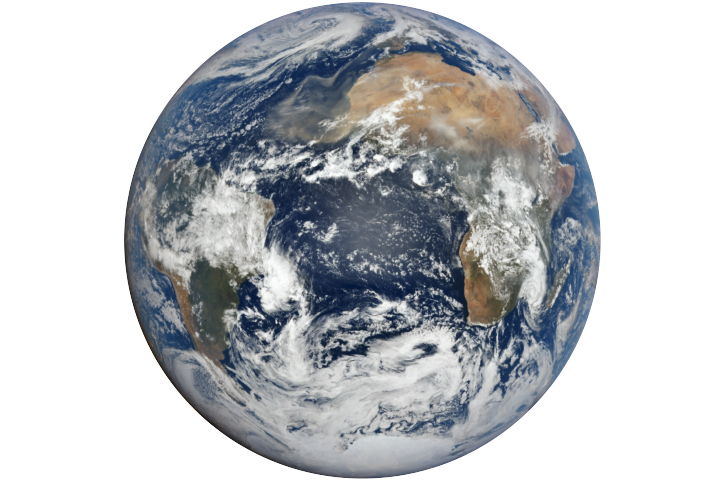
Winds pick up an estimated 100 million tons of dust from the Sahara Desert each year, and a sizable portion of it blows out over the North Atlantic Ocean. A fresh supply of dust was airlifted from the Sahara in early June 2022, and some of it appeared to be headed for the Americas.
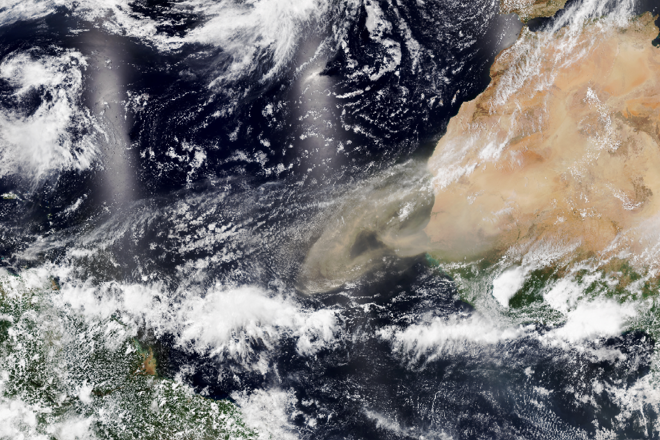
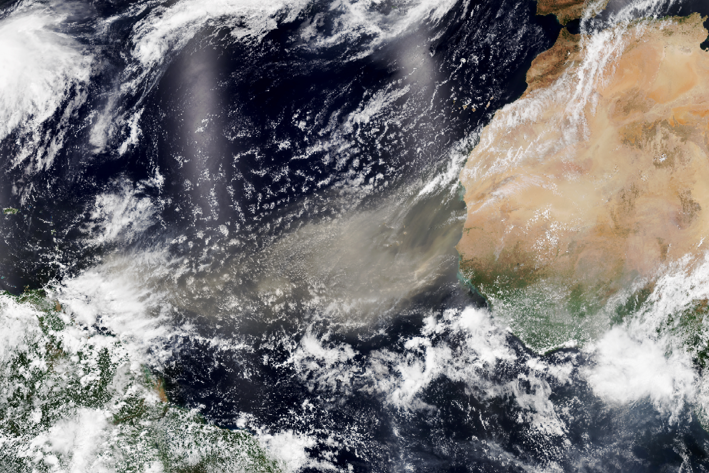
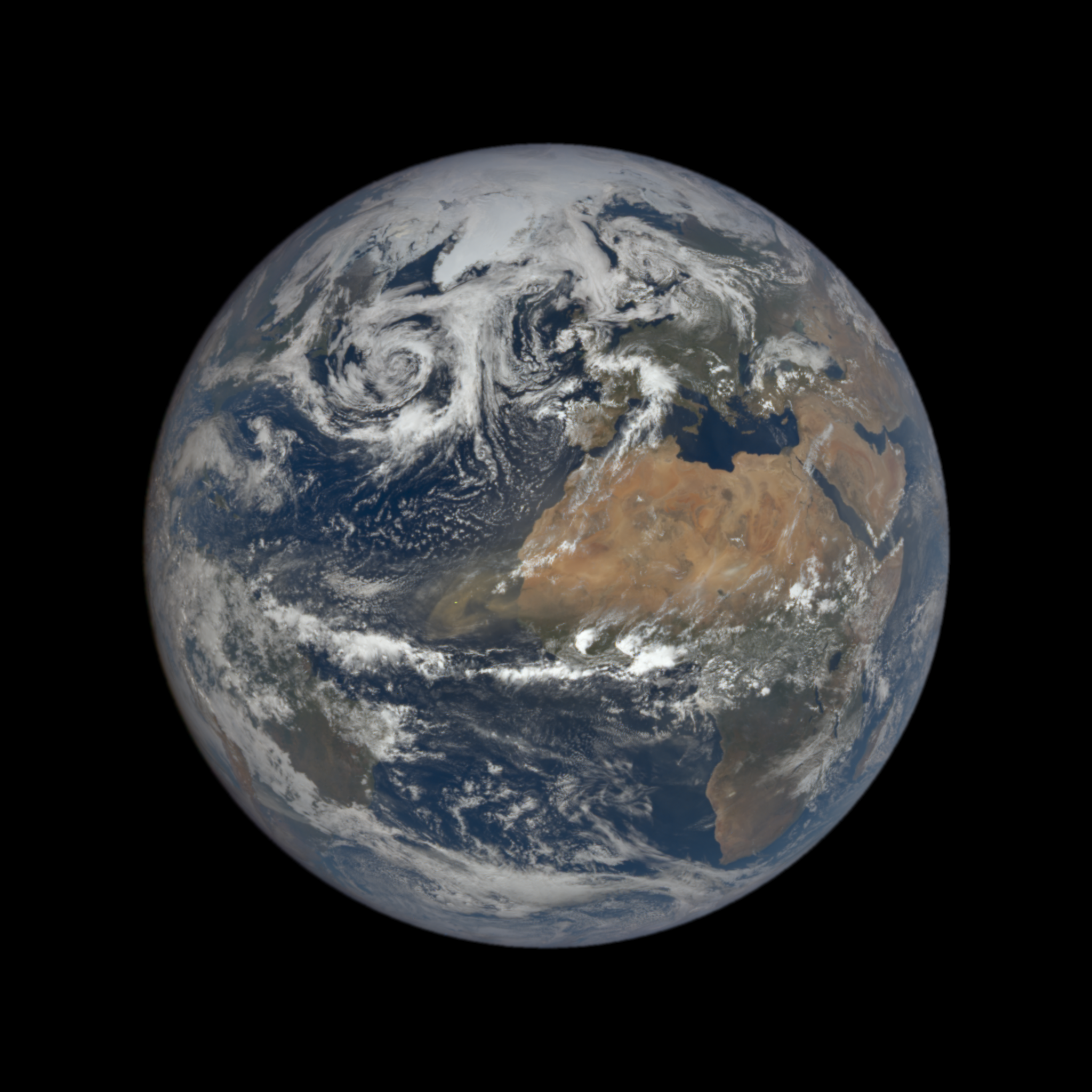
The Visible Infrared Imaging Radiometer Suite (VIIRS) on the NOAA-20 satellite acquired natural-color images (above) of dust on June 3 and 5, 2022, when the plumes were most distinct. NASA’s Earth Polychromatic Imaging Camera on NOAA’s DSCOVR satellite also acquired hemisphere-wide views of the event on June 3 and June 4.
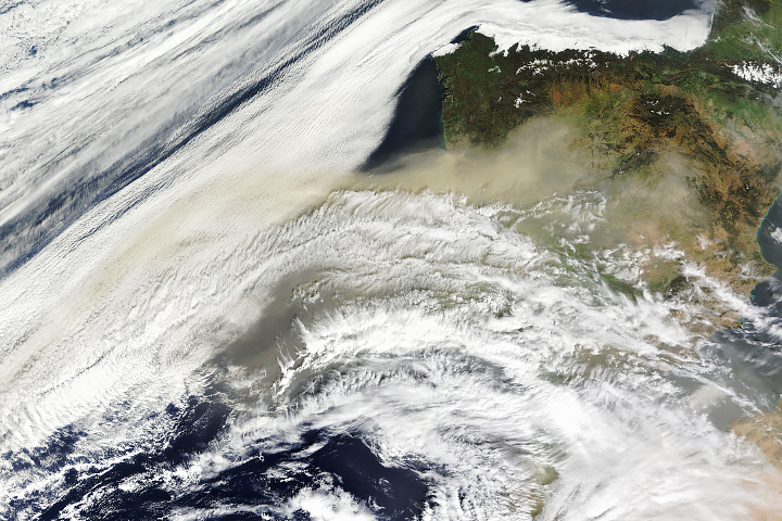
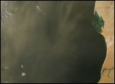
NASA satellite sensors that track aerosol optical depth observed substantial increases in sunlight-reflecting particles over the region starting on May 29 and continuing to June 6. Natural-color satellite imagery from May 30 to June 6 showed the storm’s progression across the water.
Dust plays a major role in Earth’s climate and biological systems. The airborne particles absorb and reflect sunlight—altering the amount of solar energy reaching the surface—and can also promote or reduce cloud and storm formation, depending on other atmospheric conditions. Dust can degrade air quality and have negative health effects, particularly for people with lung conditions. And dust—rich with iron and other minerals that plants and phytoplankton need—provides natural fertilizer for ocean ecosystems and lands downwind.
The Sahara Desert is by far Earth’s largest source of airborne dust, and the storms can arise at any time of year. In winter and spring storms, Saharan dust often ends up fertilizing the nutrient-poor soils of the Amazon rainforest. Dust storms in the summer tend to loft material higher into the atmosphere, allowing plumes to travel thousands of kilometers on high-level winds. Those summer seasonal wind patterns can carry the dust from Africa to the Caribbean and the Gulf of Mexico. Plumes of dust recently reached Florida, Texas, and other southern U.S. states in mid-May 2022.
NASA Earth Observatory image by Lauren Dauphin, using VIIRS data from NASA EOSDIS LANCE, GIBS/Worldview, and the Joint Polar Satellite System (JPSS). Story by Michael Carlowicz, with reporting from Sara Pratt and Kathryn Hansen.


