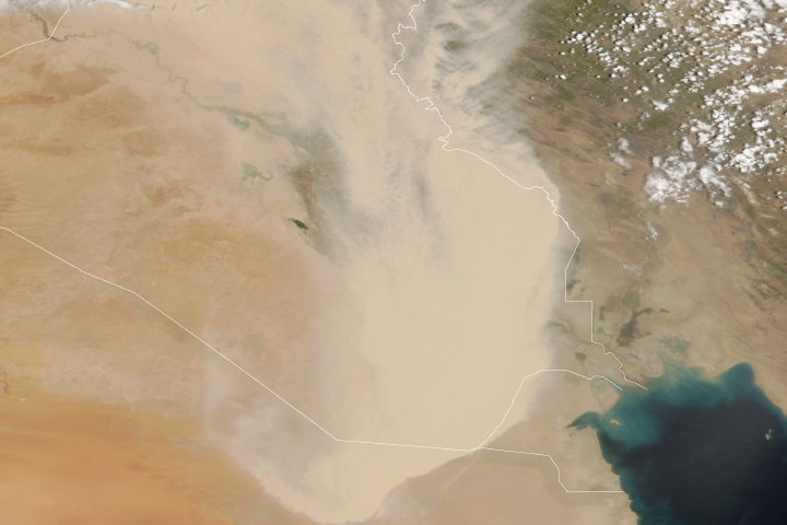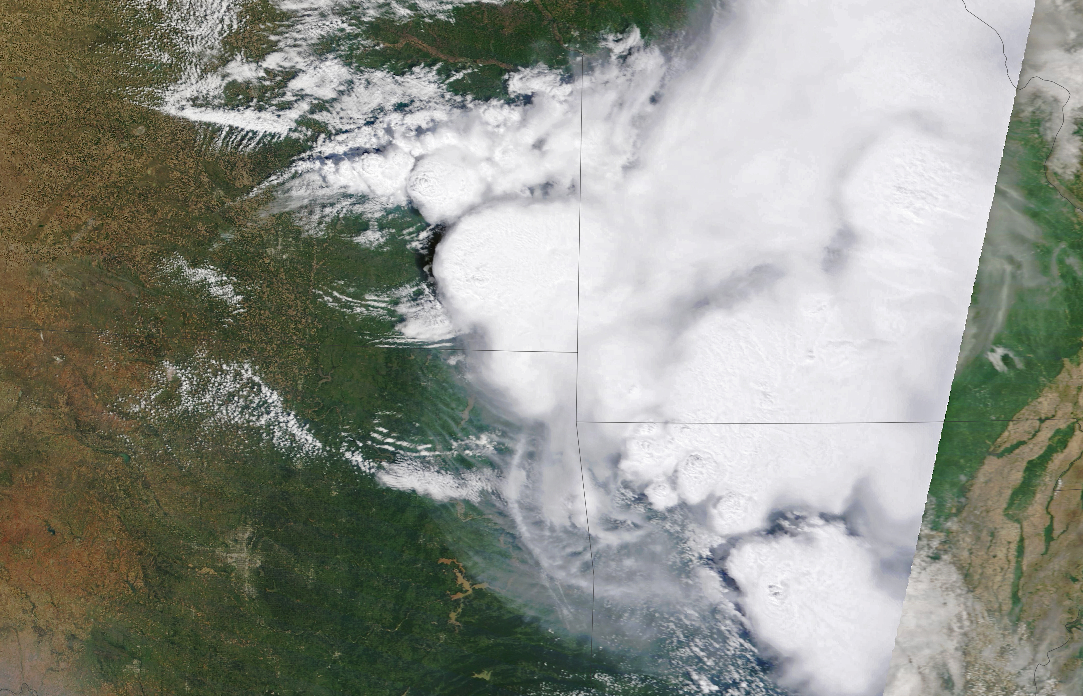
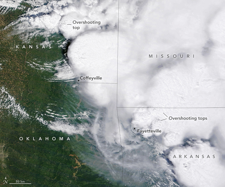
On the morning of May 15, 2022, a cluster of supercell thunderstorms raged across the Great Plains. They delivered hail, extreme lightning, gusty winds, and downpours to parts of Kansas, Oklahoma, Missouri, and Arkansas. When the Moderate Resolution Imaging Spectroradiometer (MODIS) on NASA’s Terra satellite acquired the natural-color image, a line of strong thunderstorms stretched from eastern Kansas to Little Rock, Arkansas. The weather front included multiple storm cells with features called overshooting tops and above-anvil cirrus plumes, key signs of particularly severe storms.
Overshooting tops are dome-like protrusions rising from thunderstorm clouds and driven by convective updrafts. These cloud top features can rise past the tropopause and the anvil portion of a thunderstorm cloud, sometimes punching into the lower stratosphere.
Above-anvil cirrus plumes are comparatively warm patches of cirrus clouds that get dragged into the lower stratosphere by intense updrafts and the gravity waves that they can generate. Cirrus plumes are typically warmer than the underlying anvil cloud because they mix with the air in the stratosphere, where air temperature warms with height.
Not all thunderstorms create overshooting tops and above-anvil cirrus plumes. The features are more common in storms that create the most severe weather. For instance, storms with above-anvil cirrus plumes are 14 times more likely to result in storm and damage reports to the National Weather Service’s Storm Prediction Center, according to research led by NASA Langley Research Center atmospheric scientist Kristopher Bedka.
“Overshooting tops and above-anvil cirrus plumes are often a sign that a thunderstorm will produce hail, tornadoes, extreme lightning, and destructive winds,” said Bedka. “We know this because an especially intense updraft produced the patterns we see in the satellite imagery.” In this case, the Storm Prediction Center received several reports of the May 15 storms producing pea- to golf ball-sized hail. Tens of thousands of people in Arkansas lost power as a result of the storms, according to news reports.
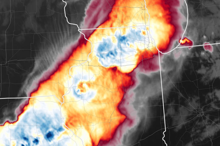
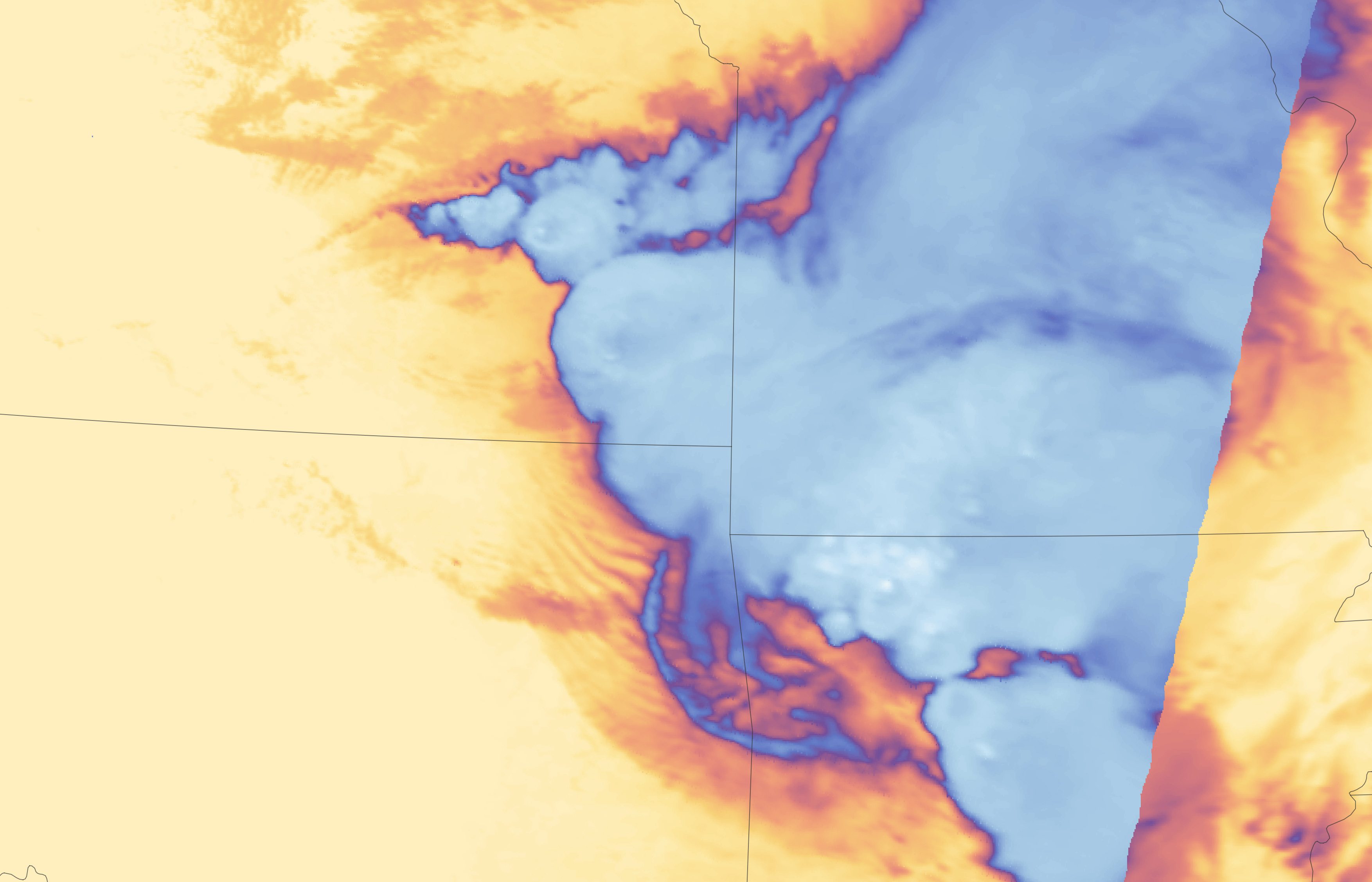
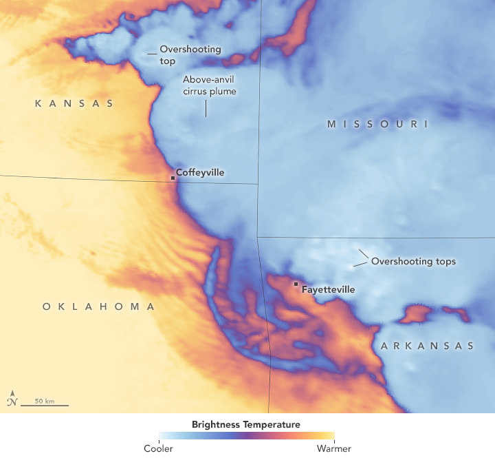
While overshooting tops and above-anvil cirrus plumes are sometimes visible in natural-color satellite imagery, they are easier to distinguish in infrared observations of the brightness temperature of clouds (second image above). Brightness temperatures are useful for distinguishing colder cloud structures and for showing finer details of a storm. In this case, the updrafts associated with the overshooting tops are significantly cooler than the surrounding air, so they appear as small white ovals. When Terra acquired the data, there were several overshooting tops north of Coffeyville and clustered west of Fayetteville. The above-anvil cirrus plumes are more subtle, but they appear as broad warm (dark) features spilling from and adjacent to the overshooting tops.
Overshooting tops and their effects on stratospheric chemistry are the focus of a NASA field campaign called Dynamic and Chemistry of the Summer Stratosphere (DCOTSS). A high-altitude aircraft, NASA’s ER-2, will chase severe storms in the central U.S. this spring and summer, sampling stratospheric cirrus and water vapor plumes that emanate from overshooting tops. The goal is to improve our understanding of how water vapor and other pollutants from the troposphere behave and change the composition of the lower stratosphere.
Data from NEXRAD Doppler weather stations indicate that more that more than 200 storms with overshooting storms occur per day over the contiguous United States. These storms are most common in Nebraska, Kansas, and Oklahoma.
NASA Earth Observatory images by Lauren Dauphin, using MODIS data from NASA EOSDIS LANCE and GIBS/Worldview. Story by Adam Voiland.